Old Maps of Carroll County, Tennessee
Explore 133 old maps of Carroll County, spanning from 1936 to today. These high-resolution historic maps reveal how streets, neighborhoods, landmarks, and natural features evolved over time — perfect for genealogy, metal detecting, research, and local history exploration.
What you can do with these maps:
- See how Carroll County changed over time: Compare historical maps to modern-day views to trace roads, homesites, rail lines & more.
- View detailed metadata: Each map includes creators, publishers, year, scale, and archive source.
- Overlay maps with satellite & LiDAR: Visualize the past alongside modern tools to explore terrain & human change.
- Trusted historical sources: Maps sourced from the USGS, Library of Congress, and other archives.
- Access maps your way: View online, download high-res files, or order prints for personal or research use.
Start exploring old maps of Carroll County to uncover forgotten places, hidden landmarks, and the deep history beneath your feet.
Carroll County, TN maps
(133)- 1936 Map of Clarksburg
 1936 Clarksburg1936 Print · USGSWest Tennessee’s rural landscape comes alive in the mid-1930s, showing the early road networks and community hubs of Carroll and Henderson Counties. Genealogists can locate family-named landmarks like Hart Cem and schools including Pritchard Sch and Clarksburg Sch.
 - 1936 Map of Yuma
 1936 Yuma1936 Print · USGSCarroll and Henderson Counties in the mid-1930s were defined by small rail-stop communities and a dense network of country schools. Genealogists can locate family burial sites at Farmsville Cem and trace the paths between New Hope Ch and Belgrade Sch.
 - 1936 Map of Seventeen Creek
 1936 Seventeen Creek1936 Print · USGSBenton and Carroll counties appear here in the mid-1930s, showing a rural landscape defined by creek-side farming and small family settlements. Researchers can locate early schools and churches including Nole Sch, Palestine Ch, and the burial grounds at Pierce Cem.
 - 1936 Map of Mansfield
 1936 Mansfield1936 Print · USGSWest Tennessee’s rural landscape is captured here in the mid-1930s, documenting a network of rail-dependent settlements and family homesteads. Genealogists can trace local roots through numerous sites like Walton Cem, Shiloh Ch, and the Mansfield Sch.
 - 1936 Map of Vale
 1936 Vale1936 Print · USGSCarroll County was a landscape of ridge-top schools and vital rail junctions in the mid-1930s. Genealogists and local historians can trace family locations near Hebron Ch, Crews Store, and the busy yards of the Nashville Chattanooga and St Louis railroad.
 - 1936 Map of Center Ridge
 1936 Center Ridge1936 Print · USGSCarroll County was undergoing significant hydrological changes in the mid-1930s as the Tennessee Valley Authority began its work. Genealogists and local historians can trace rural family landmarks like Sellers Cem, Johnson Cem, and the Poplar Springs Sch.
 - 1936 Map of Bruceton
 1936 Bruceton1936 Print · USGSBruceton was a bustling rail junction in the 1930s where the Tennessee Central met the St. Louis line. Genealogists can locate family landmarks like Sawyers Mill Zach PO, Cedar Grove Ch, and schools like Garfield Sch.
 - 1936 Map of Cavvia
 1936 Cavvia1936 Print · USGSWest Tennessee rural life is captured in the mid-1930s where four counties converge among the forks of Birdsong and Cub Creeks. Researchers can trace ancestral locations at Shiloh Cem, identify vanished schoolhouse sites like Unity Sch, or locate old commercial hubs such as Tolleys Store.
 - 1936 Map of Buena Vista
 1936 Buena Vista1936 Print · USGSCarroll County communities thrived along the St Louis and Chattanooga Nashville Railroad in the mid-1930s. Researchers can locate numerous family burial sites and rural institutions like Spellings Cem, Mc Callie Cem, and Smyrna Sch.2 unique versions available
 - 1936 Map of Manleyville
 1936 Manleyville1936 Print · USGSHenry County during the mid-1930s shows a landscape of small farming communities organized around local schools and rural churches. Researchers can locate family landmarks like Mc Davids Cem, Spring Creek Sch, and the community at Manleyville.
 - 1940 Map of Manleyville
 1940 Manleyville1940 Print · USGSThe West Tennessee river bottoms and hill country are shown just before the war, when the Big Sandy River valley was a patchwork of small farms and family cemeteries. Trace vanished local landmarks like Smith College, McDavid Sch, and the isolated Rushing Chapel among the network of drainage ditches.
 - 1941 Map of Manleyville
 1941 Manleyville1941 Print · USGSHenry and Benton County borderlands come into focus in the early 1940s, showing a rural landscape organized around the Big Sandy River. Researchers can locate several country schools and cemeteries, including Smith College, McDavid School, and Kemp Cemetery.
 - 1950 Map of Yuma, 1953 Print
 1950 Yuma1953 Print · USGSCarroll and Henderson Counties are seen here in the early fifties, a landscape where the Natchez Trace State Park and Forest meets the rail corridor. Researchers can locate family landmarks like Enochs Cem or trace the old paths near Wildersville and New Hope Church.3 unique versions available
 - 1950 Map of Palmer Shelter, 1953 Print
 1950 Palmer Shelter1953 Print · USGSCarroll County was a patchwork of family farms and small rural hubs during the early fifties. Trace local history through community anchors like Liberty All Church, Hillard Sch, and the numerous family cemeteries scattered near Palmer Shelter.3 unique versions available
 - 1950 Map of Bruceton, 1953 Print
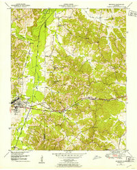 1950 Bruceton1953 Print · USGSBruceton and the surrounding Tennessee lowlands appear here in the early 1950s, showing a landscape defined by the Nashville Chattanooga and St Louis railway. Local historians can trace old landmarks like Sawyers Mill, Sandy Point Sch, and the historical path of the Natchez Trace.3 unique versions available
 - 1950 Map of Holladay, 1953 Print
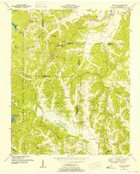 1950 Holladay1953 Print · USGSBenton and Carroll counties meet in this mid-century survey of West Tennessee just as the modern state park system was maturing. Genealogists can locate family names and rural centers like Shiloh, Poplar Springs Sch, and the Williams Cem.3 unique versions available
 - 1950 Map of Vale, 1953 Print
 1950 Vale1953 Print · USGSCarroll County was a hub of rail activity in the early 1950s, centered on the junction at Hollow Rock and Bruceton. Researchers can trace old family sites and schools like Thompson School or visit rural landmarks like Crews Store and the Bethlehem Church.3 unique versions available
 - 1950 Map of Seventeen Creek, 1953 Print
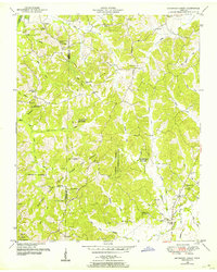 1950 Seventeen Creek1953 Print · USGSThe wooded borderlands of Carroll and Benton counties are captured here in the early fifties, a landscape defined by the Natchez Trace State Park and Forest. Genealogists can locate family landmarks like Friendship Cem and Abbott Cem alongside rural schools like Carroll Sch.4 unique versions available
 - 1950 Map of Buena Vista, 1953 Print
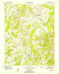 1950 Buena Vista1953 Print · USGSCarroll County was a landscape of small rail-stops and country parishes during the early fifties. Researchers can trace family ties through numerous rural landmarks like Williams Chapel, the Westport Sch, and Smyrna along the Nashville Chattanooga and St Louis line.3 unique versions available
 - 1950 Map of Mansfield, 1953 Print
 1950 Mansfield1953 Print · USGSHenry and Carroll counties are captured here in the early fifties, showcasing a rural landscape defined by the Tennessee Valley Divide. Researchers can trace old family sites like Dumpling Hill Cem and settlements at Mansfield and Routon.3 unique versions available
 - 1950 Map of Clarksburg, 1953 Print
 1950 Clarksburg1953 Print · USGSWest Tennessee rural life is documented here at mid-century, where the Tennessee Valley Divide separates the river systems of Carroll and Henderson Counties. Researchers can trace family history through numerous landmarks like Parker Crossroads, Hickory Plains Church, and Parkers Chapel School.2 unique versions available
 - 1955 Map of Henry, 1957 Print
 1955 Henry1957 Print · USGSHenry and the surrounding countryside are shown in the mid-1950s as the railroad and small-town schools shaped West Tennessee life. Genealogists can trace family landmarks like Dillahunty Cem and Caton Springs Cem, or find old gathering places such as Salem Ch.3 unique versions available
 - 1955 Map of Huntingdon, 1957 Print
 1955 Huntingdon1957 Print · USGSMid-century Carroll County shows a landscape of small communities and rail corridors centered on the town of Huntingdon. Researchers can trace the Nashville Chattanooga and St Louis line to outlying spots like Hico Station or locate family history at Long Rock Cem and Hale Sch.3 unique versions available
 - 1956 Map of Dyersburg, 1960 Print
 1956 Dyersburg1960 Print · USGSThe Four Rivers region comes alive in the mid-fifties, capturing the intricate borderlands of Tennessee, Kentucky, and Missouri. Genealogists and historians can trace the rail-and-river networks connecting Dyersburg, Caruthersville, and the shoreline of Reelfoot Lake.4 unique versions available
 - 1956 Map of Blytheville, 1964 Print
 1956 Blytheville1964 Print · USGSWest Tennessee and the Arkansas Delta come alive in this mid-century survey of the river-and-rail corridor connecting Memphis to Jackson. Genealogists and historians can trace the rail lines of the Louisville and Nashville RR and locate landmarks like Western State Hospital or Fort Pillow State Prison Farm.2 unique versions available
Showing maps 1-25 of 133
Top cities of Carroll County
- McKenzie historical maps
- Huntingdon historical maps
- Bruceton historical maps
- Atwood historical maps
- Hollow Rock historical maps
- Trezevant historical maps
See more
Frequently asked questions
- What are the different types of historical maps available for Carroll County?
- What is the oldest map of Carroll County?
- Where can I purchase historical maps of Carroll County for my home or office?
- Where can I download high-res historical maps of Carroll County?
- Are there historical topographic maps available for Carroll County?
- Is there historical aerial imagery available for Carroll County?
- Where are historical maps of Carroll County sourced from?