1900s (20th Century) Maps of Little Milligan, Tennessee
Explore 10 historic maps of Little Milligan from the 1900s (20th Century). These maps offer a rare glimpse into what life looked like during the 1900s — showing old roads, neighborhoods, homes, and landmarks that have changed or disappeared over time.
Whether you're researching your family's past, planning a metal detecting trip, or studying how Little Milligan's landscape evolved across the 1900s, these high-resolution maps are a powerful tool for exploring the history of this region.
- Focus on a specific era: All maps on this page are from the 1900s, giving you a focused view of this time period.
- See what’s changed: Compare century-old streets, trails, and buildings to today's modern landscape using overlays and satellite layers.
- Research with precision: Use these maps for genealogy, historical research, land use analysis, or educational projects.
- View, download, or print: Maps are fully viewable online in high resolution, and can be downloaded or printed for your own records.
Start exploring Little Milligan's history through authentic maps from the 1900s. This is your window into the past.
Little Milligan, TN maps
(10)- 1904 Map of Roan Mountain
 1904 Roan Mountain1904 Print · USGSUpper East Tennessee and Western North Carolina are documented here at a time when river fords and narrow-gauge railroads still connected mountain hollows. Trace the paths to Hodge Ore Bank, find old Poplar Ridge Church, or locate river crossings like Yoakley Ferry.4 unique versions available
 - 1935 Map of Watauga Valley
 1935 Watauga Valley1935 Print · USGSUpper East Tennessee's river valleys and mountain ridges are documented here during the mid-thirties, centered on the growing industrial hub of Elizabethton. Researchers can locate numerous vanished landmarks, from the Manganese Mine to rural schoolhouses like Caldwell Springs Sch.
 - 1935 Map of Fish Springs
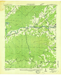 1935 Fish Springs1935 Print · USGSNortheast Tennessee in the mid-1930s was a landscape of steep mountain ridges and river-valley settlements on the eve of significant TVA changes. Researchers can trace the path of the SOUTHERN RAILWAY through Fish Springs, find remote schools like Horseshoe Sch, and locate industrial landmarks such as the LIME KILN.
 - 1938 Map of Fish Springs
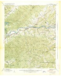 1938 Fish Springs1938 Print · USGSThe Watauga River valley in East Tennessee is shown here in the late 1930s, featuring the winding Southern Railway and the original townsite of Butler. Local historians can trace family-named landmarks and rural hubs like Fish Springs and Campbell Chapel.2 unique versions available
 - 1955 Map of Johnson City
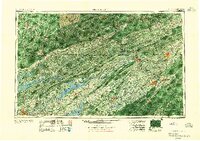 1955 Johnson City1955 Print · USGSEast Tennessee and the bordering highlands of Virginia and Kentucky appear here during the post-war industrial boom. You can trace the complex network of mountain ridges and new TVA lakes, from Johnson City to the coalfields near Middlesboro and Lynch.
 - 1957 Map of Johnson City, 1966 Print
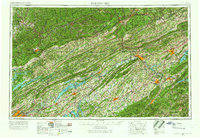 1957 Johnson City1966 Print · USGSUpper East Tennessee and Southwest Virginia are shown here during the mid-sixties transition of the Appalachians. Researchers can trace the industrial rail hubs of Kingsport, the sprawling waters of Cherokee Lake, and the historic Cumberland Gap.
 - 1960 Map of Johnson City
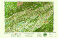 1960 Johnson City1960 Print · USGSUpper East Tennessee and the surrounding tri-state area are shown in the mid-fifties during the height of the TVA reservoir era. Trace the industrial rail lines of the Southern and Louisville and Nashville between Kingsport and Johnson City.
 - 1960 Map of Watauga Dam, 1962 Print
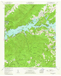 1960 Watauga Dam1962 Print · USGSThe Tennessee highlands appear here in the early sixties, centered on the newly created Watauga Lake and the relocated town of Butler. Local researchers can trace family lands through numerous burial sites like Griffith Cem and Nidiffer Chapel.4 unique versions available
 - 1963 Map of Johnson City
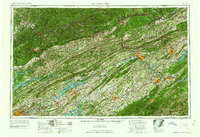 1963 Johnson City1963 Print · USGSThe Tri-Cities and the surrounding Appalachian ridges are shown in detail during the early sixties, highlighting the era's vital rail and river networks. Genealogists and historians can trace the routes of the Clinchfield RR and locate settlements from Rogersville to Elizabethton.
 - 1980 Map of Johnson City, 1981 Print
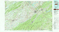 1980 Johnson City1981 Print · USGSEast Tennessee in the early eighties shows a landscape of mountain ridges and growing valley towns. Trace local history through Washington College and the Andrew Johnson National Cemetery, or find sites like David Crockett Birthplace State Park.
End of results
Showing maps 1-10 of 10
Top cities near Little Milligan
- Bristol historical maps
- Elizabethton historical maps
- Mountain City historical maps
- Walnut Hill historical maps
- Banner Elk historical maps
- Newland historical maps
See more
Frequently asked questions
- What are the different types of historical maps available for Little Milligan?
- What is the oldest map of Little Milligan?
- Where can I purchase historical maps of Little Milligan for my home or office?
- Where can I download high-res historical maps of Little Milligan?
- Are there historical topographic maps available for Little Milligan?
- Is there historical aerial imagery available for Little Milligan?
- Where are historical maps of Little Milligan sourced from?