2020s Maps of Clay County, Tennessee
Explore 10 historic maps of Clay County from the 2020s. These maps offer a rare glimpse into what life looked like during the 2020s — showing old roads, neighborhoods, homes, and landmarks that have changed or disappeared over time.
Whether you're researching your family's past, planning a metal detecting trip, or studying how Clay County's landscape evolved across the 2020s, these high-resolution maps are a powerful tool for exploring the history of this region.
- Focus on a specific era: All maps on this page are from the 2020s, giving you a focused view of this time period.
- See what’s changed: Compare century-old streets, trails, and buildings to today's modern landscape using overlays and satellite layers.
- Research with precision: Use these maps for genealogy, historical research, land use analysis, or educational projects.
- View, download, or print: Maps are fully viewable online in high resolution, and can be downloaded or printed for your own records.
Start exploring Clay County's history through authentic maps from the 2020s. This is your window into the past.
Clay County, TN maps
(10)- 2022 Map of Willette, 2022 Print
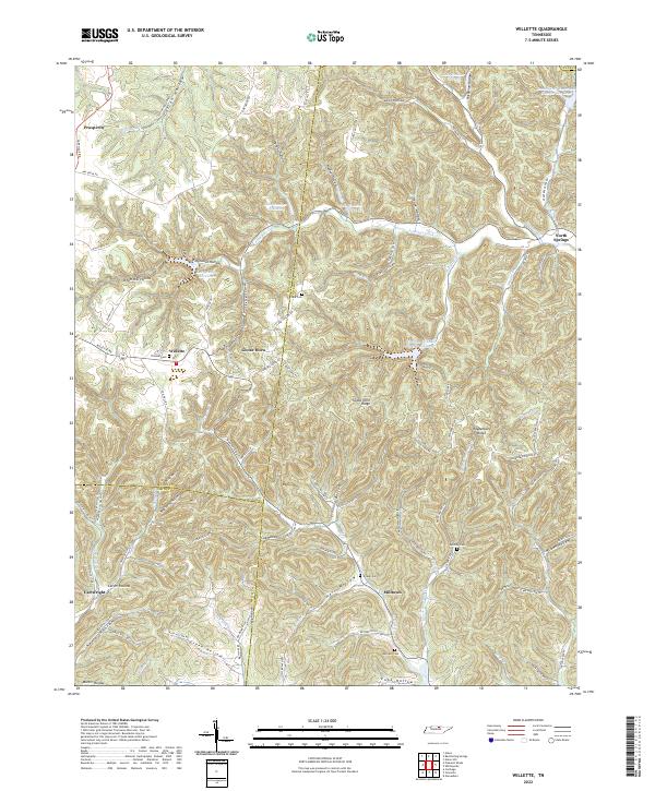 2022 Willette2022 Print · USGSUpper Middle Tennessee hill country is captured here in the early twenty-first century where Macon, Jackson, and Smith counties meet. Researchers can trace family history through numerous rural burials like Thomas Cemetery and Clark Cemetery, or explore the deep hollows of Willette and North Springs.
 - 2022 Map of Celina, 2022 Print
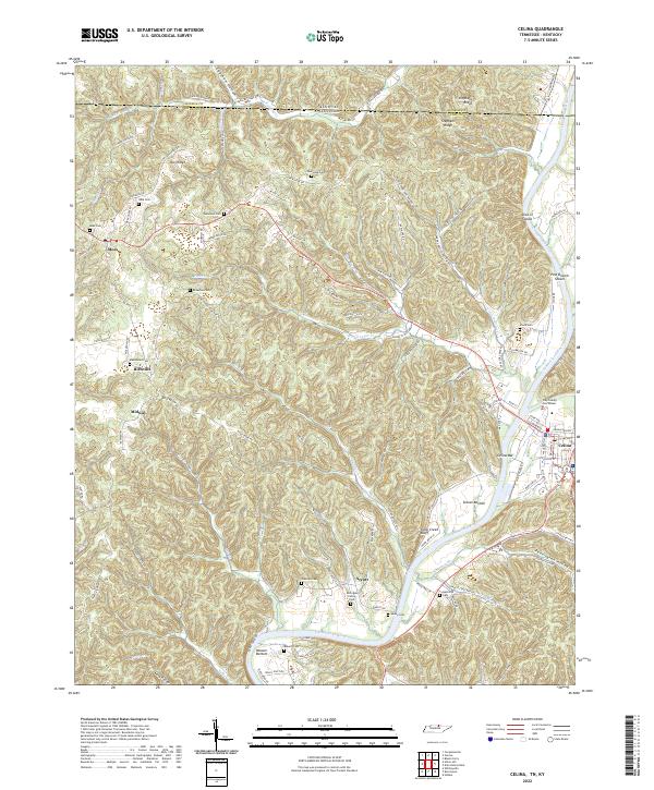 2022 Celina2022 Print · USGSThe Tennessee-Kentucky border comes alive in this contemporary survey of the Clay County highlands. Researchers can trace ancestral roots through dozens of family burial grounds like the McColgan Family Cem or study river navigation at Pine Branch Shoals and Celina Bar.
 - 2022 Map of Hilham, 2022 Print
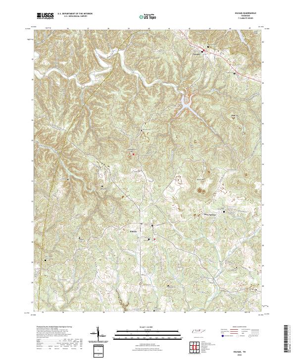 2022 Hilham2022 Print · USGSOverton County’s rugged plateau terrain is documented here in the early twenty-first century, showing a landscape deeply shaped by family history and rural traditions. Genealogists can locate specific family plots like the Johnie Humpy Brown Cem and Hawkins Family Cem or trace the early paths of Old Standing Stone Rd.
 - 2022 Map of Union Hill, 2022 Print
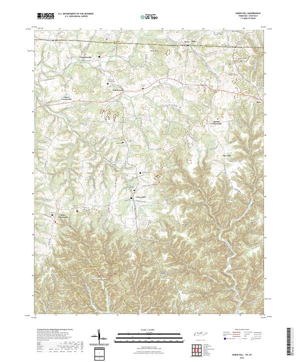 2022 Union Hill2022 Print · USGSThe Tennessee-Kentucky border comes alive in this 2022 survey of Clay County, showing a landscape of deep hollows and high ridges. Trace family history through numerous burial sites like Union Hill Cem and the James H Cherry Family Cem.
 - 2022 Map of Burristown, 2022 Print
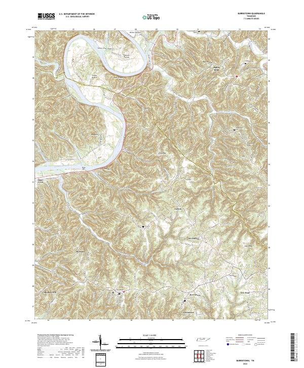 2022 Burristown2022 Print · USGSThe Cumberland River loops through the Tennessee hills near the Clay and Jackson county line in this contemporary record. Genealogists and local researchers can trace family landmarks like McDonald Cem, find old river bottoms such as Tinsley Bottom, and locate rural settlements including Burristown and Harmony.
 - 2022 Map of Red Boiling Springs, 2022 Print
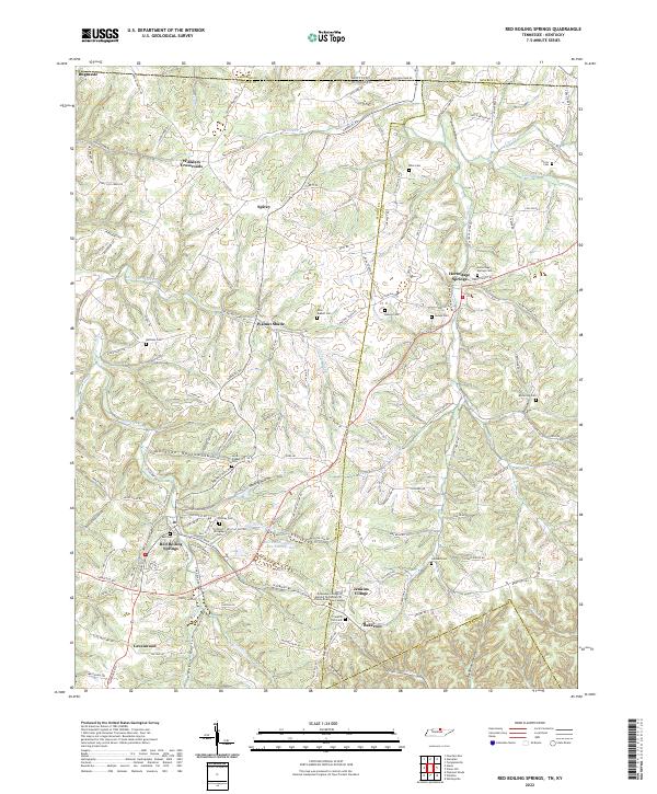 2022 Red Boiling Springs2022 Print · USGSMacon County's mineral spring country and the Tennessee-Kentucky border are shown in detail here. Genealogists can trace family landmarks across the landscape, including Bugtussle, the Cothron-Gregory Cem, and several rural churches like Smith Chapel.
 - 2022 Map of Dale Hollow Dam, 2022 Print
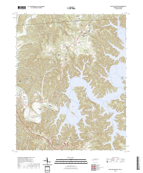 2022 Dale Hollow Dam2022 Print · USGSClay County and the Tennessee-Kentucky border are defined by the winding waters of the Obey River and the plateau ridges. Genealogists can trace family heritage through numerous remote burial sites like Free Hill Cem, Tinsley Cem, and Thompson Webb Cem.
 - 2022 Map of Whitleyville, 2022 Print
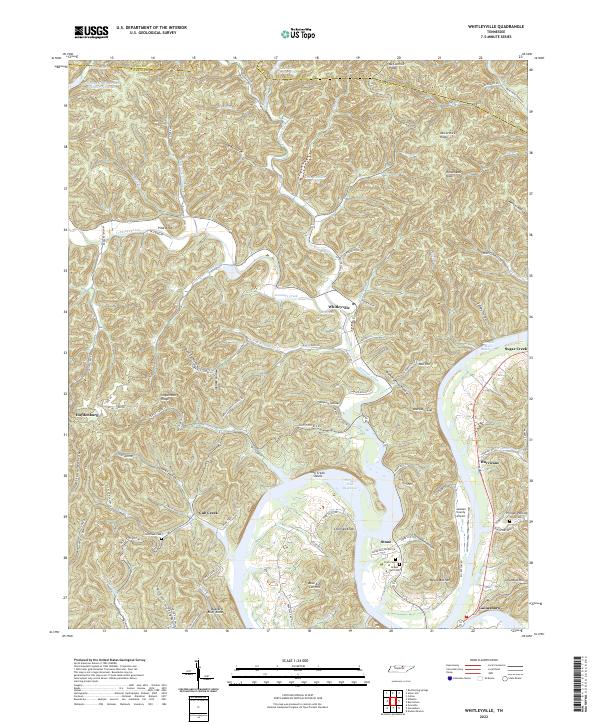 2022 Whitleyville2022 Print · USGSJackson County at the start of the 2020s shows a landscape defined by the winding waters of the Cordell Hull Reservoir and steep ridge-and-hollow terrain. Researchers can locate historic rural burial grounds like Clark Cem and trace old routes through Moccasin Gap and the community of Whitleyville.
 - 2022 Map of Dale Hollow Reservoir SE, 2022 Print
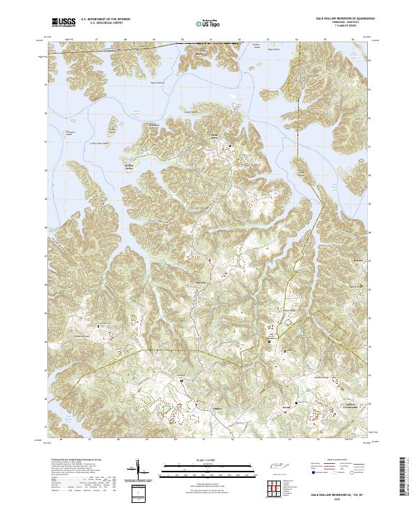 2022 Dale Hollow Reservoir SE2022 Print · USGSThe Dale Hollow Reservoir region in North-Central Tennessee is captured here in the early twenty-first century, showing the complex interaction of modern waters and old upland settlements. Trace family history through numerous burial sites like Chowning Cem or explore the ridges surrounding Willow Grove and Taylors Crossroads.
 - 2022 Map of Frogue, 2022 Print
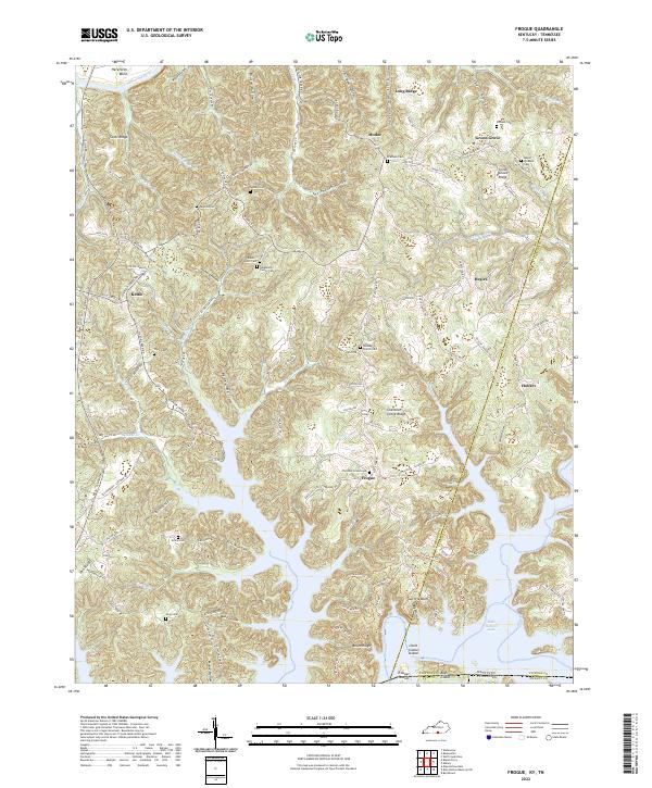 2022 Frogue2022 Print · USGSThe Cumberland and Clinton County line meets the Tennessee border in this modern map of a deeply dissected reservoir landscape. Genealogists can locate numerous family burial grounds like Mount Pleasant Cem and Grace Cem or trace old routes near Frogue and Hegira.
End of results
Showing maps 1-10 of 10
Top cities of Clay County
Frequently asked questions
- What are the different types of historical maps available for Clay County?
- What is the oldest map of Clay County?
- Where can I purchase historical maps of Clay County for my home or office?
- Where can I download high-res historical maps of Clay County?
- Are there historical topographic maps available for Clay County?
- Is there historical aerial imagery available for Clay County?
- Where are historical maps of Clay County sourced from?