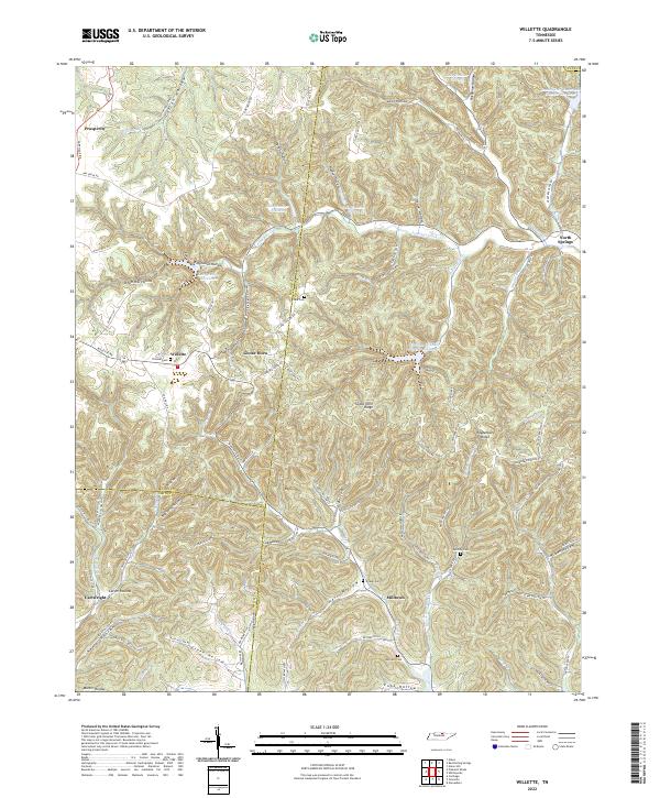
2022 Map of Willette
USGS Topo · Published 2022About this map
The intersection of Macon, Jackson, and Smith counties forms the heart of this landscape, where steep-walled hollows and ridges dictate the pattern of rural settlement. Small communities like Willette and Goose Horn are positioned along the lower elevations where creeks like Jennings Creek and Wartrace Creek have carved navigable paths through the terrain. The map reveals a dense network of family-named landmarks and secluded burials, including Thomas Cemetery and Wartrace Cemetery, which serve as vital touchstones for local genealogists.
Find a feature on this map
100 named features on this map. Tap any name to fly to it.
Don’t see what you’re looking for? This feature index may not catch every label — zoom into the map to look around manually.
Map Details
Editions of this 2022 Willette Map
This is the sole edition of this map. No revisions or reprints were ever made.
Other maps of this area

1925 · Gainesboro
USGS Topo · 1:62,500

1929 · Gainesboro
USGS Topo · 1:62,500

1929 · Tompkinsville
USGS Topo · 1:62,500

1931 · Red Boiling Springs
USGS Topo · 1:62,500

1932 · Carthage
USGS Topo · 1:62,500

1956 · Corbin
USGS Topo · 1:250,000

1958 · Corbin
USGS Topo · 1:250,000
1968 · Willette
USGS Topo · 1:24,000
1968 · Pleasant Shade
USGS Topo · 1:24,000
1968 · Whitleyville
USGS Topo · 1:24,000