
1956 Map of Corbin
USGS Topo · Published 1966About this map
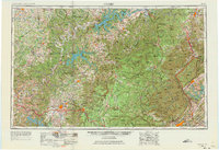
Lake Cumberland and the Cumberland River anchor the northern landscape of this mid-century regional survey, which spans the rugged borderlands between Kentucky and Tennessee. The map illustrates a period of significant infrastructure and conservation, showing the established bounds of the Cumberland National Forest and large-scale water projects like Dale Hollow Res and Norris Lake. This era highlights the transition from traditional river-and-rail economies to the modern highway system, as the newly traced Interstate 75 begins to cut through the territory, paralleling older routes like U S 25 and the historic Louisville and Nashville railroad.
Find a feature on this map
55 named features on this map. Tap any name to fly to it.
Don’t see what you’re looking for? This feature index may not catch every label — zoom into the map to look around manually.
Map Details
Editions of this 1956 Corbin Map
3 editions found
Other maps of this area

1886 · Knoxville
USGS Topo · 1:125,000

1886 · Cumberland Gap
USGS Topo · 1:125,000

1887 · Kingston
USGS Topo · 1:125,000

1888 · Cumberland Gap
USGS Topo · 1:125,000

1890 · Williamsburg
USGS Topo · 1:125,000

1891 · Manchester
USGS Topo · 1:125,000

1891 · Cumberland Gap
USGS Topo · 1:125,000

1891 · Kingston
USGS Topo · 1:125,000

1892 · Pikeville
USGS Topo · 1:125,000

1892 · Knoxville
USGS Topo · 1:125,000