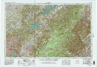
1956 Map of Corbin
USGS Topo · Published 1981About this map
Corbin and the surrounding plateau regions of southern Kentucky and north-central Tennessee are documented during a period of significant mid-century transition. The landscape is defined by the development of the Upper Cumberland and the emergence of Oak Ridge as a major regional center. The map captures the established county seats and market towns such as Monticello, Cookeville, and Glasgow before the full expansion of the modern interstate system. These settlements are connected by a dense network of primary and secondary roads, many of which were revised in 1965 to reflect updated infrastructure. In the east, La Follette and Williamsburg sit within the rising topography of the Cumberland Mountains. This 1:250,000 scale survey provides a regional perspective on the relationship between the river valleys, the developing highlands, and the industrial hubs like Clinton that supported the growing population in the post-war era.
Find a feature on this map
16 named features on this map. Tap any name to fly to it.
Don’t see what you’re looking for? This feature index may not catch every label — zoom into the map to look around manually.
Map Details
Editions of this 1956 Corbin Map
3 editions found

Other maps of this area

1886 · Knoxville
USGS Topo · 1:125,000

1886 · Cumberland Gap
USGS Topo · 1:125,000

1887 · Kingston
USGS Topo · 1:125,000

1888 · Cumberland Gap
USGS Topo · 1:125,000

1890 · Williamsburg
USGS Topo · 1:125,000

1891 · Manchester
USGS Topo · 1:125,000

1891 · Cumberland Gap
USGS Topo · 1:125,000

1891 · Kingston
USGS Topo · 1:125,000

1892 · Pikeville
USGS Topo · 1:125,000

1892 · Knoxville
USGS Topo · 1:125,000