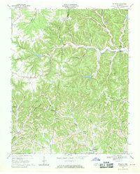
1968 Map of Willette
USGS Topo · Published 1970About this map
Willette and North Springs anchor this landscape of deep hollows and narrow ridges at the junction of Macon, Jackson, and Smith counties. The terrain is defined by its intricate drainage patterns, with Jennings Creek winding through the center, flanked by prominent features like Goose Horn Ridge and Haydenburg Ridge. This 1968 survey documents the rural character of the region just as the Cordell Hull Reservoir was set to alter the southern landscape; blue hatching indicates the specific low-lying areas along Wartrace Creek and Defeated Creek slated for submersion.
Find a feature on this map
53 named features on this map. Tap any name to fly to it.
Don’t see what you’re looking for? This feature index may not catch every label — zoom into the map to look around manually.
Map Details
Editions of this 1968 Willette Map
This is the sole edition of this map. No revisions or reprints were ever made.
Other maps of this area

1925 · Gainesboro
USGS Topo · 1:62,500

1929 · Gainesboro
USGS Topo · 1:62,500

1929 · Tompkinsville
USGS Topo · 1:62,500

1931 · Red Boiling Springs
USGS Topo · 1:62,500

1932 · Carthage
USGS Topo · 1:62,500

1956 · Corbin
USGS Topo · 1:250,000

1958 · Corbin
USGS Topo · 1:250,000
1968 · Pleasant Shade
USGS Topo · 1:24,000
1968 · Whitleyville
USGS Topo · 1:24,000
1968 · Gainesboro
USGS Topo · 1:24,000