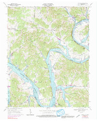
1968 Map of Granville
USGS Topo · Published 1991About this map
Cumberland River bends sharply through Jackson and Smith Counties, defining the agricultural and early industrial life of the Upper Cumberland. By the late 1960s, the landscape was undergoing a significant transformation with the rising waters of the Cordell Hull Reservoir, which submerged the river's traditional banks and altered the topography of Brooks Bend and Holleman Bend. The settlement of Granville remains a focal point, supported by the Granville Sch and nearby rural communities like Kempville and Bagdad.
Find a feature on this map
65 named features on this map. Tap any name to fly to it.
Don’t see what you’re looking for? This feature index may not catch every label — zoom into the map to look around manually.
Map Details
Editions of this 1968 Granville Map
3 editions found
Other maps of this area

1925 · Gainesboro
USGS Topo · 1:62,500

1928 · Gordonsville
USGS Topo · 1:62,500

1929 · Gainesboro
USGS Topo · 1:62,500

1932 · Carthage
USGS Topo · 1:62,500

1942 · Statesville
USGS Topo · 1:100,000

1943 · Cookeville
USGS Topo · 1:100,000

1944 · Cookeville
USGS Topo · 1:100,000

1955 · Baxter
USGS Topo · 1:24,000

1956 · Corbin
USGS Topo · 1:250,000

1958 · Corbin
USGS Topo · 1:250,000