
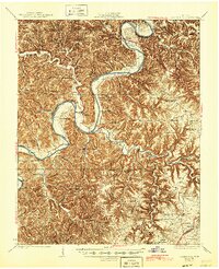
1929 Map of Gainesboro
USGS Topo · Published 1929About this map
Gainesboro serves as the focal point of this Jackson County landscape, situated near the confluence of the Cumberland River and the Roaring River. Surveyed in the mid-1920s, the map reveals a society deeply reliant on river crossings before the era of modern bridging, with Gainesboro Ferry, Brooks Ferry, and Wicks Ferry providing vital links for rural commerce. The intricate network of hills and hollows is dotted with small-scale agrarian infrastructure, including Cummins Mill and numerous family-named landmarks like Butlers Landing. The social fabric of these upland communities is clearly defined by its educational and religious centers, such as Twelve Corners Sch and Smith Chapel. The terrain's complexity is emphasized by landmarks like Sisters Bluff and the broad agricultural flat of Big Bottom, illustrating how the winding river system dictated settlement patterns in the Highland Rim.
Find a feature on this map
75 named features on this map. Tap any name to fly to it.
Don’t see what you’re looking for? This feature index may not catch every label — zoom into the map to look around manually.
Map Details
Editions of this 1929 Gainesboro Map
2 editions found
Other maps of this area

1897 · Standingstone
USGS Topo · 1:125,000

1898 · Standingstone
USGS Topo · 1:125,000

1924 · Lillydale
USGS Topo · 1:62,500

1925 · Gainesboro
USGS Topo · 1:62,500

1926 · Lillydale
USGS Topo · 1:62,500

1928 · Gordonsville
USGS Topo · 1:62,500

1929 · Lillydale
USGS Topo · 1:62,500

1929 · Tompkinsville
USGS Topo · 1:62,500

1931 · Red Boiling Springs
USGS Topo · 1:62,500

1932 · Carthage
USGS Topo · 1:62,500