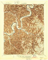
1929 Map of Gainesboro
USGS Topo · Published 1945About this map
Cumberland River carves a deep path through Jackson County, defining the commerce and movement of the region through several vital crossings like Crowders Ferry, Gainesboro Ferry, and Brooks Ferry. This 1925 survey reveals a landscape of high ridges and narrow valleys, where small farming communities are connected by a dense network of country schools and local churches. The county seat at Gainesboro serves as the central hub, while smaller settlements like Whitleyville and Tinsley Bottom anchor the outlying districts.
Find a feature on this map
73 named features on this map. Tap any name to fly to it.
Don’t see what you’re looking for? This feature index may not catch every label — zoom into the map to look around manually.
Map Details
Editions of this 1929 Gainesboro Map
2 editions found
Other maps of this area

1897 · Standingstone
USGS Topo · 1:125,000

1898 · Standingstone
USGS Topo · 1:125,000

1924 · Lillydale
USGS Topo · 1:62,500

1925 · Gainesboro
USGS Topo · 1:62,500

1926 · Lillydale
USGS Topo · 1:62,500

1928 · Gordonsville
USGS Topo · 1:62,500

1929 · Lillydale
USGS Topo · 1:62,500

1929 · Gainesboro
USGS Topo · 1:62,500

1929 · Tompkinsville
USGS Topo · 1:62,500

1931 · Red Boiling Springs
USGS Topo · 1:62,500