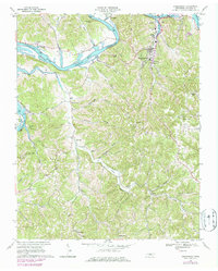
1968 Map of Gainesboro
USGS Topo · Published 1979About this map
Gainesboro serves as the focal point of this Jackson County survey, situated near the confluence where the Roaring River meets the winding Cumberland River. The mid-century landscape is defined by the significant presence of the Cordell Hull Reservoir, which carves through the terrain between steep ridges like Poston Ridge and Ray Bluff Knob. The map documents a deeply rural social fabric, evidenced by numerous named hollows such as Pinchgut, Shakerag, and Buffalo. Genealogists will find a wealth of specific local landmarks, from the uniquely named settlement of Nameless in the south to various country churches and family burial grounds like Pharris Cem and Stafford Cem. Smaller communities such as Flynns Lick, McCoinsville, and Antioch are connected by a network of valley roads like Fort Blount Ferry Road, tracing the paths of Flynn Creek and its many branches.
Find a feature on this map
63 named features on this map. Tap any name to fly to it.
Don’t see what you’re looking for? This feature index may not catch every label — zoom into the map to look around manually.
Map Details
Editions of this 1968 Gainesboro Map
3 editions found
Other maps of this area

1925 · Gainesboro
USGS Topo · 1:62,500

1928 · Gordonsville
USGS Topo · 1:62,500

1929 · Gainesboro
USGS Topo · 1:62,500

1932 · Carthage
USGS Topo · 1:62,500

1942 · Statesville
USGS Topo · 1:100,000

1943 · Cookeville
USGS Topo · 1:100,000

1944 · Cookeville
USGS Topo · 1:100,000

1953 · Cookeville West
USGS Topo · 1:24,000

1955 · Baxter
USGS Topo · 1:24,000

1956 · Corbin
USGS Topo · 1:250,000