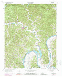
1968 Map of Whitleyville
USGS Topo · Published 1989About this map
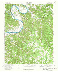
Whitleyville lies at the heart of this landscape, situated where Jennings Creek meanders toward its confluence with the Cumberland River. The topography is defined by the winding course of the Cordell Hull Reservoir, which floods the ancient river valley and forms deep inlets such as Moore Bottom. Along the western edge, Haydenburg Ridge rises sharply, punctuated by a Lookout Tower overlooking the community of Haydenburg. The mapping reveals a rural infrastructure of small family settlements and religious centers like South Fork Ch and Willow Grove Ch. North of the river, the terrain is fragmented by numerous branches including Lick Branch and German Branch, while to the south, the Jackson County Airport and the outskirts of Gainesboro indicate more modern development. This document captures the transition of the Cumberland valley following the reservoir's creation, showing how water and ridges dictate the placement of roads and homesteads.
Find a feature on this map
59 named features on this map. Tap any name to fly to it.
Don’t see what you’re looking for? This feature index may not catch every label — zoom into the map to look around manually.
Map Details
Editions of this 1968 Whitleyville Map
2 editions found
Other maps of this area

1925 · Gainesboro
USGS Topo · 1:62,500

1929 · Gainesboro
USGS Topo · 1:62,500

1929 · Tompkinsville
USGS Topo · 1:62,500

1931 · Red Boiling Springs
USGS Topo · 1:62,500

1932 · Carthage
USGS Topo · 1:62,500

1956 · Corbin
USGS Topo · 1:250,000

1958 · Corbin
USGS Topo · 1:250,000
1968 · Dodson Branch
USGS Topo · 1:24,000
1968 · Willette
USGS Topo · 1:24,000
1968 · Burristown
USGS Topo · 1:24,000