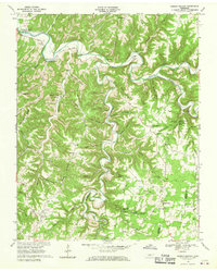
1968 Map of Dodson Branch
USGS Topo · Published 1970About this map
Roaring River and Blackburn Fork carve deep, winding paths through the highland plateau of north-central Tennessee. This late-1960s survey captures a landscape defined by isolated ridge-top settlements and narrow hollows, where family-named landmarks like Overton Cem and Hensley Cem reveal deep generational roots. The map documents the northern extent of the Cordell Hull Reservoir as its waters began to influence the drainage of the river.
Find a feature on this map
73 named features on this map. Tap any name to fly to it.
Don’t see what you’re looking for? This feature index may not catch every label — zoom into the map to look around manually.
Map Details
Editions of this 1968 Dodson Branch Map
This is the sole edition of this map. No revisions or reprints were ever made.
Other maps of this area

1897 · Standingstone
USGS Topo · 1:125,000

1898 · Standingstone
USGS Topo · 1:125,000

1925 · Gainesboro
USGS Topo · 1:62,500

1929 · Gainesboro
USGS Topo · 1:62,500

1943 · Cookeville
USGS Topo · 1:100,000

1944 · Cookeville
USGS Topo · 1:100,000

1951 · Windle
USGS Topo · 1:24,000

1953 · Cookeville East
USGS Topo · 1:24,000

1953 · Cookeville West
USGS Topo · 1:24,000
1955 · Hilham
USGS Topo · 1:24,000