Old Maps of Clevenger, Newport for Metal Detecting
Plan your next treasure hunt with 17 historic maps of Clevenger. Find old homesites, ghost towns, trails, and gathering spots that may be lost to time — perfect for identifying promising metal detecting locations.
- Locate forgotten sites: Uncover places like long-lost settlements, abandoned rail lines, or gathering spots.
- Plan better hunts: Use map overlays combined with LiDAR or satellite views to narrow in on historically rich areas.
- Made for detectorists: Thousands of hobbyists use these maps to discover relics, coins, and hidden history.
Use these historic maps to boost your research and find new opportunities beneath the surface of Clevenger.
Clevenger, Newport maps
(17)- 1893 Map of Mt Guyot
 1893 Mt Guyot1893 Print · USGSThe Tennessee and North Carolina borderlands are captured here in the 1890s, when isolated mountain coves and river towns relied on the Virginia and Georgia Railroad. Researchers can trace old family sites and transport routes through Fair Garden, Jones Cove, and along the Elliot Ferry Road.3 unique versions available
 - 1912 Map of Mt Guyot
 1912 Mt Guyot1912 Print · USGSThe Tennessee and North Carolina borderlands come into focus in the early twentieth century, prior to the creation of the Great Smoky Mountains National Park. Trace ancestral locations like Cataloochee and Smokemont or follow the Southern RR to Newport.5 unique versions available
 - 1935 Map of English Mountain
 1935 English Mountain1935 Print · USGSSevier County and the foothills of the Smokies are seen here during the mid-thirties as the national park was taking shape. Genealogists can trace family roots through scores of rural institutions like Smoky Mtn Academy, Pittman Center, and the Crockettville Sch.
 - 1935 Map of Clevenger
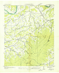 1935 Clevenger1935 Print · USGSJefferson and Cocke Counties are shown in the mid-1930s, featuring the rural communities nestled against the slopes of English Mountain. Genealogists and historians can locate family landmarks like Bridges Ch, trace the site of CCC Camp No 1467, or find the old Blowing Cave Mill.
 - 1939 Map of Clevenger, 1954 Print
 1939 Clevenger1954 Print · USGSJefferson and Cocke counties meet along the French Broad River in the late thirties, just as the local highway network was expanding. Genealogists can trace early homesteads and landmarks like Blowing Cave Mill, Bird Crossroads, and the Bogard Ch Rainwater Sch.
 - 1940 Map of Clevenger
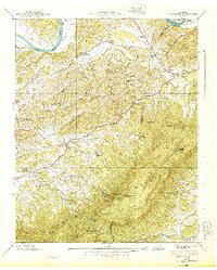 1940 Clevenger1940 Print · USGSJefferson and Cocke counties are captured here in the late 1930s, showing a landscape of high ridges and river bottomlands. Researchers can find numerous rural landmarks like the Blowing Cave Mill, the Bogard Ch Rainwater Sch, and the riverside community of Dutch Bottoms.2 unique versions available
 - 1955 Map of Knoxville
 1955 Knoxville1955 Print · USGSThe Southern Appalachians and the Smoky Mountains are shown here at a peak of mid-century development and conservation. Genealogists and historians can trace the early road networks connecting Gatlinburg, Waynesville, and the Cherokee Indian Reservation across the high ridges.
 - 1957 Map of Knoxville, 1966 Print
 1957 Knoxville1966 Print · USGSThe Southern Appalachians of Tennessee and North Carolina are mapped here during the mid-twentieth century as new highways reached the high country. Genealogists and historians can trace the topography between Knoxville and Asheville, locating family landmarks near Fontana Lake or along the Blue Ridge Parkway.4 unique versions available
 - 1960 Map of Knoxville
 1960 Knoxville1960 Print · USGSThe Southern Appalachians come alive in the 1950s, showing the intersection of new national park tourism and deep-rooted mountain industry. Trace old rail lines like the Clinchfield RR and find high-altitude landmarks from Mt Le Conte to the Cherokee Indian Reservation.2 unique versions available
 - 1961 Map of Chestnut Hill, 1964 Print
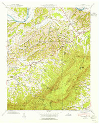
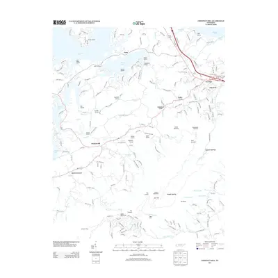
 1961 Chestnut Hill1964 Print · USGSThe foothills of the Smokies in the early sixties are defined here by the rise of English Mountain above the French Broad River. Genealogists and historians can trace numerous family-named landmarks and rural hubs, from Blowing Cave Mill to Dickey School Ch and Reidtown.3 unique versions available
 - 1964 Map of Knoxville
 1964 Knoxville1964 Print · USGSThe Southern Appalachians and Great Smokies are captured here during the mid-sixties, showing the rugged borderlands of Tennessee and North Carolina. Researchers can trace historic mountain routes like U S 441, the expanse of Pisgah National Forest, and the growing footprints of Asheville and Knoxville.
 - 1983 Map of Knoxville, 1984 Print
 1983 Knoxville1984 Print · USGSThe Tennessee valley and the rising Smokies are captured here in the early eighties, showing the region as the tourism and transit hub of the Southern Appalachians. Researchers can trace the layout of the University of Tennessee or locate rural landmarks like Shady Grove Ch and Pleasant Hill Cem.
 - 2010 Map of Chestnut Hill, 2010 Print
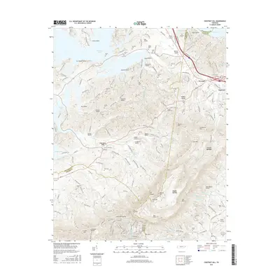
 2010 Chestnut Hill2010 Print · USGSCovers Clevenger, including Newport, Tryon, and other nearby areas
 - 2013 Map of Chestnut Hill, 2013 Print
 2013 Chestnut Hill2013 Print · USGSCovers Clevenger, including Newport, Tryon, and other nearby areas
 - 2016 Map of Chestnut Hill, 2016 Print
 2016 Chestnut Hill2016 Print · USGSCovers Clevenger, including Newport, Tryon, and other nearby areas
 - 2019 Map of Chestnut Hill, 2019 Print
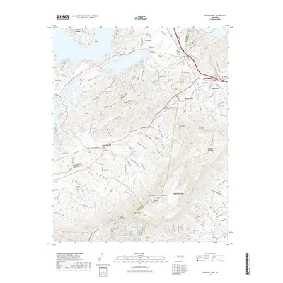 2019 Chestnut Hill2019 Print · USGSCovers Clevenger, including Newport, Tryon, and other nearby areas
 - 2022 Map of Chestnut Hill, 2022 Print
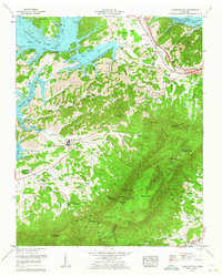
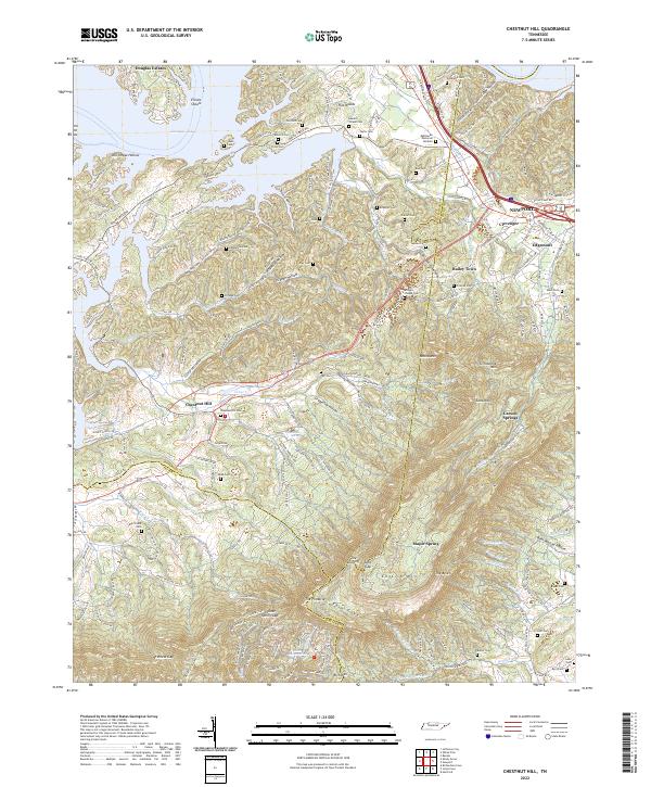 2022 Chestnut Hill2022 Print · USGSThe foothills and ridges of East Tennessee come alive in this detailed look at the area between Douglas Lake and English Mountain. Genealogists can trace family heritage through dozens of local sites like Bridges Chapel Cem, Webb Cem, and the community at Chestnut Hill.
End of results
Showing maps 1-17 of 17
Top cities near Clevenger
- Morristown historical maps
- Sevierville historical maps
- Jefferson City historical maps
- Newport historical maps
- Gatlinburg historical maps
- Dandridge historical maps
See more
Frequently asked questions
- What are the different types of historical maps available for Clevenger?
- What is the oldest map of Clevenger?
- Where can I purchase historical maps of Clevenger for my home or office?
- Where can I download high-res historical maps of Clevenger?
- Are there historical topographic maps available for Clevenger?
- Is there historical aerial imagery available for Clevenger?
- Where are historical maps of Clevenger sourced from?