1900s (20th Century) Maps of Dickson, Tennessee
Explore 7 historic maps of Dickson from the 1900s (20th Century). These maps offer a rare glimpse into what life looked like during the 1900s — showing old roads, neighborhoods, homes, and landmarks that have changed or disappeared over time.
Whether you're researching your family's past, planning a metal detecting trip, or studying how Dickson's landscape evolved across the 1900s, these high-resolution maps are a powerful tool for exploring the history of this region.
- Focus on a specific era: All maps on this page are from the 1900s, giving you a focused view of this time period.
- See what’s changed: Compare century-old streets, trails, and buildings to today's modern landscape using overlays and satellite layers.
- Research with precision: Use these maps for genealogy, historical research, land use analysis, or educational projects.
- View, download, or print: Maps are fully viewable online in high resolution, and can be downloaded or printed for your own records.
Start exploring Dickson's history through authentic maps from the 1900s. This is your window into the past.
Dickson, TN maps
(7)- 1936 Map of Burns
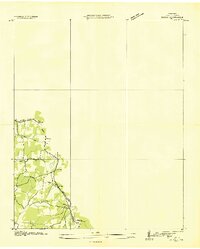 1936 Burns1936 Print · USGSDickson County's rural landscape is captured during the mid-1930s as modern infrastructure began to reshape the Tennessee interior. Researchers can trace the path of the N C AND ST L railroad through Tidwell and Pomona or locate the site of the Herbertson Sch.
 - 1936 Map of Dickson
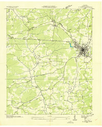 1936 Dickson1936 Print · USGSIn the mid-thirties, the area around Dickson was a bustling rail junction where the Nashville Chattanooga and St Louis Ry met the local timber and river economy. Genealogists can trace family names at England Cem or find historic rural sites like Eno Sch and Bethel Ch.
 - 1953 Map of Dickson, 1957 Print
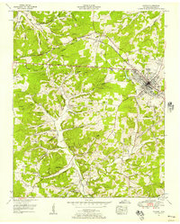 1953 Dickson1957 Print · USGSMid-century Dickson, Tennessee is captured here as a bustling railroad hub surrounded by deep-rooted family homesteads. Genealogists and historians can locate dozens of ancestral sites like Sullivan Cem and Robinson Chapel, or trace the industrial history of abandoned iron mines.3 unique versions available
 - 1953 Map of Burns, 1958 Print
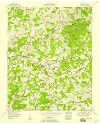 1953 Burns1958 Print · USGSMid-century Dickson County centers on the railroad towns of Burns and Colesburg as the local economy shifts from industry to recreation. Genealogists and historians can locate numerous family burial sites such as Dugan Cem or trace the early layout of Montgomery Bell State Park.5 unique versions available
 - 1956 Map of Nashville, 1971 Print
 1956 Nashville1971 Print · USGSThe Tennessee-Kentucky borderlands come into focus in the mid-1960s as major reservoir projects transformed the Cumberland and Tennessee river valleys. Researchers can trace the rail networks of the Louisville and Nashville and visit sites like Fort Campbell and Fort Donelson National Military Park.2 unique versions available
 - 1959 Map of Nashville
 1959 Nashville1959 Print · USGSMiddle Tennessee and Southern Kentucky come into focus during the late fifties, showing the region's transition into a modern transportation and military hub. Researchers can trace the sprawling Fort Campbell Military Reservation or locate historic rail stops along the Tennessee Central Ry and Illinois Central RR.
 - 1985 Map of Dickson
 1985 Dickson1985 Print · USGSMid-Tennessee in the mid-1980s was defined by the intersection of the Cumberland and Tennessee rivers and a massive network of wildlife refuges. Researchers can trace the Seaboard System rail lines connecting Waverly, Dickson, and White Bluff, or locate old landmarks near Fort Donelson National Military Park.
End of results
Showing maps 1-7 of 7
Top cities near Dickson
- Fairview historical maps
- Centerville historical maps
- White Bluff historical maps
- Burns historical maps
- Charlotte historical maps
- Vanleer historical maps
See more
Top neighborhoods of Dickson
- Pomona historical maps
- West Dickson historical maps
- East Dickson historical maps
- Eastwood historical maps
Frequently asked questions
- What are the different types of historical maps available for Dickson?
- What is the oldest map of Dickson?
- Where can I purchase historical maps of Dickson for my home or office?
- Where can I download high-res historical maps of Dickson?
- Are there historical topographic maps available for Dickson?
- Is there historical aerial imagery available for Dickson?
- Where are historical maps of Dickson sourced from?