Old Maps of Trimble, Tennessee for Genealogy
Trace your family roots with 8 historic maps of Trimble. These high-res maps reveal old neighborhoods, homesites, landmarks, and streets — helping you uncover where your ancestors lived and how the area evolved over time.
- Explore historic neighborhoods: Identify where your relatives may have lived in the 1800s or 1900s.
- Compare maps over time: Trace the changes in streets, buildings, and landmarks for multi-generational research.
- Perfect for genealogy & ancestry research: Used by family historians and researchers to map out lineage and migration.
These maps are an incredible resource for exploring your personal connection to Trimble's past.
Trimble, TN maps
(8)- 1956 Map of Dyersburg, 1960 Print
 1956 Dyersburg1960 Print · USGSThe Four Rivers region comes alive in the mid-fifties, capturing the intricate borderlands of Tennessee, Kentucky, and Missouri. Genealogists and historians can trace the rail-and-river networks connecting Dyersburg, Caruthersville, and the shoreline of Reelfoot Lake.4 unique versions available
 - 1965 Map of Trimble, 1967 Print
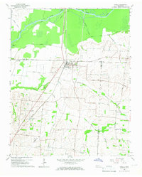 1965 Trimble1967 Print · USGSThe Dyer and Obion County line in the mid-1960s shows a landscape of river-bottom drainage and rail-side commerce. Genealogists can trace family names at Pierce Cem and McCorkle Cem or locate rural centers like Harmony Ch and Templeton.2 unique versions available
 - 1983 Map of Dyersburg
 1983 Dyersburg1983 Print · USGSSpanning the Mississippi River at the start of the 1980s, this area shows the vital river-and-rail connections between Tennessee and Missouri. Researchers can trace family sites at Mount Pisgah Cemetery or study the evolving shoreline near Caruthersville and Reelfoot Lake.
 - 2010 Map of Trimble, 2010 Print
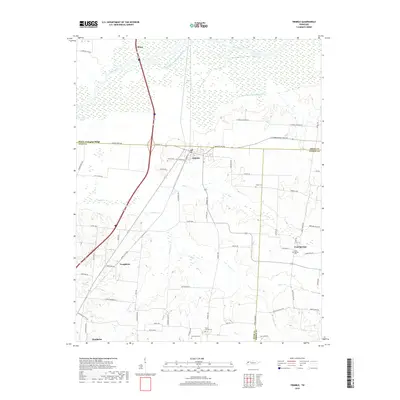
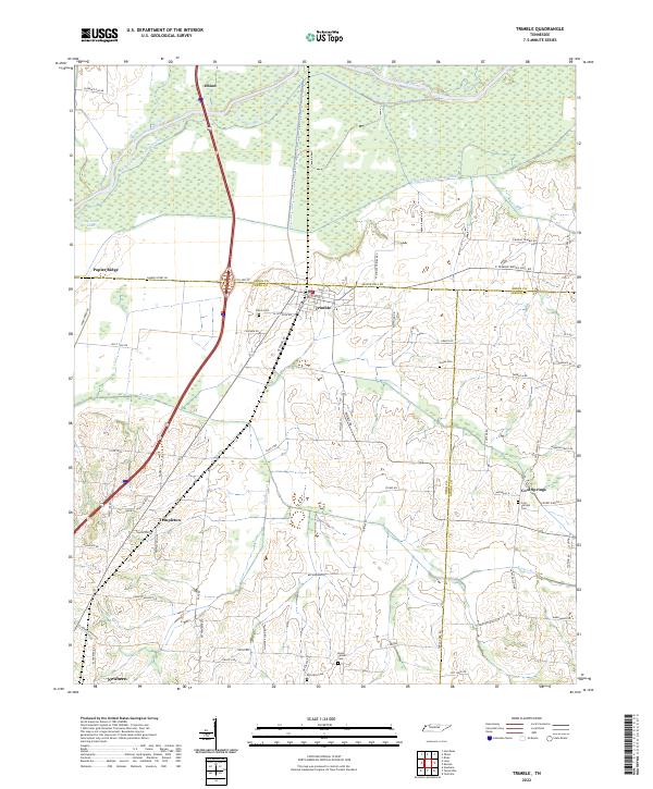
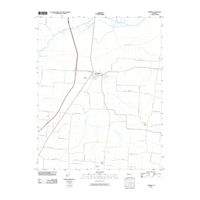 2010 Trimble2010 Print · USGSCovers Trimble, including Newbern, Obion, and other nearby areas
 - 2013 Map of Trimble, 2013 Print
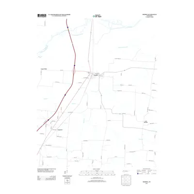 2013 Trimble2013 Print · USGSCovers Trimble, including Newbern, Obion, and other nearby areas
 - 2016 Map of Trimble, 2016 Print
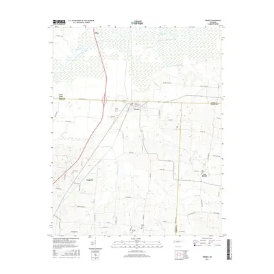 2016 Trimble2016 Print · USGSCovers Trimble, including Newbern, Obion, and other nearby areas
 - 2019 Map of Trimble, 2019 Print
 2019 Trimble2019 Print · USGSCovers Trimble, including Newbern, Obion, and other nearby areas
 - 2022 Map of Trimble, 2022 Print
 2022 Trimble2022 Print · USGSWest Tennessee’s river bottomlands and rural crossroads are meticulously documented in this recent survey. Genealogists and local historians can trace family-named landmarks and old burial grounds like Jones Cem and Cool Springs Cem near the Obion River.
End of results
Showing maps 1-8 of 8
Top cities near Trimble
- Dyersburg historical maps
- Union City historical maps
- Trenton historical maps
- Newbern historical maps
- Dyer historical maps
- Troy historical maps
See more
Frequently asked questions
- What are the different types of historical maps available for Trimble?
- What is the oldest map of Trimble?
- Where can I purchase historical maps of Trimble for my home or office?
- Where can I download high-res historical maps of Trimble?
- Are there historical topographic maps available for Trimble?
- Is there historical aerial imagery available for Trimble?
- Where are historical maps of Trimble sourced from?