2020s Maps of Mosheim, Tennessee
Explore 2 historic maps of Mosheim from the 2020s. These maps offer a rare glimpse into what life looked like during the 2020s — showing old roads, neighborhoods, homes, and landmarks that have changed or disappeared over time.
Whether you're researching your family's past, planning a metal detecting trip, or studying how Mosheim's landscape evolved across the 2020s, these high-resolution maps are a powerful tool for exploring the history of this region.
- Focus on a specific era: All maps on this page are from the 2020s, giving you a focused view of this time period.
- See what’s changed: Compare century-old streets, trails, and buildings to today's modern landscape using overlays and satellite layers.
- Research with precision: Use these maps for genealogy, historical research, land use analysis, or educational projects.
- View, download, or print: Maps are fully viewable online in high resolution, and can be downloaded or printed for your own records.
Start exploring Mosheim's history through authentic maps from the 2020s. This is your window into the past.
Mosheim, TN maps
(2)- 2022 Map of Mosheim, 2022 Print
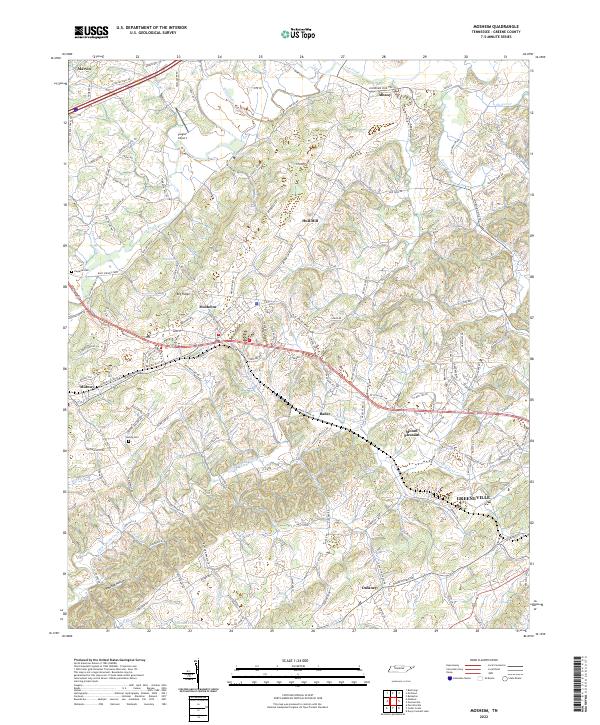 2022 Mosheim2022 Print · USGSGreene County is shown here in the early twenty-first century, spanning the rolling gap between Lick Creek and Little Chucky Creek. Local historians can trace family-named landmarks and rural settlements like Mosheim, Hull Mill, and the historic Weems Chapel.
 - 2022 Map of Mohawk, 2022 Print
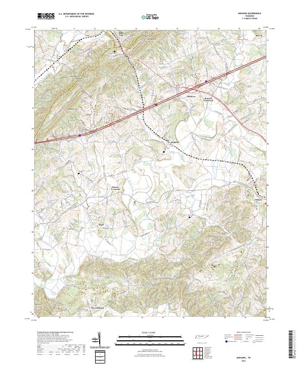 2022 Mohawk2022 Print · USGSThe East Tennessee ridge-and-valley landscape near the Greene-Hamblen border is captured here in recent decades. Researchers can trace family history through numerous landmarks like Wisecarver Cemetery, Bibles Chapel, and the community at Bulls Gap.
End of results
Showing maps 1-2 of 2
Top cities near Mosheim
- Morristown historical maps
- Greeneville historical maps
- Newport historical maps
- Rogersville historical maps
- Tusculum historical maps
- Bulls Gap historical maps
See more
Top neighborhoods of Mosheim
Frequently asked questions
- What are the different types of historical maps available for Mosheim?
- What is the oldest map of Mosheim?
- Where can I purchase historical maps of Mosheim for my home or office?
- Where can I download high-res historical maps of Mosheim?
- Are there historical topographic maps available for Mosheim?
- Is there historical aerial imagery available for Mosheim?
- Where are historical maps of Mosheim sourced from?