Old Maps of Sequoia Hills, Tennessee for Genealogy
Trace your family roots with 17 historic maps of Sequoia Hills. These high-res maps reveal old neighborhoods, homesites, landmarks, and streets — helping you uncover where your ancestors lived and how the area evolved over time.
- Explore historic neighborhoods: Identify where your relatives may have lived in the 1800s or 1900s.
- Compare maps over time: Trace the changes in streets, buildings, and landmarks for multi-generational research.
- Perfect for genealogy & ancestry research: Used by family historians and researchers to map out lineage and migration.
These maps are an incredible resource for exploring your personal connection to Sequoia Hills's past.
Sequoia Hills, TN maps
(17)- 1892 Map of Greeneville
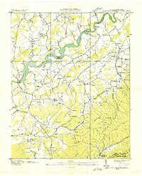
 1892 Greeneville1892 Print · USGSEast Tennessee in the late nineteenth century was a landscape of river-crossing ferries and mountain gaps centered on Greeneville. Genealogists and historians can trace the early rail corridor of the East Tennessee Virginia and Georgia R. R. and locate family-named sites like Britton Ferry and Evans X Rds.
 - 1896 Map of Greeneville
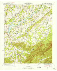
 1896 Greeneville1896 Print · USGSUpper East Tennessee thrives in the late nineteenth century as a hub of rail travel and river commerce centered around the county seat. Genealogists can trace family roots through numerous crossroads and post offices like Chissolms P. O., Hawes X Roads, and Britton Ferry.2 unique versions available
 - 1904 Map of Greeneville
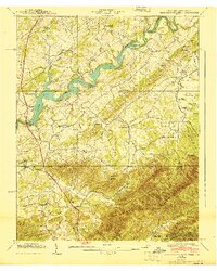
 1904 Greeneville1904 Print · USGSEast Tennessee at the turn of the century reveals a land of ridge-valley farms and early educational centers. Genealogists can trace family roots through historic settlements like Surgoinsville, early institutions like Washington College, and landmarks such as Bashors Mill.4 unique versions available
 - 1936 Map of Lake Davy Crockett
 1936 Lake Davy Crockett1936 Print · USGSGreene County is documented here during the mid-1930s as new reservoirs began to alter the river valleys. Local historians can trace the foundations of many vanished community sites, from the Cove Creek Mill to the Tobacco Experimental Station and the original Birds Bridge.
 - 1939 Map of Davy Crockett Lake, 1956 Print
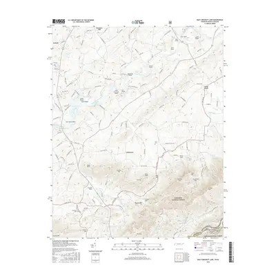
 1939 Davy Crockett Lake1956 Print · USGSIn the late 1930s, this Greene County landscape was dominated by the waters of Davy Crockett Lake and the rugged boundary of the Bald Mountains. Researchers can trace old family sites and community roots through landmarks like Staunton Mill, Price Cem, and the path of Lonesome Pine Trail.5 unique versions available
 - 1940 Map of Davy Crockett Lake
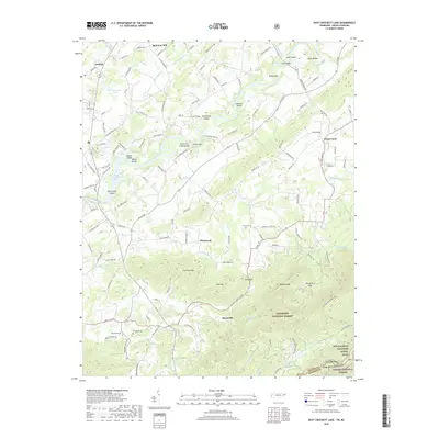
 1940 Davy Crockett Lake1940 Print · USGSGreene County, Tennessee, is captured here in the early 1940s just as the Nolichucky River valley was being reshaped by the waters of Lake Davy Crockett. Trace family roots and local history through features like Cove Creek Mill, Price Cem, and the Orphanage.
 - 1955 Map of Johnson City
 1955 Johnson City1955 Print · USGSEast Tennessee and the bordering highlands of Virginia and Kentucky appear here during the post-war industrial boom. You can trace the complex network of mountain ridges and new TVA lakes, from Johnson City to the coalfields near Middlesboro and Lynch.
 - 1957 Map of Johnson City, 1966 Print
 1957 Johnson City1966 Print · USGSUpper East Tennessee and Southwest Virginia are shown here during the mid-sixties transition of the Appalachians. Researchers can trace the industrial rail hubs of Kingsport, the sprawling waters of Cherokee Lake, and the historic Cumberland Gap.
 - 1960 Map of Johnson City
 1960 Johnson City1960 Print · USGSUpper East Tennessee and the surrounding tri-state area are shown in the mid-fifties during the height of the TVA reservoir era. Trace the industrial rail lines of the Southern and Louisville and Nashville between Kingsport and Johnson City.
 - 1963 Map of Johnson City
 1963 Johnson City1963 Print · USGSThe Tri-Cities and the surrounding Appalachian ridges are shown in detail during the early sixties, highlighting the era's vital rail and river networks. Genealogists and historians can trace the routes of the Clinchfield RR and locate settlements from Rogersville to Elizabethton.
 - 1980 Map of Johnson City, 1981 Print
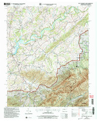
 1980 Johnson City1981 Print · USGSEast Tennessee in the early eighties shows a landscape of mountain ridges and growing valley towns. Trace local history through Washington College and the Andrew Johnson National Cemetery, or find sites like David Crockett Birthplace State Park.
 - 2003 Map of Davy Crockett Lake, 2004 Print
 2003 Davy Crockett Lake2004 Print · USGSGreene County is shown at the turn of the century as the mountain landscape meets the Nolichucky River. Local historians can trace old thoroughfares like Stagecoach Road and locate rural landmarks such as Staunton Mill and Bernard Chapel.
 - 2011 Map of Davy Crockett Lake, 2011 Print
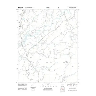 2011 Davy Crockett Lake2011 Print · USGSCovers Sequoia Hills, including Hayesville, Staunton Mill, and other nearby areas
 - 2013 Map of Davy Crockett Lake, 2013 Print
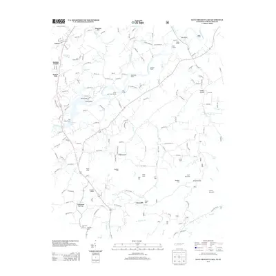 2013 Davy Crockett Lake2013 Print · USGSCovers Sequoia Hills, including Hayesville, Staunton Mill, and other nearby areas
 - 2016 Map of Davy Crockett Lake, 2016 Print
 2016 Davy Crockett Lake2016 Print · USGSCovers Sequoia Hills, including Hayesville, Staunton Mill, and other nearby areas
 - 2019 Map of Davy Crockett Lake, 2019 Print
 2019 Davy Crockett Lake2019 Print · USGSCovers Sequoia Hills, including Hayesville, Staunton Mill, and other nearby areas
 - 2022 Map of Davy Crockett Lake, 2022 Print
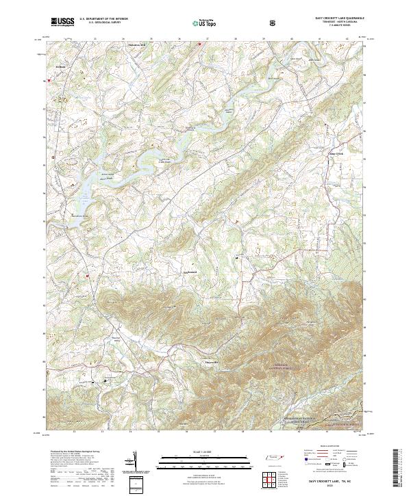 2022 Davy Crockett Lake2022 Print · USGSThe Nolichucky River valley at the Tennessee-North Carolina border shows a landscape shaped by river shoals and mountain gaps. Genealogists and hikers can trace family names and historic paths through Hayesville, Beersheba Cem, and the rugged slopes of Greene Mtn.
End of results
Showing maps 1-17 of 17
Top cities near Sequoia Hills
- Greeneville historical maps
- Tusculum historical maps
- Mosheim historical maps
- Bulls Gap historical maps
- Hot Springs historical maps
- Baileyton historical maps
See more
Frequently asked questions
- What are the different types of historical maps available for Sequoia Hills?
- What is the oldest map of Sequoia Hills?
- Where can I purchase historical maps of Sequoia Hills for my home or office?
- Where can I download high-res historical maps of Sequoia Hills?
- Are there historical topographic maps available for Sequoia Hills?
- Is there historical aerial imagery available for Sequoia Hills?
- Where are historical maps of Sequoia Hills sourced from?