Old Maps of Lakemoore, Morristown for Metal Detecting
Plan your next treasure hunt with 18 historic maps of Lakemoore. Find old homesites, ghost towns, trails, and gathering spots that may be lost to time — perfect for identifying promising metal detecting locations.
- Locate forgotten sites: Uncover places like long-lost settlements, abandoned rail lines, or gathering spots.
- Plan better hunts: Use map overlays combined with LiDAR or satellite views to narrow in on historically rich areas.
- Made for detectorists: Thousands of hobbyists use these maps to discover relics, coins, and hidden history.
Use these historic maps to boost your research and find new opportunities beneath the surface of Lakemoore.
Lakemoore, Morristown maps
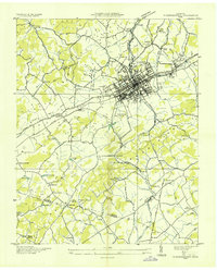
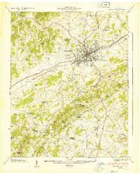
(18)- 1883 Map of Morristown
 1883 Morristown1883 Print · USGSCovers Lakemoore, including Morristown, Jefferson City, and other nearby areas
 - 1893 Map of Morristown
 1893 Morristown1893 Print · USGSCovers Lakemoore, including Morristown, Jefferson City, and other nearby areas
 - 1895 Map of Morristown
 1895 Morristown1895 Print · USGSCovers Lakemoore, including Morristown, Jefferson City, and other nearby areas5 unique versions available
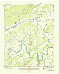
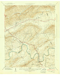
 - 1935 Map of Tate Springs
 1935 Tate Springs1935 Print · USGSCovers Lakemoore, including Morristown, Bean Station, and other nearby areas
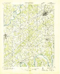
 - 1935 Map of Morristown
 1935 Morristown1935 Print · USGSCovers Lakemoore, including Morristown, White Pine, and other nearby areas
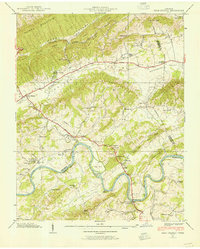
 - 1935 Map of Bean Station
 1935 Bean Station1935 Print · USGSCovers Lakemoore, including Morristown, Bean Station, and other nearby areas
 - 1935 Map of Dandridge
 1935 Dandridge1935 Print · USGSCovers Lakemoore, including Morristown, Jefferson City, and other nearby areas
 - 1938 Map of Bean Station, 1954 Print
 1938 Bean Station1954 Print · USGSCovers Lakemoore, including Morristown, Bean Station, and other nearby areas
 - 1939 Map of Morristown
 1939 Morristown1939 Print · USGSCovers Lakemoore, including Morristown, White Pine, and other nearby areas2 unique versions available
 - 1939 Map of Bean Station
 1939 Bean Station1939 Print · USGSCovers Lakemoore, including Morristown, Bean Station, and other nearby areas2 unique versions available
 - 1955 Map of Johnson City
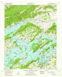
 1955 Johnson City1955 Print · USGSCovers Lakemoore, including Knoxville, Johnson City, and other nearby areas
 - 1957 Map of Johnson City, 1966 Print
 1957 Johnson City1966 Print · USGSCovers Lakemoore, including Knoxville, Johnson City, and other nearby areas
 - 1960 Map of Johnson City
 1960 Johnson City1960 Print · USGSCovers Lakemoore, including Knoxville, Johnson City, and other nearby areas
 - 1960 Map of Bean Station, 1962 Print
 1960 Bean Station1962 Print · USGSCovers Lakemoore, including Morristown, Bean Station, and other nearby areas2 unique versions available
 - 1961 Map of Morristown, 1963 Print
 1961 Morristown1963 Print · USGSCovers Lakemoore, including Morristown, White Pine, and other nearby areas2 unique versions available
 - 1963 Map of Johnson City
 1963 Johnson City1963 Print · USGSCovers Lakemoore, including Knoxville, Johnson City, and other nearby areas
 - 1979 Map of Morristown, 1980 Print
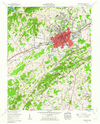
 1979 Morristown1980 Print · USGSCovers Lakemoore, including Morristown, White Pine, and other nearby areas2 unique versions available
 - 1981 Map of Morristown
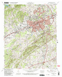
 1981 Morristown1981 Print · USGSCovers Lakemoore, including Knoxville, Morristown, and other nearby areas
End of results
Showing maps 1-18 of 18
Frequently asked questions
- What are the different types of historical maps available for Lakemoore?
- What is the oldest map of Lakemoore?
- Where can I purchase historical maps of Lakemoore for my home or office?
- Where can I download high-res historical maps of Lakemoore?
- Are there historical topographic maps available for Lakemoore?
- Is there historical aerial imagery available for Lakemoore?
- Where are historical maps of Lakemoore sourced from?