
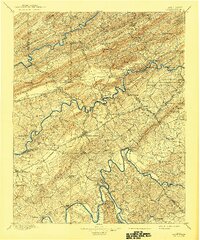
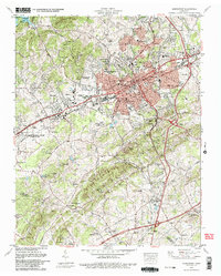
1883 Map of Morristown
USGS Topo · Published 1883About this map
Morristown and its surrounding valleys are captured here in the early 1880s, revealing a landscape defined by the prominent Clinch Mountain and the winding Nolichucky River. The settlement pattern follows the fertile gaps and ridges, with early industrial sites like Witt's Foundry and Sharp's Mill anchored to the waterways. This era shows the critical junction at Rogersville Junction and the path of the Virginia Tennessee rail line, which facilitated the growth of centers like Mossy Creek and Whitesburg. Notable landmarks for local historians include Tate's Springs, a prominent mineral spring resort of the period, and strategic transit points such as Bean's Station Gap. The map also documents numerous rural post offices and crossroads that served as the social hubs for East Tennessee families, including Kimbrough's X Roads and Cheek's X Roads, many of which were central to the region's 19th-century development.
Find a feature on this map
118 named features on this map. Tap any name to fly to it.
Don’t see what you’re looking for? This feature index may not catch every label — zoom into the map to look around manually.
Map Details
Editions of this 1883 Morristown Map
This is the sole edition of this map. No revisions or reprints were ever made.
Historical Maps of Morristown Through Time
13 maps found
1883 Morristown
Hamblen County, TN

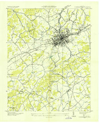
1893 Morristown
Hamblen County, TN
1895 Morristown
Hamblen County, TN
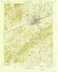
1935 Morristown
Hamblen County, TN
1939 Morristown
Hamblen County, TN
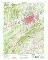
1961 Morristown
Hamblen County, TN
1979 Morristown
Hamblen County, TN

1981 Morristown
Hamblen County, TN
2010 Morristown
Hamblen County, TN
2013 Morristown
Hamblen County, TN
2016 Morristown
Hamblen County, TN
2019 Morristown
Hamblen County, TN
2022 Morristown
Hamblen County, TN