Old Maps of Point Seven, Hamblen County for Genealogy
Trace your family roots with 19 historic maps of Point Seven. These high-res maps reveal old neighborhoods, homesites, landmarks, and streets — helping you uncover where your ancestors lived and how the area evolved over time.
- Explore historic neighborhoods: Identify where your relatives may have lived in the 1800s or 1900s.
- Compare maps over time: Trace the changes in streets, buildings, and landmarks for multi-generational research.
- Perfect for genealogy & ancestry research: Used by family historians and researchers to map out lineage and migration.
These maps are an incredible resource for exploring your personal connection to Point Seven's past.
Point Seven, Hamblen County maps
(19)- 1883 Map of Morristown
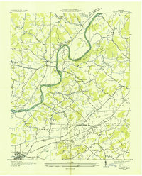
 1883 Morristown1883 Print · USGSEast Tennessee in the 1880s is defined by the convergence of mountain ridges and the vital rail corridor through Morristown. Researchers can trace the early industrial landscape of the region through landmarks like Witt's Foundry, Tate's Springs, and the historic Bean's Station.
 - 1893 Map of Morristown
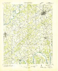
 1893 Morristown1893 Print · USGSEast Tennessee in the 1890s was a landscape of deep mountain ridges and vital rail junctions centered around Morristown. Researchers can trace the nineteenth-century river economy through numerous crossings like Cloud Ferry and find early industry at Lotspeachy Mill.
 - 1895 Map of Morristown
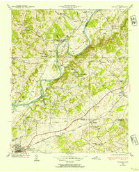
 1895 Morristown1895 Print · USGSThe East Tennessee ridge-and-valley country comes alive in the late nineteenth century as a hub of rail and river transit. Trace the routes of old Evans Ferry or locate vanished stops along the Southern R.R. near Morristown and Bull Gap.5 unique versions available
 - 1935 Map of Talbott
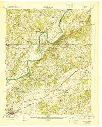
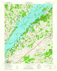
 1935 Talbott1935 Print · USGSThe rural river valley at the borders of Hamblen and Jefferson counties comes to life in this mid-1930s survey. Genealogists can locate family landmarks like the Martha Sunderland Cem, Wilson Cager Sch, and old river sites like Collins Ford.
 - 1935 Map of Dandridge
 1935 Dandridge1935 Print · USGSEast Tennessee in the mid-1930s is mapped here in great detail as the region's river valleys prepared for the impacts of the Tennessee Valley Authority. Researchers can trace ancestral locations through dozens of landmarks like Martha Sunderland Cem, Panther Creek Mill, and Roe Ch.
 - 1938 Map of Talbott, 1954 Print
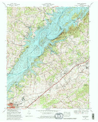
 1938 Talbott1954 Print · USGSEast Tennessee in the late thirties shows a landscape of river-bend farms and small rail towns along the Southern line. Genealogists and historians can trace family locations near Old Hull Mill, Kidwell Sch, or the C C C Camp at the edge of town.
 - 1940 Map of Talbott
 1940 Talbott1940 Print · USGSIn the Tennessee Valley just before the 1940s, this area shows a landscape shaped by the Holston River and the Southern railroad. Genealogists can locate family-named landmarks like Kidwell Ridge Ch, Lawrence Mill, and the Sunderland Cem.
 - 1955 Map of Johnson City
 1955 Johnson City1955 Print · USGSEast Tennessee and the bordering highlands of Virginia and Kentucky appear here during the post-war industrial boom. You can trace the complex network of mountain ridges and new TVA lakes, from Johnson City to the coalfields near Middlesboro and Lynch.
 - 1957 Map of Johnson City, 1966 Print
 1957 Johnson City1966 Print · USGSUpper East Tennessee and Southwest Virginia are shown here during the mid-sixties transition of the Appalachians. Researchers can trace the industrial rail hubs of Kingsport, the sprawling waters of Cherokee Lake, and the historic Cumberland Gap.
 - 1960 Map of Johnson City
 1960 Johnson City1960 Print · USGSUpper East Tennessee and the surrounding tri-state area are shown in the mid-fifties during the height of the TVA reservoir era. Trace the industrial rail lines of the Southern and Louisville and Nashville between Kingsport and Johnson City.
 - 1960 Map of Talbott, 1963 Print
 1960 Talbott1963 Print · USGSEast Tennessee's landscape is shown in the early sixties as the sprawling waters of Cherokee Lake reshaped the tri-county area. Genealogists can locate family names at Bacon Cem or trace the rural routes connecting Talbott and Alpha.
 - 1963 Map of Johnson City
 1963 Johnson City1963 Print · USGSThe Tri-Cities and the surrounding Appalachian ridges are shown in detail during the early sixties, highlighting the era's vital rail and river networks. Genealogists and historians can trace the routes of the Clinchfield RR and locate settlements from Rogersville to Elizabethton.
 - 1980 Map of Talbott, 1981 Print
 1980 Talbott1981 Print · USGSEast Tennessee's landscape was transformed by the 1980s as industrial growth met the rising waters of the Holston River. Genealogists can trace family landmarks like Bacon Cem and Sitton Cem near the developed shores of Cherokee Lake.2 unique versions available
 - 1981 Map of Morristown
 1981 Morristown1981 Print · USGSEast Tennessee's ridge-and-valley corridor is captured here in the early eighties, showing the region's transformation by TVA reservoirs. Genealogists and historians can trace family locations near Alpha Ch, follow the Southern Railway, or locate the Young Mine.
 - 2010 Map of Talbott, 2010 Print
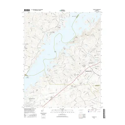
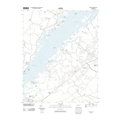 2010 Talbott2010 Print · USGSCovers Point Seven, including Morristown, Jefferson City, and other nearby areas
 - 2013 Map of Talbott, 2013 Print
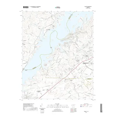
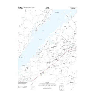 2013 Talbott2013 Print · USGSCovers Point Seven, including Morristown, Jefferson City, and other nearby areas
 - 2016 Map of Talbott, 2016 Print
 2016 Talbott2016 Print · USGSCovers Point Seven, including Morristown, Jefferson City, and other nearby areas
 - 2019 Map of Talbott, 2019 Print
 2019 Talbott2019 Print · USGSCovers Point Seven, including Morristown, Jefferson City, and other nearby areas
 - 2022 Map of Talbott, 2022 Print
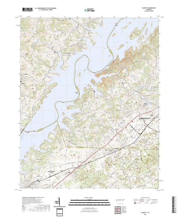 2022 Talbott2022 Print · USGSHamblen and Jefferson counties are captured here in the early 2020s, showing the intersection of lake life and suburban growth. Researchers can trace numerous family burial sites like Martha Sunderland Cem or explore historic industrial roots at Ore Mine Hill.
End of results
Showing maps 1-19 of 19
Frequently asked questions
- What are the different types of historical maps available for Point Seven?
- What is the oldest map of Point Seven?
- Where can I purchase historical maps of Point Seven for my home or office?
- Where can I download high-res historical maps of Point Seven?
- Are there historical topographic maps available for Point Seven?
- Is there historical aerial imagery available for Point Seven?
- Where are historical maps of Point Seven sourced from?