Old Maps of Lookout Mountain, Tennessee
Explore 36 old maps of Lookout Mountain, spanning from 1886 to today. These high-resolution historic maps reveal how streets, neighborhoods, landmarks, and natural features evolved over time — perfect for genealogy, metal detecting, research, and local history exploration.
What you can do with these maps:
- See how Lookout Mountain changed over time: Compare historical maps to modern-day views to trace roads, homesites, rail lines & more.
- View detailed metadata: Each map includes creators, publishers, year, scale, and archive source.
- Overlay maps with satellite & LiDAR: Visualize the past alongside modern tools to explore terrain & human change.
- Trusted historical sources: Maps sourced from the USGS, Library of Congress, and other archives.
- Access maps your way: View online, download high-res files, or order prints for personal or research use.
Start exploring old maps of Lookout Mountain to uncover forgotten places, hidden landmarks, and the deep history beneath your feet.
Lookout Mountain, TN maps
(36)- 1886 Map of Ringgold
 1886 Ringgold1886 Print · USGSNorthwest Georgia in the 1880s was a landscape of industrial river valleys and steep ridges defined by early rail lines. Local historians can trace family-named landmarks like Gilreath's Mill, the Trion Factory textile site, and the rural stop at Tap's Store.
 - 1888 Map of Chattanooga
 1888 Chattanooga1888 Print · USGSSoutheast Tennessee in the late nineteenth century was a landscape of river ferries and mountain mining. Trace family roots and vanished landmarks near Chattanooga, from the Aetna Mines to historic river crossings like Harrison Ferry.
 - 1892 Map of Ringgold
 1892 Ringgold1892 Print · USGSNorth Georgia and the Tennessee border are mapped here in the late nineteenth century as the region transitioned into a post-war rail and tourism hub. Researchers can trace the early National Park boundaries, industrial Coal Mines, and vanished stops like High Point or Lisbon Sta..9 unique versions available
 - 1893 Map of Chattanooga
 1893 Chattanooga1893 Print · USGSSoutheast Tennessee is shown here in the 1890s, when river ferries and coal mines defined the landscape around the booming hub of Chattanooga. Genealogists and researchers can trace family lands near Eldridge Landing, the Mc Nabb Mines, or old settlements like Ooltewah.9 unique versions available
 - 1936 Map of Fort Oglethorpe
 1936 Fort Oglethorpe1936 Print · USGSThe Georgia-Tennessee borderlands appear here in the mid-1930s, featuring the extensive grounds of the Chickamauga battlefield and the early development of Lookout Mountain. Researchers can locate historic farmsteads and monuments such as the Snodgrass House, the Lee and Gordon Mill, and Rock City Gardens.
 - 1936 Map of Chattanooga
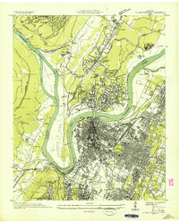 1936 Chattanooga1936 Print · USGSChattanooga and the Tennessee River are shown here in the mid-thirties as the river valley underwent massive transformation. Trace the historic street grid and landmarks like the Incline Railway, National Cem, and Moccasin Bend.
 - 1940 Map of Chattanooga
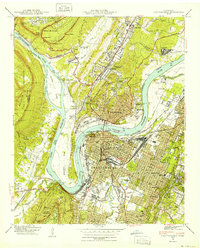 1940 Chattanooga1940 Print · USGSChattanooga and the Tennessee River valley are captured here at the dawn of the 1940s, showcasing a bustling rail and river hub. Researchers can trace the legacy of Union Station, find family plots in National Cem, or locate the historic Cravens House on the slopes of Lookout Mountain.2 unique versions available
 - 1941 Map of Chattanooga
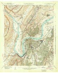 1941 Chattanooga1941 Print · USGSChattanooga was a powerhouse of rail and river industry just before the Second World War. Genealogists and historians can trace the early city grid from Union Station to MISSIONARY RIDGE, locating landmarks like Ruby Falls and National Cem.5 unique versions available
 - 1942 Map of Fort Oglethorpe, 1946 Print
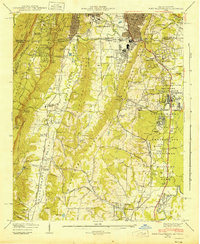 1942 Fort Oglethorpe1946 Print · USGSThe Tennessee-Georgia borderlands are captured here during the early 1940s, highlighting the transition from historic battlefields to growing residential communities. Genealogists and historians can trace family-named sites like Snodgrass House, McCallie Lake, and Lee and Gordon Mill.3 unique versions available
 - 1953 Map of Chattanooga
 1953 Chattanooga1953 Print · USGSSoutheast Tennessee in the early fifties shows a landscape reshaped by river management and rail power. Trace the rail lines of the Southern Ry through riverside towns or locate the preserved grounds of the Chickamauga and Chattanooga National Military Park.
 - 1955 Map of Rome
 1955 Rome1955 Print · USGSThe tri-state borderlands of Georgia, Alabama, and Tennessee appear in the mid-fifties as a landscape of ridge-and-valley industry and river navigation. Genealogists can trace family footprints near Chattanooga, the iron works of Gadsden, and textile towns like Trion or Summerville.
 - 1957 Map of Chattanooga, 1966 Print
 1957 Chattanooga1966 Print · USGSEast Tennessee in the mid-1960s shows a landscape of massive hydroelectric reservoirs and emerging industrial sites like the Atomic Energy Commission (Oak Ridge Area). Trace the rail networks of the Southern Ry through Chattanooga or locate family-named ridges across the Cumberland Plateau.3 unique versions available
 - 1958 Map of Chattanooga, 1959 Print
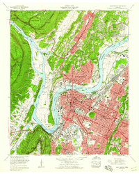 1958 Chattanooga1959 Print · USGSChattanooga and the Tennessee River valley are shown in the late fifties at a peak of industrial and suburban development. Genealogists and historians can trace family names at Sivley Cem, explore the massive Citico Yards, and locate landmarks like the Baylor Sch.3 unique versions available
 - 1958 Map of Fort Oglethorpe, 1959 Print
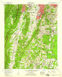 1958 Fort Oglethorpe1959 Print · USGSCrossing the state line in the late fifties, this survey captures the convergence of Civil War memory and mid-century suburbanization. Trace historical sites within the National Military Park or locate family roots near Shields Crossroads and Blowing Spring.2 unique versions available
 - 1958 Map of Rome, 1966 Print
 1958 Rome1966 Print · USGSNorthwest Georgia and neighboring Tennessee and Alabama are captured here in the late fifties, showcasing a landscape of high ridges and river valleys. Researchers can trace historic rail lines like the Seaboard Air Line RR and explore the bounds of Cloudland Canyon State Park or Fort Oglethorpe.3 unique versions available
 - 1959 Map of Chattanooga
 1959 Chattanooga1959 Print · USGSSoutheast Tennessee is shown here during a decade of industrial growth and hydroelectric development. Trace the regional rail networks of the Southern Ry and find landmark sites like Lookout Mountain, Fall Creek Falls State Park, and Chattanooga.
 - 1960 Map of Chattanooga
 1960 Chattanooga1960 Print · USGSSoutheast Tennessee and the southern Appalachians are shown here at the height of the river-management era. You can trace the valley rail lines and locate Lookout Mountain and the expansive waters of Chickamauga Reservoir.
 - 1961 Map of Rome
 1961 Rome1961 Print · USGSNorthwest Georgia and neighboring Tennessee and Alabama are shown here at a moment of significant mid-century growth. Researchers can trace the rail networks of the Central of Georgia or locate landmarks within Chickamauga and Chattanooga Nat Military Park.
 - 1963 Map of Rome
 1963 Rome1963 Print · USGSThe tri-state corner of Georgia, Alabama, and Tennessee is captured here during a period of massive reservoir expansion and post-war growth. Genealogists and historians can trace the rail corridors of the Southern Ry or locate landmarks like Fort Oglethorpe and Cloudland Canyon State Park.
 - 1964 Map of Chattanooga
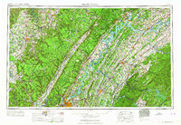 1964 Chattanooga1964 Print · USGSSoutheast Tennessee and the western Carolinas appear in the mid-sixties as a powerhouse of river-driven industry and mountain wilderness. Genealogists and historians can trace rail-town lineages along the Southern Ry or locate family landmarks near Watts Bar Lake and Tellico Plains.
 - 1969 Map of Chattanooga
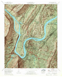 1969 Chattanooga1969 Print · USGSChattanooga and the Tennessee River valley are captured in the late sixties as new interstate construction began to cut through the city's historic core. Trace the layout of the National Cemetery, the rail lines at Cravens Yards, and the unique development of Moccasin Bend.6 unique versions available
 - 1969 Map of Fort Oglethorpe, 1970 Print
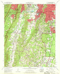 1969 Fort Oglethorpe1970 Print · USGSThe Georgia-Tennessee borderlands south of Chattanooga come into focus in the late sixties, showing the suburban expansion and military heritage of the region. Researchers can trace family roots through Humphreys Cem, locate the Chattanooga Valley High School, or study the grounds of Chickamauga and Chattanooga National Military Park.
 - 1979 Map of Chattanooga, 1980 Print
 1979 Chattanooga1980 Print · USGSSoutheast Tennessee in the late seventies reveals a landscape shaped by massive TVA river projects and the industrial strength of the Cumberland Plateau. Genealogists and historians can trace the rail-to-river network through L & N RR junctions, the University of the South, and the Volunteer Army Ammunition Plant.
 - 1981 Map of Chickamauga, 1982 Print
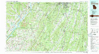 1981 Chickamauga1982 Print · USGSThe tri-state border region of Georgia, Alabama, and Tennessee comes into focus during the early eighties, defined by the towering ridges of the Appalachians. Historians can trace the preserved grounds of Chickamauga and Chattanooga National Military Park and old rail stops like Rising Fawn or Sulphur Springs.2 unique versions available
 - 1982 Map of Fort Oglethorpe, 1983 Print
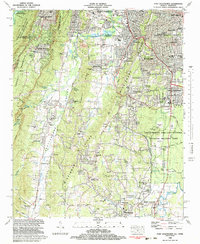 1982 Fort Oglethorpe1983 Print · USGSThe Georgia-Tennessee borderlands in the early eighties show a landscape deeply shaped by Civil War history and post-war growth. Researchers can trace family sites and local landmarks from Lookout Mountain to the Lee and Gordon Mill, including the Wilder Obsv Tower and Brotherton House.3 unique versions available
Showing maps 1-25 of 36
Top cities near Lookout Mountain
- Chattanooga historical maps
- East Ridge historical maps
- East Ridge historical maps
- Soddy-Daisy historical maps
- Fort Oglethorpe historical maps
- Signal Mountain historical maps
See more
Frequently asked questions
- What are the different types of historical maps available for Lookout Mountain?
- What is the oldest map of Lookout Mountain?
- Where can I purchase historical maps of Lookout Mountain for my home or office?
- Where can I download high-res historical maps of Lookout Mountain?
- Are there historical topographic maps available for Lookout Mountain?
- Is there historical aerial imagery available for Lookout Mountain?
- Where are historical maps of Lookout Mountain sourced from?