Old Maps of Bruton Branch, Tennessee for Hiking & Exploration
Hike through history with 12 historic maps of Bruton Branch. Explore old trails, ghost towns, and forgotten backroads — perfect for outdoor adventurers and local explorers.
- Rediscover forgotten places: Map out old mining camps, roads, and footpaths that no longer exist on modern maps.
- Layer with modern tools: Combine with LiDAR or satellite views to plan hikes through historical terrain.
- Made for exploration: Popular among hikers, overlanders, and local history lovers.
Use these maps to find adventure and explore the hidden past of Bruton Branch.
Bruton Branch, TN maps
(12)- 1936 Map of Pickwick
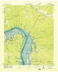 1936 Pickwick1936 Print · USGSThe Tennessee-Alabama border country stands at the brink of change during the New Deal era as the valley prepares for inundation. Genealogists can locate family landmarks like Shanghai Ch, the CCC Camp, and numerous schools including Walnut Grove Sch.
 - 1949 Map of Pickwick, 1967 Print
 1949 Pickwick1967 Print · USGSThe Tennessee and Alabama borderlands were being reshaped by hydroelectric power in the late 1940s. Researchers can trace family history through local landmarks like Shanghai Ch, Bryson Sch, and the Old White Sulphur Springs Cem.
 - 1952 Map of Pickwick
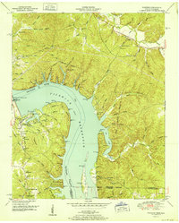 1952 Pickwick1952 Print · USGSThe Tennessee River valley at mid-century reveals a landscape transformed by the Pickwick Landing Dam and the rising Pickwick Reservoir. Genealogists can locate rural landmarks like Shanghai Ch, Bryson Sch, and the Old White Sulphur Springs Cem.
 - 1956 Map of Blytheville, 1964 Print
 1956 Blytheville1964 Print · USGSWest Tennessee and the Arkansas Delta come alive in this mid-century survey of the river-and-rail corridor connecting Memphis to Jackson. Genealogists and historians can trace the rail lines of the Louisville and Nashville RR and locate landmarks like Western State Hospital or Fort Pillow State Prison Farm.2 unique versions available
 - 1959 Map of Blytheville
 1959 Blytheville1959 Print · USGSWest Tennessee and Northeast Arkansas meet along the river in the late fifties, during a period of steady industrial and agricultural growth. Genealogists can trace the rail corridors of the Illinois Central through Jackson or explore landmarks like Shiloh National Military Park and Fort Pillow State Prison.
 - 1972 Map of Pickwick, 1974 Print
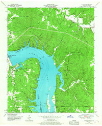
 1972 Pickwick1974 Print · USGSHardin County's river landscape is shown here in the early 1970s, shortly after the Tennessee Valley Authority updated its surveys of the area. Researchers can trace the development of Pickwick Landing State Park or locate historic burial grounds like White Sulphur Cem and Garrett Cem.2 unique versions available
 - 1986 Map of Selmer
 1986 Selmer1986 Print · USGSThe Tennessee River valley and the West Tennessee highlands come into focus in the mid-eighties, showing the region's unique intersection of Civil War history and modern infrastructure. Genealogists and researchers can trace family landmarks like Gillisses Mills, the campus of Freed-Hardeman College, and the hallowed grounds of Shiloh National Military Park.3 unique versions available
 - 2010 Map of Pickwick, 2010 Print
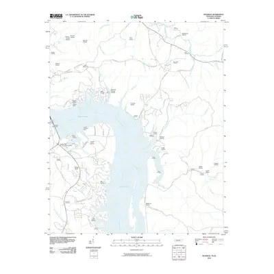 2010 Pickwick2010 Print · USGSCovers Bruton Branch, including Red Sulphur Springs, Winn Springs, and other nearby areas
 - 2013 Map of Pickwick, 2013 Print
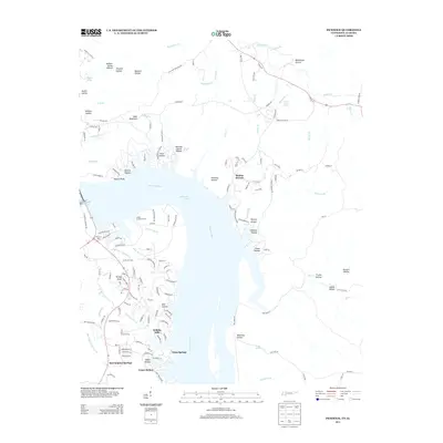 2013 Pickwick2013 Print · USGSCovers Bruton Branch, including Red Sulphur Springs, Winn Springs, and other nearby areas
 - 2016 Map of Pickwick, 2016 Print
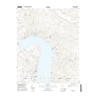 2016 Pickwick2016 Print · USGSCovers Bruton Branch, including Red Sulphur Springs, Winn Springs, and other nearby areas
 - 2019 Map of Pickwick, 2019 Print
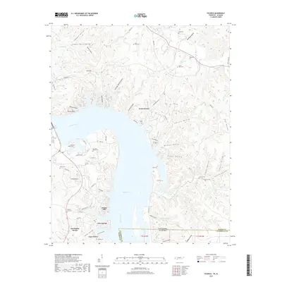 2019 Pickwick2019 Print · USGSCovers Bruton Branch, including Red Sulphur Springs, Winn Springs, and other nearby areas
 - 2022 Map of Pickwick, 2022 Print
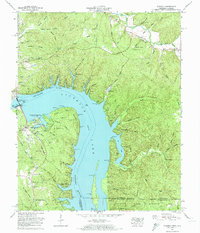
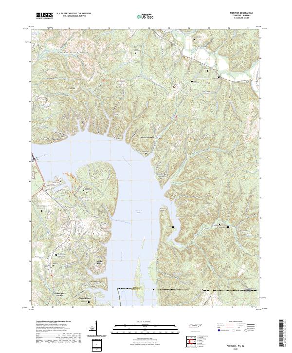 2022 Pickwick2022 Print · USGSThe Tennessee-Alabama state line and the waters of Pickwick Lake define this area as it appeared in the early 2020s. Genealogists and local historians can locate several family cemeteries, including Old White Sulphur Cem and Thomas Cem, alongside the community at Red Sulphur Springs.
End of results
Showing maps 1-12 of 12
Top cities near Bruton Branch
- Savannah historical maps
- Adamsville historical maps
- Crump historical maps
- Burnsville historical maps
- Michie historical maps
- Stantonville historical maps
See more
Frequently asked questions
- What are the different types of historical maps available for Bruton Branch?
- What is the oldest map of Bruton Branch?
- Where can I purchase historical maps of Bruton Branch for my home or office?
- Where can I download high-res historical maps of Bruton Branch?
- Are there historical topographic maps available for Bruton Branch?
- Is there historical aerial imagery available for Bruton Branch?
- Where are historical maps of Bruton Branch sourced from?