2020s Maps of Parkers Crossroads, Tennessee
Explore 2 historic maps of Parkers Crossroads from the 2020s. These maps offer a rare glimpse into what life looked like during the 2020s — showing old roads, neighborhoods, homes, and landmarks that have changed or disappeared over time.
Whether you're researching your family's past, planning a metal detecting trip, or studying how Parkers Crossroads's landscape evolved across the 2020s, these high-resolution maps are a powerful tool for exploring the history of this region.
- Focus on a specific era: All maps on this page are from the 2020s, giving you a focused view of this time period.
- See what’s changed: Compare century-old streets, trails, and buildings to today's modern landscape using overlays and satellite layers.
- Research with precision: Use these maps for genealogy, historical research, land use analysis, or educational projects.
- View, download, or print: Maps are fully viewable online in high resolution, and can be downloaded or printed for your own records.
Start exploring Parkers Crossroads's history through authentic maps from the 2020s. This is your window into the past.
Parkers Crossroads, TN maps
(2)- 2022 Map of Lexington, 2022 Print
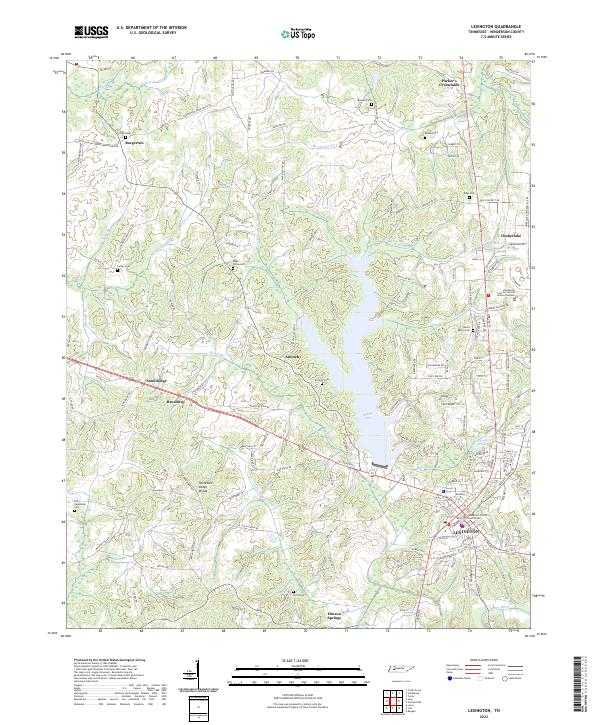 2022 Lexington2022 Print · USGSHenderson County comes to life in the early 2020s, centered on the growing county seat and its surrounding reservoir. Genealogists can trace family lines through Beech River Cem, Kizer Cem, and the historic Antioch Cem.
 - 2022 Map of Clarksburg, 2022 Print
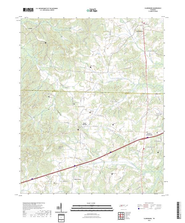 2022 Clarksburg2022 Print · USGSThe Tennessee and Mississippi drainage basins meet here along the Tennessee Valley Divide in Carroll and Henderson counties. Genealogists can trace family heritage through numerous burial sites like Palestine Cem, Rock Springs Cem, and the quiet crossroads at Jumbo.
End of results
Showing maps 1-2 of 2
Top cities near Parkers Crossroads
- Lexington historical maps
- Huntingdon historical maps
- Trezevant historical maps
- Clarksburg historical maps
- McLemoresville historical maps
Top neighborhoods of Parkers Crossroads
Frequently asked questions
- What are the different types of historical maps available for Parkers Crossroads?
- What is the oldest map of Parkers Crossroads?
- Where can I purchase historical maps of Parkers Crossroads for my home or office?
- Where can I download high-res historical maps of Parkers Crossroads?
- Are there historical topographic maps available for Parkers Crossroads?
- Is there historical aerial imagery available for Parkers Crossroads?
- Where are historical maps of Parkers Crossroads sourced from?