Old Maps of Chickasaw Heights, Paris for Academic Research
Study the evolution of Chickasaw Heights with 10 high-resolution historic maps. Whether you're teaching, researching, or modeling changes in land use, these maps provide essential visual documentation of urban, environmental, and geographic change.
- Analyze long-term change: Track patterns in development, transportation, and natural features.
- Ideal for environmental or urban studies: Support academic projects with primary historical map data.
- Use in the classroom or lab: Educators and researchers rely on these maps to bring historical context to life.
These maps are a powerful tool for teaching, research, and visualizing how Chickasaw Heights has changed over the decades.
Chickasaw Heights, Paris maps
(10)- 1936 Map of Paris
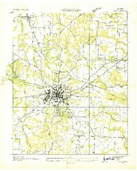 1936 Paris1936 Print · USGSHenry County is captured here in the mid-1930s as a bustling railroad hub and a focus of New Deal-era development. Genealogists and historians can trace family locations near Paris, CCC Camp TVA No 36, and numerous rural landmarks like Vandyke Grove Ch and Maplewood Cem.
 - 1950 Map of Paris
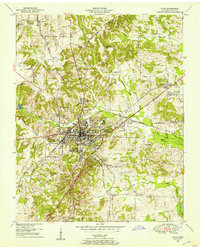 1950 Paris1950 Print · USGSMid-century Paris, Tennessee, thrived as a vital railroad crossroads where two major lines intersected amidst the ridges of the Tennessee Valley Divide. Genealogists can trace family roots through numerous sites like Jones Chapel, Greenwood Cem, and the Nelson Sch.
 - 1956 Map of Dyersburg, 1960 Print
 1956 Dyersburg1960 Print · USGSThe Four Rivers region comes alive in the mid-fifties, capturing the intricate borderlands of Tennessee, Kentucky, and Missouri. Genealogists and historians can trace the rail-and-river networks connecting Dyersburg, Caruthersville, and the shoreline of Reelfoot Lake.4 unique versions available
 - 1965 Map of Paris, 1967 Print
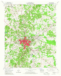 1965 Paris1967 Print · USGSMid-century Henry County centers on the thriving rail hub of Paris as it expands into new residential tracts. Researchers can trace family roots at Maplewood Cem, find the old Rowe School, and locate rural landmarks like India and Birds Creek Church.2 unique versions available
 - 1986 Map of McKenzie
 1986 McKenzie1986 Print · USGSWest Tennessee in the mid-eighties was a landscape defined by its deep river forks and the massive waters of Kentucky Lake. Researchers can trace the rail lines of the Louisville & Nashville RR and find local landmarks from Skullbone to the Paris Landing State Park.3 unique versions available
 - 2010 Map of Paris, 2010 Print
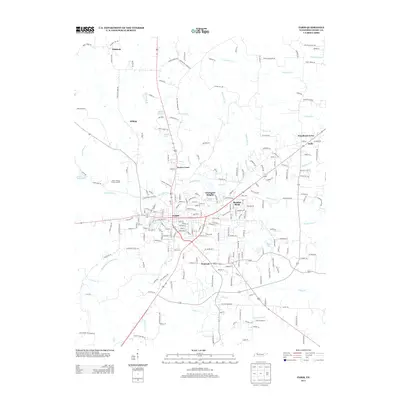
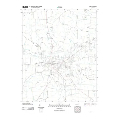 2010 Paris2010 Print · USGSCovers Chickasaw Heights, including Paris, Hilltop, and other nearby areas
 - 2013 Map of Paris, 2013 Print
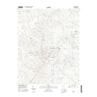
 2013 Paris2013 Print · USGSCovers Chickasaw Heights, including Paris, Hilltop, and other nearby areas
 - 2016 Map of Paris, 2016 Print
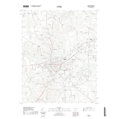
 2016 Paris2016 Print · USGSCovers Chickasaw Heights, including Paris, Hilltop, and other nearby areas
 - 2019 Map of Paris, 2019 Print
 2019 Paris2019 Print · USGSCovers Chickasaw Heights, including Paris, Hilltop, and other nearby areas
 - 2022 Map of Paris, 2022 Print
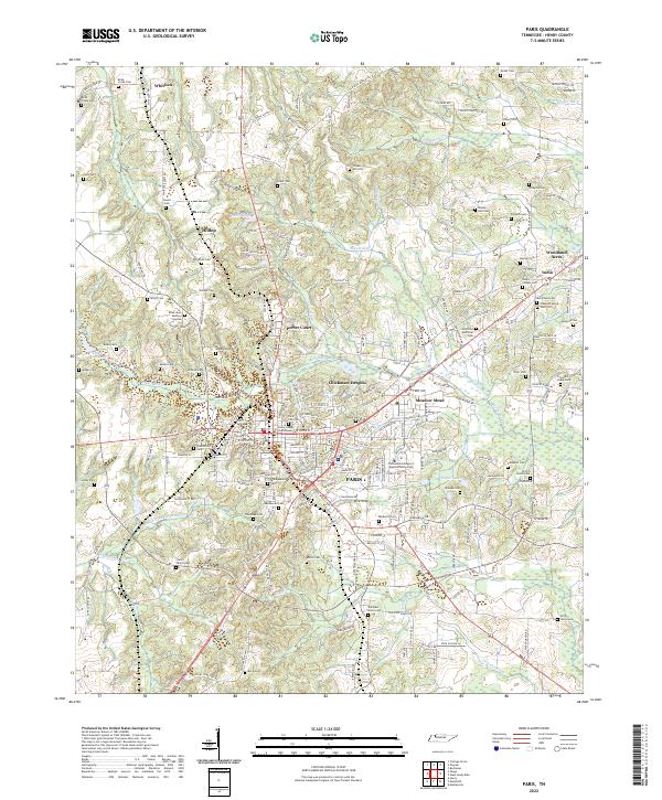 2022 Paris2022 Print · USGSThe Henry County seat and its rural surroundings are captured here during a period of steady growth. Researchers can trace decades of local heritage through sites like the Henry County Courthouse, Maplewood Cem, and the old settlement of India.
End of results
Showing maps 1-10 of 10
Top cities near Chickasaw Heights
- Paris historical maps
- McKenzie historical maps
- Camden historical maps
- Puryear historical maps
- Henry historical maps
- Big Sandy historical maps
See more
Frequently asked questions
- What are the different types of historical maps available for Chickasaw Heights?
- What is the oldest map of Chickasaw Heights?
- Where can I purchase historical maps of Chickasaw Heights for my home or office?
- Where can I download high-res historical maps of Chickasaw Heights?
- Are there historical topographic maps available for Chickasaw Heights?
- Is there historical aerial imagery available for Chickasaw Heights?
- Where are historical maps of Chickasaw Heights sourced from?