Old Maps of Chilhowee Hills, Knoxville for Metal Detecting
Plan your next treasure hunt with 59 historic maps of Chilhowee Hills. Find old homesites, ghost towns, trails, and gathering spots that may be lost to time — perfect for identifying promising metal detecting locations.
- Locate forgotten sites: Uncover places like long-lost settlements, abandoned rail lines, or gathering spots.
- Plan better hunts: Use map overlays combined with LiDAR or satellite views to narrow in on historically rich areas.
- Made for detectorists: Thousands of hobbyists use these maps to discover relics, coins, and hidden history.
Use these historic maps to boost your research and find new opportunities beneath the surface of Chilhowee Hills.
Chilhowee Hills, Knoxville maps
(59)- 1886 Map of Knoxville
 1886 Knoxville1886 Print · USGSEast Tennessee in the late nineteenth century was a landscape of river ferries and mountain coves centered around the growing hub of Knoxville. Genealogists can locate family landmarks like Spencer Cabin, Montvale Springs, and the old Brabsons Ferry river crossing.
 - 1892 Map of Knoxville
 1892 Knoxville1892 Print · USGSEastern Tennessee in the late nineteenth century shows a landscape of river-valley commerce transitioning into the Great Smokies. Genealogists can trace early homesteads near Sevierville or locate landmarks like Porter Academy and Boyd Ferry.
 - 1894 Map of Knoxville
 1894 Knoxville1894 Print · USGSThe Tennessee valley meets the high Smokies in the 1890s, revealing a landscape of river ferries, mountain coves, and emerging rail towns. Genealogists and historians can trace early crossings at Boyd Ferry, established schools like Porter Academy, and the early footprints of Gatlinburg and Pigeon Forge.
 - 1895 Map of Knoxville
 1895 Knoxville1895 Print · USGSThe Tennessee and French Broad Rivers converge in this late-nineteenth-century survey of East Tennessee’s rising landscape. Trace the early rail lines and mountain crossings that shaped life for families in Sevierville, Gatlinburg, and Maryville.2 unique versions available
 - 1897 Map of Maynardville
 1897 Maynardville1897 Print · USGSEast Tennessee in the late nineteenth century was a landscape of high ridges and vital river fords. Genealogists and historians can trace old homesteads and transit hubs like Nances Ferry, the Lead Mine at New Prospect, and Massongills Mill.
 - 1900 Map of Maynardville
 1900 Maynardville1900 Print · USGSEast Tennessee was a world of river fords and mountain gaps at the turn of the century, dominated by the winding Clinch and Powell rivers. Genealogists can trace family roots through specific landmarks like Massongills Mill, Church Grove, and Sharps Chapel.4 unique versions available
 - 1901 Map of Knoxville
 1901 Knoxville1901 Print · USGSThe East Tennessee borderlands meet the high Smokies at the turn of the century. Genealogists can trace early homesteads and crossroads near Sevierville and Maryville, or find landmarks like Cade Cove and Gatlinburg before they became tourist hubs.5 unique versions available
 - 1935 Map of Knoxville
 1935 Knoxville1935 Print · USGSKnoxville and its southern Blount County neighbors appear here in the mid-1930s as the TVA era begins. Researchers can trace family roots through Mt Olive Cem, locate the old Eastern State Hospital, or study the early layout of Sequoyah Hills.
 - 1935 Map of Fountain City
 1935 Fountain City1935 Print · USGSKnox County north of Knoxville in the mid-1930s reveals a transition from traditional ridge-and-valley farming to suburban clusters. Genealogists can trace family names at Mynatt Cem, visit Halls Crossroads, or locate the Beverly Hills Sanitarium.
 - 1936 Map of Gorryton
 1936 Gorryton1936 Print · USGSNortheast of Knoxville in the mid-1930s, the landscape was being reshaped by the newly flooded Norris Reservoir. Genealogists and historians can trace numerous rural landmarks, including Welch Mill, Big Ridge Park Cemetery, and the Southern Railway corridor.
 - 1936 Map of Shooks Gap
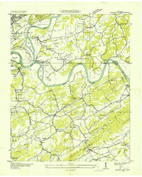 1936 Shooks Gap1936 Print · USGSEast of Knoxville in the mid-1930s, the confluence of the French Broad and Holston rivers shaped a landscape of ferry crossings and ridge-top farming. Genealogists can trace family footprints at Old Salem Cem, Whites Village, and the many rural schools like Anderson Sch.
 - 1936 Map of Knoxville
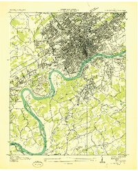 1936 Knoxville1936 Print · USGSKnoxville and its riverfront suburbs come alive in this mid-1930s survey, showing the city just as the TVA began its regional work. Genealogists and historians can locate family homes near Knoxville College, the State School for Deaf, or old cemeteries like New Gray Cem.
 - 1936 Map of John Sevier
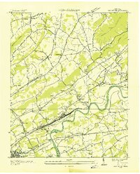 1936 John Sevier1936 Print · USGSKnox County is captured here in the mid-thirties, showing the vital rail and river corridor east of Knoxville during the early TVA era. Researchers can trace family sites from Maloneyville to Mascot, locating landmarks like the Legg England Cem, John Sevier Sta, and Rising Sun Ch.
 - 1940 Map of John Sevier
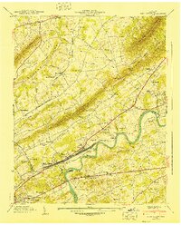 1940 John Sevier1940 Print · USGSKnox County at the start of the 1940s is defined by the Holston River and the industrial activity of the Southern railroad. Trace family sites like Clapps Chapel, the County Workhouse, and Ruggles Ferry Bridge before the landscape was fully reshaped by modern expansion.2 unique versions available
 - 1940 Map of Shooks Gap
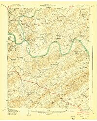 1940 Shooks Gap1940 Print · USGSThe confluence of the French Broad and Holston rivers defines this 1940 Knox County landscape just east of Knoxville. Genealogists can trace family sites at Asbury Cem, find the Riverdale Ferry crossing, or locate old schoolhouses like New Prospect Sch.3 unique versions available
 - 1941 Map of Fountain City
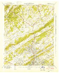 1941 Fountain City1941 Print · USGSKnox County is captured here just before the mid-century, showing the suburban expansion of Fountain City against the backdrop of the ridge-and-valley landscape. Researchers can locate family landmarks like Lynnhurst Cem, Fort Sumter Sch, and the Beverly Hills Sanitarium.
 - 1942 Map of Knoxville
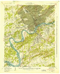 1942 Knoxville1942 Print · USGSKnoxville and its riverfront neighborhoods are shown here at the start of the 1940s, just as the reservoir system began to reshape the valley. Genealogists can trace family roots through numerous burial grounds like Old Gray Cem and Wells Cem, or locate landmarks such as the University of Tennessee.
 - 1953 Map of Fountain City, 1954 Print
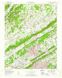 1953 Fountain City1954 Print · USGSNorth of Knoxville in the early fifties, the landscape was a mix of ridgeline farms and growing suburbs like Fountain City. Genealogists can locate family burial plots at Mayes Chapel Cemetery and landmarks like the Dante School or Beverly Hills Sanatorium.2 unique versions available
 - 1953 Map of Shooks Gap, 1954 Print
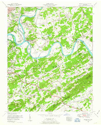 1953 Shooks Gap1954 Print · USGSEast of Knoxville in the early fifties, the landscape was a mix of river-bottom farms and rising suburban development. Genealogists can find family landmarks like McCammon Cemetery, industrial sites at Meades Quarry, and the historic Riverdale Ferry crossing.3 unique versions available
 - 1953 Map of John Sevier, 1954 Print
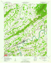 1953 John Sevier1954 Print · USGSKnox County is captured in the early fifties as the river-and-rail economy defined the eastern edge of Knoxville. Researchers can trace family history through dozens of landmarks, including John Sevier Station, the Potters Field Cemetery, and the Rising Sun School.2 unique versions available
 - 1953 Map of Knoxville, 1955 Print
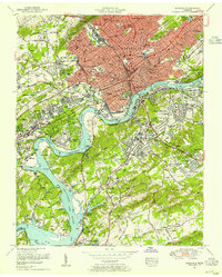 1953 Knoxville1955 Print · USGSKnoxville's mid-century skyline and riverfront are meticulously documented here just as the city's modern footprint was taking shape. Genealogists and local historians can trace the foundations of Knoxville College, the bustling Coster Yards, and family plots in National Cemetery.2 unique versions available
 - 1955 Map of Knoxville
 1955 Knoxville1955 Print · USGSThe Southern Appalachians and the Smoky Mountains are shown here at a peak of mid-century development and conservation. Genealogists and historians can trace the early road networks connecting Gatlinburg, Waynesville, and the Cherokee Indian Reservation across the high ridges.
 - 1955 Map of Johnson City
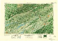 1955 Johnson City1955 Print · USGSEast Tennessee and the bordering highlands of Virginia and Kentucky appear here during the post-war industrial boom. You can trace the complex network of mountain ridges and new TVA lakes, from Johnson City to the coalfields near Middlesboro and Lynch.
 - 1957 Map of Knoxville, 1966 Print
 1957 Knoxville1966 Print · USGSThe Southern Appalachians of Tennessee and North Carolina are mapped here during the mid-twentieth century as new highways reached the high country. Genealogists and historians can trace the topography between Knoxville and Asheville, locating family landmarks near Fontana Lake or along the Blue Ridge Parkway.4 unique versions available
 - 1957 Map of Johnson City, 1966 Print
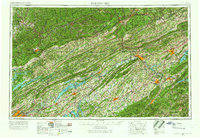 1957 Johnson City1966 Print · USGSUpper East Tennessee and Southwest Virginia are shown here during the mid-sixties transition of the Appalachians. Researchers can trace the industrial rail hubs of Kingsport, the sprawling waters of Cherokee Lake, and the historic Cumberland Gap.
Showing maps 1-25 of 59
Frequently asked questions
- What are the different types of historical maps available for Chilhowee Hills?
- What is the oldest map of Chilhowee Hills?
- Where can I purchase historical maps of Chilhowee Hills for my home or office?
- Where can I download high-res historical maps of Chilhowee Hills?
- Are there historical topographic maps available for Chilhowee Hills?
- Is there historical aerial imagery available for Chilhowee Hills?
- Where are historical maps of Chilhowee Hills sourced from?