Old Maps of Deer Creek, Knoxville for Academic Research
Study the evolution of Deer Creek with 39 high-resolution historic maps. Whether you're teaching, researching, or modeling changes in land use, these maps provide essential visual documentation of urban, environmental, and geographic change.
- Analyze long-term change: Track patterns in development, transportation, and natural features.
- Ideal for environmental or urban studies: Support academic projects with primary historical map data.
- Use in the classroom or lab: Educators and researchers rely on these maps to bring historical context to life.
These maps are a powerful tool for teaching, research, and visualizing how Deer Creek has changed over the decades.
Deer Creek, Knoxville maps
(39)- 1886 Map of Knoxville
 1886 Knoxville1886 Print · USGSEast Tennessee in the late nineteenth century was a landscape of river ferries and mountain coves centered around the growing hub of Knoxville. Genealogists can locate family landmarks like Spencer Cabin, Montvale Springs, and the old Brabsons Ferry river crossing.
 - 1892 Map of Knoxville
 1892 Knoxville1892 Print · USGSEastern Tennessee in the late nineteenth century shows a landscape of river-valley commerce transitioning into the Great Smokies. Genealogists can trace early homesteads near Sevierville or locate landmarks like Porter Academy and Boyd Ferry.
 - 1894 Map of Knoxville
 1894 Knoxville1894 Print · USGSThe Tennessee valley meets the high Smokies in the 1890s, revealing a landscape of river ferries, mountain coves, and emerging rail towns. Genealogists and historians can trace early crossings at Boyd Ferry, established schools like Porter Academy, and the early footprints of Gatlinburg and Pigeon Forge.
 - 1895 Map of Loudon
 1895 Loudon1895 Print · USGSEastern Tennessee is mapped here during a decade of rail expansion and river-based commerce. Genealogists and historians can trace family-named river crossings and early industry at Huff Ferry, Hiwassee College, and Brick Mill.6 unique versions available
 - 1895 Map of Knoxville
 1895 Knoxville1895 Print · USGSThe Tennessee and French Broad Rivers converge in this late-nineteenth-century survey of East Tennessee’s rising landscape. Trace the early rail lines and mountain crossings that shaped life for families in Sevierville, Gatlinburg, and Maryville.2 unique versions available
 - 1901 Map of Knoxville
 1901 Knoxville1901 Print · USGSThe East Tennessee borderlands meet the high Smokies at the turn of the century. Genealogists can trace early homesteads and crossroads near Sevierville and Maryville, or find landmarks like Cade Cove and Gatlinburg before they became tourist hubs.5 unique versions available
 - 1935 Map of Knoxville
 1935 Knoxville1935 Print · USGSKnoxville and its southern Blount County neighbors appear here in the mid-1930s as the TVA era begins. Researchers can trace family roots through Mt Olive Cem, locate the old Eastern State Hospital, or study the early layout of Sequoyah Hills.
 - 1935 Map of Bearden
 1935 Bearden1935 Print · USGSKnox County is captured in the mid-1930s just as the Tennessee Valley Authority began reshaping the regional landscape. Trace the old rail lines of the Southern railroad and find local landmarks like the County Prison Farm and Karns Sch.
 - 1936 Map of Knoxville
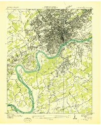 1936 Knoxville1936 Print · USGSKnoxville and its riverfront suburbs come alive in this mid-1930s survey, showing the city just as the TVA began its regional work. Genealogists and historians can locate family homes near Knoxville College, the State School for Deaf, or old cemeteries like New Gray Cem.
 - 1936 Map of Friendship
 1936 Friendship1936 Print · USGSEast Tennessee in the mid-1930s is documented here at a turning point for the river and rail landscape of Knox and Blount counties. Genealogists can trace family names at Mt Zion Ch, Martel Sch, and the riverside settlement of Louisville before the valley landscape was transformed.
 - 1940 Map of Bearden
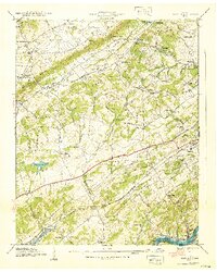 1940 Bearden1940 Print · USGSKnox County just before the completion of Fort Loudoun Lake shows a landscape of ridge-top farms and growing rail-side communities. Genealogists can locate family names at Edgewood Cem, Karns Sch, and the settlements of Bearden or Rocky Hill.2 unique versions available
 - 1942 Map of Knoxville
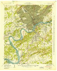 1942 Knoxville1942 Print · USGSKnoxville and its riverfront neighborhoods are shown here at the start of the 1940s, just as the reservoir system began to reshape the valley. Genealogists can trace family roots through numerous burial grounds like Old Gray Cem and Wells Cem, or locate landmarks such as the University of Tennessee.
 - 1953 Map of Chattanooga
 1953 Chattanooga1953 Print · USGSSoutheast Tennessee in the early fifties shows a landscape reshaped by river management and rail power. Trace the rail lines of the Southern Ry through riverside towns or locate the preserved grounds of the Chickamauga and Chattanooga National Military Park.
 - 1953 Map of Knoxville, 1955 Print
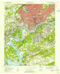 1953 Knoxville1955 Print · USGSKnoxville's mid-century skyline and riverfront are meticulously documented here just as the city's modern footprint was taking shape. Genealogists and local historians can trace the foundations of Knoxville College, the bustling Coster Yards, and family plots in National Cemetery.2 unique versions available
 - 1953 Map of Bearden, 1955 Print
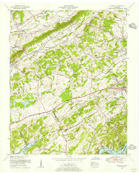 1953 Bearden1955 Print · USGSWest of Knoxville in the early fifties, this area shows a landscape transitioning from rural ridges to suburban communities. Trace family roots at Mars Hill Cemetery, the Blue Grass School, or along the busy tracks of the Louisville and Nashville railroad.
 - 1955 Map of Knoxville
 1955 Knoxville1955 Print · USGSThe Southern Appalachians and the Smoky Mountains are shown here at a peak of mid-century development and conservation. Genealogists and historians can trace the early road networks connecting Gatlinburg, Waynesville, and the Cherokee Indian Reservation across the high ridges.
 - 1957 Map of Knoxville, 1966 Print
 1957 Knoxville1966 Print · USGSThe Southern Appalachians of Tennessee and North Carolina are mapped here during the mid-twentieth century as new highways reached the high country. Genealogists and historians can trace the topography between Knoxville and Asheville, locating family landmarks near Fontana Lake or along the Blue Ridge Parkway.4 unique versions available
 - 1957 Map of Chattanooga, 1966 Print
 1957 Chattanooga1966 Print · USGSEast Tennessee in the mid-1960s shows a landscape of massive hydroelectric reservoirs and emerging industrial sites like the Atomic Energy Commission (Oak Ridge Area). Trace the rail networks of the Southern Ry through Chattanooga or locate family-named ridges across the Cumberland Plateau.3 unique versions available
 - 1959 Map of Chattanooga
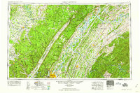 1959 Chattanooga1959 Print · USGSSoutheast Tennessee is shown here during a decade of industrial growth and hydroelectric development. Trace the regional rail networks of the Southern Ry and find landmark sites like Lookout Mountain, Fall Creek Falls State Park, and Chattanooga.
 - 1960 Map of Knoxville
 1960 Knoxville1960 Print · USGSThe Southern Appalachians come alive in the 1950s, showing the intersection of new national park tourism and deep-rooted mountain industry. Trace old rail lines like the Clinchfield RR and find high-altitude landmarks from Mt Le Conte to the Cherokee Indian Reservation.2 unique versions available
 - 1960 Map of Chattanooga
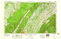 1960 Chattanooga1960 Print · USGSSoutheast Tennessee and the southern Appalachians are shown here at the height of the river-management era. You can trace the valley rail lines and locate Lookout Mountain and the expansive waters of Chickamauga Reservoir.
 - 1964 Map of Chattanooga
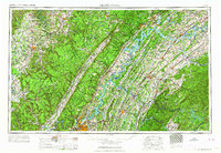 1964 Chattanooga1964 Print · USGSSoutheast Tennessee and the western Carolinas appear in the mid-sixties as a powerhouse of river-driven industry and mountain wilderness. Genealogists and historians can trace rail-town lineages along the Southern Ry or locate family landmarks near Watts Bar Lake and Tellico Plains.
 - 1964 Map of Knoxville
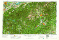 1964 Knoxville1964 Print · USGSThe Southern Appalachians and Great Smokies are captured here during the mid-sixties, showing the rugged borderlands of Tennessee and North Carolina. Researchers can trace historic mountain routes like U S 441, the expanse of Pisgah National Forest, and the growing footprints of Asheville and Knoxville.
 - 1966 Map of Knoxville, 1968 Print
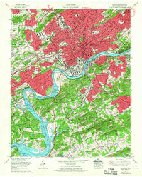 1966 Knoxville1968 Print · USGSKnoxville in the mid-sixties is a city in transition, as new interstate highways begin to cut through historic urban neighborhoods and older rail corridors. Researchers can trace the footprints of Knoxville College, Old Gray Cem, and the riverfront campus of the University of Tennessee.2 unique versions available
 - 1966 Map of Bearden, 1968 Print
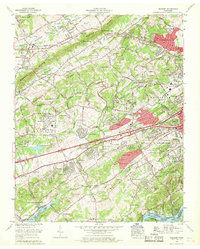 1966 Bearden1968 Print · USGSWestern Knoxville and the Beaver Valley are captured in the mid-sixties during a transformative era of suburban growth. Genealogists and historians can trace the transition from rural landmarks like Beaver Ridge Cem to rising neighborhoods such as West Hills and Rocky Hill.
Showing maps 1-25 of 39
Frequently asked questions
- What are the different types of historical maps available for Deer Creek?
- What is the oldest map of Deer Creek?
- Where can I purchase historical maps of Deer Creek for my home or office?
- Where can I download high-res historical maps of Deer Creek?
- Are there historical topographic maps available for Deer Creek?
- Is there historical aerial imagery available for Deer Creek?
- Where are historical maps of Deer Creek sourced from?