2020s Maps of Grays Camp, Tennessee
Explore 1 historic maps of Grays Camp from the 2020s. These maps offer a rare glimpse into what life looked like during the 2020s — showing old roads, neighborhoods, homes, and landmarks that have changed or disappeared over time.
Whether you're researching your family's past, planning a metal detecting trip, or studying how Grays Camp's landscape evolved across the 2020s, these high-resolution maps are a powerful tool for exploring the history of this region.
- Focus on a specific era: All maps on this page are from the 2020s, giving you a focused view of this time period.
- See what’s changed: Compare century-old streets, trails, and buildings to today's modern landscape using overlays and satellite layers.
- Research with precision: Use these maps for genealogy, historical research, land use analysis, or educational projects.
- View, download, or print: Maps are fully viewable online in high resolution, and can be downloaded or printed for your own records.
Start exploring Grays Camp's history through authentic maps from the 2020s. This is your window into the past.
Grays Camp, TN maps
(1)- 2022 Map of Samburg, 2022 Print
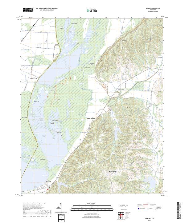 2022 Samburg2022 Print · USGSSamburg and the eastern shores of Reelfoot Lake appear in detail during the early 2020s, showing a landscape defined by complex wetlands and ridge-top settlements. Researchers can trace family names and local landmarks from Roneys Store and Walnut Log to the Crescent Cem on the slopes of Fishgap Hill.
End of results
Showing maps 1-1 of 1
Top cities near Grays Camp
- Tiptonville historical maps
- New Madrid historical maps
- Hickman historical maps
- Ridgely historical maps
- Troy historical maps
- Obion historical maps
See more
Frequently asked questions
- What are the different types of historical maps available for Grays Camp?
- What is the oldest map of Grays Camp?
- Where can I purchase historical maps of Grays Camp for my home or office?
- Where can I download high-res historical maps of Grays Camp?
- Are there historical topographic maps available for Grays Camp?
- Is there historical aerial imagery available for Grays Camp?
- Where are historical maps of Grays Camp sourced from?