Old Maps of Madison County, Tennessee for Hiking & Exploration
Hike through history with 120 historic maps of Madison County. Explore old trails, ghost towns, and forgotten backroads — perfect for outdoor adventurers and local explorers.
- Rediscover forgotten places: Map out old mining camps, roads, and footpaths that no longer exist on modern maps.
- Layer with modern tools: Combine with LiDAR or satellite views to plan hikes through historical terrain.
- Made for exploration: Popular among hikers, overlanders, and local history lovers.
Use these maps to find adventure and explore the hidden past of Madison County.
Madison County, TN maps
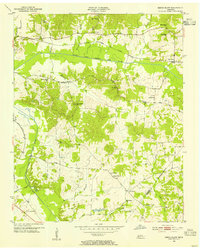
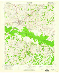
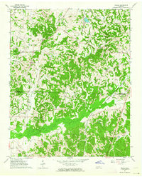
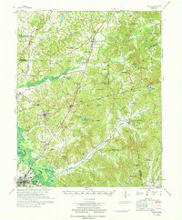
(120)- 1950 Map of Jackson South, 1952 Print
 1950 Jackson South1952 Print · USGSMadison County transitions from a bustling railroad and college center to a rural landscape of company towns and family homesteads in the early fifties. Genealogists can trace property near Bemis, identify early campus footprints for Union University, or locate rural landmarks like Lester Chapel.5 unique versions available
 - 1950 Map of Jackson North, 1962 Print
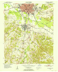
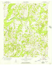
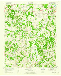
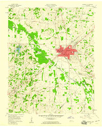
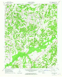
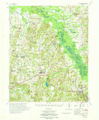
 1950 Jackson North1962 Print · USGSMid-century Madison County comes alive as the city of JACKSON expands northward toward the river forks. Researchers can trace family-named lanes and historic institutions like Lane College, Bible Grove Ch, and the Brick Kilns along the rail lines.5 unique versions available
 - 1951 Map of Jackson North
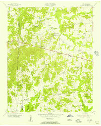
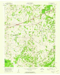
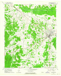
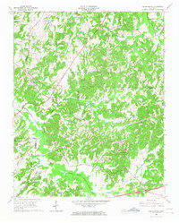
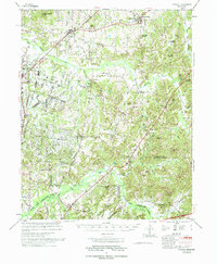
 1951 Jackson North1951 Print · USGSMadison County thrived at mid-century as a rail and education center, shown here before the modern highway system reshaped the Tennessee landscape. Researchers can trace the heritage of Lane College, find family markers at Elmwood Cem, or locate landmarks like the Brick Kilns.
 - 1953 Map of Claybrook, 1955 Print
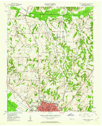
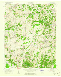
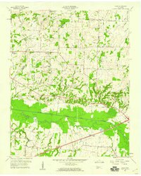
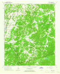
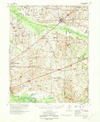
 1953 Claybrook1955 Print · USGSMadison County rural life in the early fifties is defined by its network of country schools and churches. Genealogists can trace family footprints near Claybrook, Salem Cem, and along the Gulf Mobile and Ohio rail line.4 unique versions available
 - 1953 Map of Beech Bluff, 1955 Print
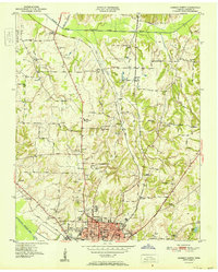
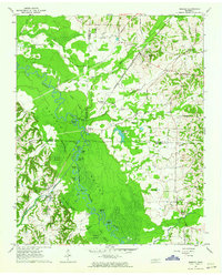
 1953 Beech Bluff1955 Print · USGSMadison and Chester Counties are captured here in the early 1950s, centered on the river-fed agricultural lands of West Tennessee. Genealogists can trace family roots at numerous rural landmarks, from Potts Chapel and Beech Bluff Sch to the crossroads at Five Points.3 unique versions available
 - 1955 Map of Luray, 1956 Print
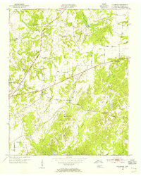
 1955 Luray1956 Print · USGSHenderson and Chester counties are captured here in the mid-fifties, showing a landscape defined by the Nashville Chattanooga and St Louis rail line. Genealogists can trace family names through numerous landmarks like Buckley Cem, Jackson Range Sta, and the New Friendship Sch.2 unique versions available
 - 1955 Map of Juno, 1956 Print
 1955 Juno1956 Print · USGSHenderson County rural life in the mid-1950s is captured here through its network of small communities and country churches. Genealogists can trace family roots through sites like Juno Ch, Holly Springs Sch, and the Claybrook Sch Cem.2 unique versions available
 - 1956 Map of Blytheville, 1964 Print
 1956 Blytheville1964 Print · USGSWest Tennessee and the Arkansas Delta come alive in this mid-century survey of the river-and-rail corridor connecting Memphis to Jackson. Genealogists and historians can trace the rail lines of the Louisville and Nashville RR and locate landmarks like Western State Hospital or Fort Pillow State Prison Farm.2 unique versions available
 - 1959 Map of Medina
 1959 Medina1959 Print · USGSWest Tennessee’s rail-and-river landscape comes alive in the late fifties as three major railroads cross the Gibson and Madison county lines. Researchers can trace the vanished footprints of Fly Sch, explore the community around Bakers Chapel, and locate family plots at White Rose Cem.4 unique versions available
 - 1959 Map of Blytheville
 1959 Blytheville1959 Print · USGSWest Tennessee and Northeast Arkansas meet along the river in the late fifties, during a period of steady industrial and agricultural growth. Genealogists can trace the rail corridors of the Illinois Central through Jackson or explore landmarks like Shiloh National Military Park and Fort Pillow State Prison.
 - 1959 Map of Bells, 1960 Print
 1959 Bells1960 Print · USGSWest Tennessee agriculture and rail transport intersect in the late fifties where the Gulf Mobile and Ohio meets the L&N at Bells. Local researchers can trace family roots through several rural landmarks, including Morris Hill Sch, Belleview Cem, and East Haywood Ch.2 unique versions available
 - 1959 Map of Westover, 1960 Print
 1959 Westover1960 Print · USGSMadison County in the late fifties was a landscape of small crossroads communities and rural social hubs. Genealogists and local historians can trace the locations of dozens of family-named landmarks, from Neely Sch and Blairs Sch to Andrews Chapel.3 unique versions available
 - 1959 Map of Denmark, 1960 Print
 1959 Denmark1960 Print · USGSWest Tennessee rural life is documented here in the late fifties, spanning the Haywood and Madison county line. Researchers can locate family landmarks like Bond Cem, local schools such as Lower Ingram Sch, and the village of Denmark.3 unique versions available
 - 1959 Map of Adair, 1960 Print
 1959 Adair1960 Print · USGSWest Tennessee’s rural landscape is captured here in the late fifties, centered on the Adair community and the South Fork Forked Deer River. Researchers can trace old family burial sites at Jewette Cem and McLemore Cem or locate the historic Gulf Mobile and Ohio rail line.4 unique versions available
 - 1959 Map of Humboldt, 1960 Print
 1959 Humboldt1960 Print · USGSHumboldt and the surrounding West Tennessee countryside are captured here in the late fifties, during a period of steady growth and rail-side industry. Genealogists can locate family landmarks like Mason Grove or trace ancestors at Rose Hill Cemetery and New Shiloh Ch.2 unique versions available
 - 1961 Map of Medon, 1964 Print
 1961 Medon1964 Print · USGSThe West Tennessee borderlands of Madison, Chester, and Hardeman counties are captured here in the early sixties as a network of rail lines and rural parishes. Genealogists can locate family landmarks like the Rosenwald Sch, Farlow Cem, and Big Springs Ch.3 unique versions available
 - 1961 Map of Mercer, 1964 Print
 1961 Mercer1964 Print · USGSThe Hatchie River floodplain in the early sixties is a landscape of oxbow lakes and rail-side settlements. Researchers can trace family history at Hayes Chapel Cem, find the site of the Brown Sch, or locate the Old Ferry Landing.2 unique versions available
 - 1961 Map of Henderson, 1964 Print
 1961 Henderson1964 Print · USGSChester County at the dawn of the 1960s shows a landscape of established rail towns and significant archaeological sites. Researchers can locate family landmarks such as Montezuma Cem and Rogers Cem or trace the early campus footprint of Freed Hardeman College.3 unique versions available
 - 1961 Map of Teague, 1964 Print
 1961 Teague1964 Print · USGSMadison and Hardeman Counties are shown here in the early sixties, a landscape of family-run farms and traditional country parishes. Genealogists can trace specific family landmarks including Uptonville Cem, Marshall Chapel, and the Indian Mound near Hart Creek.2 unique versions available
 - 1966 Map of Spring Creek, 1967 Print
 1966 Spring Creek1967 Print · USGSWestern Tennessee at the height of the Cold War is captured here, showing the intersection of rural agriculture and military industry. Trace the massive footprint of the Milan Army Ammunition Plant alongside local landmarks like Latham Chapel and the Illinois Central RR.3 unique versions available
 - 1966 Map of Cedar Grove, 1968 Print
 1966 Cedar Grove1968 Print · USGSWest Tennessee rural life is documented here in the mid-1960s as the landscape transitions across the Carroll and Henderson county lines. Genealogists can locate family landmarks like Furgerson Cem, Pleasant Hill Ch, and the settlement at Cedar Grove.
 - 1970 Map of Bells
 1970 Bells1970 Print · USGSWest Tennessee river bottoms and upland farms come alive in this 1970s survey of the Haywood and Crockett county border. Researchers can trace historic family burial sites at Magnolia Cem and Hess Cem or locate vanished local schools such as Bradford Sch.
 - 1971 Map of Teague
 1971 Teague1971 Print · USGSThe Hatchie River lowlands and the uplands of Chickasaw State Park are captured here in the early seventies. Genealogists and historians can trace rail-side communities like Medon and Toone or locate family sites like Maple Springs Cem and Toone Sch.
 - 1971 Map of Whiteville
 1971 Whiteville1971 Print · USGSWest Tennessee’s river-bottom country is captured here in the early seventies, centered on the Hatchie River and its vast wetlands. Genealogists can trace family names through dozens of rural landmarks like Hayes Chapel Cem, Rubens Sch, and the Western State Hospital grounds.
 - 1977 Map of Atwood
 1977 Atwood1977 Print · USGSCarroll County and its neighbors are captured in the late seventies, showing a landscape defined by small-town life and military industry. Researchers can trace local roots through numerous country landmarks like Latham Chapel, Atwood, and the Full Gospel Mission.
Showing maps 1-25 of 120
Top cities of Madison County
Frequently asked questions
- What are the different types of historical maps available for Madison County?
- What is the oldest map of Madison County?
- Where can I purchase historical maps of Madison County for my home or office?
- Where can I download high-res historical maps of Madison County?
- Are there historical topographic maps available for Madison County?
- Is there historical aerial imagery available for Madison County?
- Where are historical maps of Madison County sourced from?