Old Maps of Orme, Tennessee
Explore 33 old maps of Orme, spanning from 1886 to today. These high-resolution historic maps reveal how streets, neighborhoods, landmarks, and natural features evolved over time — perfect for genealogy, metal detecting, research, and local history exploration.
What you can do with these maps:
- See how Orme changed over time: Compare historical maps to modern-day views to trace roads, homesites, rail lines & more.
- View detailed metadata: Each map includes creators, publishers, year, scale, and archive source.
- Overlay maps with satellite & LiDAR: Visualize the past alongside modern tools to explore terrain & human change.
- Trusted historical sources: Maps sourced from the USGS, Library of Congress, and other archives.
- Access maps your way: View online, download high-res files, or order prints for personal or research use.
Start exploring old maps of Orme to uncover forgotten places, hidden landmarks, and the deep history beneath your feet.
Orme, TN maps
(33)- 1886 Map of Stevenson
 1886 Stevenson1886 Print · USGSNortheast Alabama at the peak of the railroad era shows a landscape tied to the river and the rails. Genealogists can trace family landmarks like Coffey's Store or locate river crossings such as Caperton Ferry and Snodgrass Ferry.
 - 1892 Map of Stevenson
 1892 Stevenson1892 Print · USGSNortheast Alabama and the Tennessee border in the 1890s reveal a landscape of mountain coves and vital river crossings. Genealogists and historians can trace rail junctions at Stevenson, river landings like Coffey's Ferry, and landmarks like Nickajack Cave.
 - 1895 Map of Stevenson
 1895 Stevenson1895 Print · USGSThe Tennessee River valley and surrounding plateaus were a hub of rail and river commerce at the close of the century. Genealogists can trace family crossings at Island Creek Ferry or locate old communities like Bellefonte, Stevenson, and Valley Head.6 unique versions available
 - 1895 Map of Sewanee
 1895 Sewanee1895 Print · USGSThe Cumberland Plateau and Sequatchie Valley come alive in the late nineteenth century, showing a landscape shaped by coal, iron, and the rails. Genealogists and historians can trace family-named coves and industrial sites like the Cowan Tunnel, Beersheba Springs, and the Stone Quarry.6 unique versions available
 - 1936 Map of Orme
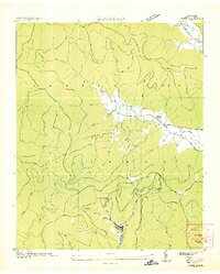 1936 Orme1936 Print · USGSThe Cumberland Plateau mining economy and valley settlements are preserved in this mid-1930s survey of Marion County. Genealogists and industrial historians can trace the rail lines at Orme, the Battle Creek Mines, and community sites like Sweden Cove Sch.
 - 1936 Map of Doran Cove
 1936 Doran Cove1936 Print · USGSJackson County and the Tennessee River are captured here in the mid-1930s as the Tennessee Valley Authority planned the region's modernization. Researchers can locate family landmarks like the Rosenwald Sch, Widows Bar Lock and Dam, and Bonaventure Cem.
 - 1947 Map of Orme, 1974 Print
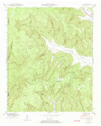 1947 Orme1974 Print · USGSMarion County's mountain coves and the settlement of Orme are documented here in the late 1940s. Researchers can trace rural life through the Sweden Cove School, family plots like Beene Cem, and the path of the original Dixie Highway.4 unique versions available
 - 1950 Map of Orme
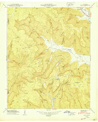 1950 Orme1950 Print · USGSMarion County at mid-century reveals a landscape of isolated coves and high plateau settlements tucked into the Cumberland Mountains. Genealogists and hikers can trace old family sites like the Thomas Cem or locate the remote Orme Mountain School and Lous Chapel.
 - 1950 Map of Doran Cove
 1950 Doran Cove1950 Print · USGSJackson County, Alabama, is shown here as the post-war industrial era arrives along the Tennessee River. Researchers can trace family sites at Hackworth Cem, visit Coopers Mill, or locate the Widows Creek Steam Plant during its construction.2 unique versions available
 - 1953 Map of Chattanooga
 1953 Chattanooga1953 Print · USGSSoutheast Tennessee in the early fifties shows a landscape reshaped by river management and rail power. Trace the rail lines of the Southern Ry through riverside towns or locate the preserved grounds of the Chickamauga and Chattanooga National Military Park.
 - 1955 Map of Rome
 1955 Rome1955 Print · USGSThe tri-state borderlands of Georgia, Alabama, and Tennessee appear in the mid-fifties as a landscape of ridge-and-valley industry and river navigation. Genealogists can trace family footprints near Chattanooga, the iron works of Gadsden, and textile towns like Trion or Summerville.
 - 1957 Map of Chattanooga, 1966 Print
 1957 Chattanooga1966 Print · USGSEast Tennessee in the mid-1960s shows a landscape of massive hydroelectric reservoirs and emerging industrial sites like the Atomic Energy Commission (Oak Ridge Area). Trace the rail networks of the Southern Ry through Chattanooga or locate family-named ridges across the Cumberland Plateau.3 unique versions available
 - 1958 Map of Rome, 1966 Print
 1958 Rome1966 Print · USGSNorthwest Georgia and neighboring Tennessee and Alabama are captured here in the late fifties, showcasing a landscape of high ridges and river valleys. Researchers can trace historic rail lines like the Seaboard Air Line RR and explore the bounds of Cloudland Canyon State Park or Fort Oglethorpe.3 unique versions available
 - 1959 Map of Chattanooga
 1959 Chattanooga1959 Print · USGSSoutheast Tennessee is shown here during a decade of industrial growth and hydroelectric development. Trace the regional rail networks of the Southern Ry and find landmark sites like Lookout Mountain, Fall Creek Falls State Park, and Chattanooga.
 - 1960 Map of Chattanooga
 1960 Chattanooga1960 Print · USGSSoutheast Tennessee and the southern Appalachians are shown here at the height of the river-management era. You can trace the valley rail lines and locate Lookout Mountain and the expansive waters of Chickamauga Reservoir.
 - 1961 Map of Rome
 1961 Rome1961 Print · USGSNorthwest Georgia and neighboring Tennessee and Alabama are shown here at a moment of significant mid-century growth. Researchers can trace the rail networks of the Central of Georgia or locate landmarks within Chickamauga and Chattanooga Nat Military Park.
 - 1963 Map of Rome
 1963 Rome1963 Print · USGSThe tri-state corner of Georgia, Alabama, and Tennessee is captured here during a period of massive reservoir expansion and post-war growth. Genealogists and historians can trace the rail corridors of the Southern Ry or locate landmarks like Fort Oglethorpe and Cloudland Canyon State Park.
 - 1964 Map of Chattanooga
 1964 Chattanooga1964 Print · USGSSoutheast Tennessee and the western Carolinas appear in the mid-sixties as a powerhouse of river-driven industry and mountain wilderness. Genealogists and historians can trace rail-town lineages along the Southern Ry or locate family landmarks near Watts Bar Lake and Tellico Plains.
 - 1967 Map of Doran Cove, 1972 Print
 1967 Doran Cove1972 Print · USGSThe Alabama-Tennessee borderlands appear here in the late sixties, where the Cumberland Plateau gives way to river-valley industry. Genealogists can trace family ties at Hackworth Cem, Walker Cem, and the historic Russell Cave National Monument.4 unique versions available
 - 1979 Map of Chattanooga, 1980 Print
 1979 Chattanooga1980 Print · USGSSoutheast Tennessee in the late seventies reveals a landscape shaped by massive TVA river projects and the industrial strength of the Cumberland Plateau. Genealogists and historians can trace the rail-to-river network through L & N RR junctions, the University of the South, and the Volunteer Army Ammunition Plant.
 - 1981 Map of Chickamauga, 1982 Print
 1981 Chickamauga1982 Print · USGSThe tri-state border region of Georgia, Alabama, and Tennessee comes into focus during the early eighties, defined by the towering ridges of the Appalachians. Historians can trace the preserved grounds of Chickamauga and Chattanooga National Military Park and old rail stops like Rising Fawn or Sulphur Springs.2 unique versions available
 - 1988 Map of Chattanooga, 1991 Print
 1988 Chattanooga1991 Print · USGSSoutheast Tennessee at the end of the 1980s reveals a complex landscape of deep river valleys and high coal-rich plateaus. Researchers can trace the legacy of the L & N RR through Tracy City or locate the sprawling Strip Mines near Whitwell.
 - 2010 Map of Orme, 2010 Print
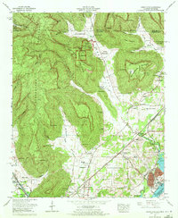
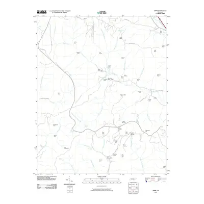 2010 Orme2010 Print · USGSCovers Orme, including The Crossroads, Franklin County, and other nearby areas
 - 2010 Map of Doran Cove, 2010 Print
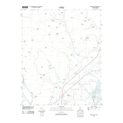 2010 Doran Cove2010 Print · USGSCovers Orme, including Bridgeport, Stevenson, and other nearby areas
 - 2011 Map of Doran Cove, 2011 Print
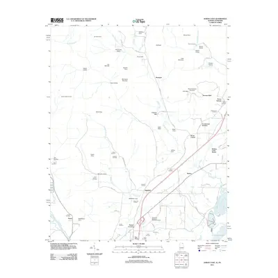 2011 Doran Cove2011 Print · USGSCovers Orme, including Bridgeport, Stevenson, and other nearby areas
Showing maps 1-25 of 33
Top cities near Orme
- South Pittsburg historical maps
- Jasper historical maps
- Sewanee historical maps
- Bridgeport historical maps
- Decherd historical maps
- Stevenson historical maps
See more
Frequently asked questions
- What are the different types of historical maps available for Orme?
- What is the oldest map of Orme?
- Where can I purchase historical maps of Orme for my home or office?
- Where can I download high-res historical maps of Orme?
- Are there historical topographic maps available for Orme?
- Is there historical aerial imagery available for Orme?
- Where are historical maps of Orme sourced from?