Old Maps of Jasper, Tennessee
Explore 25 old maps of Jasper, spanning from 1895 to today. These high-resolution historic maps reveal how streets, neighborhoods, landmarks, and natural features evolved over time — perfect for genealogy, metal detecting, research, and local history exploration.
What you can do with these maps:
- See how Jasper changed over time: Compare historical maps to modern-day views to trace roads, homesites, rail lines & more.
- View detailed metadata: Each map includes creators, publishers, year, scale, and archive source.
- Overlay maps with satellite & LiDAR: Visualize the past alongside modern tools to explore terrain & human change.
- Trusted historical sources: Maps sourced from the USGS, Library of Congress, and other archives.
- Access maps your way: View online, download high-res files, or order prints for personal or research use.
Start exploring old maps of Jasper to uncover forgotten places, hidden landmarks, and the deep history beneath your feet.
Jasper, TN maps
(25)- 1895 Map of Sewanee
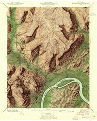
 1895 Sewanee1895 Print · USGSThe Cumberland Plateau and Sequatchie Valley come alive in the late nineteenth century, showing a landscape shaped by coal, iron, and the rails. Genealogists and historians can trace family-named coves and industrial sites like the Cowan Tunnel, Beersheba Springs, and the Stone Quarry.6 unique versions available
 - 1936 Map of Sequatchie
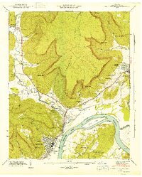
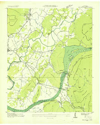 1936 Sequatchie1936 Print · USGSMarion County is captured during its mid-1930s transformation as the TVA restructured the Tennessee River for hydroelectric power. Researchers can locate vanished landmarks like Rankin Ferry and the Marion County Home, or trace family roots at Old Union Cem and Wesley Chapel.
 - 1936 Map of South Pittsburg
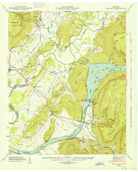
 1936 South Pittsburg1936 Print · USGSMarion County is seen here during a pivotal era of transformation as the Tennessee Valley Authority prepared for new reservoirs. Genealogists and historians can trace family-named sites like Gilliam Cem or Raulstontown, alongside the river-based commerce of the South Pittsburg Ferry.
 - 1942 Map of Sequatchie
 1942 Sequatchie1942 Print · USGSMarion County during the early 1940s reveals a landscape defined by the Tennessee River and the rising Sequatchie Valley. Genealogists can locate family landmarks like Old Union Cem and Wesley Chapel or trace the old Rankin Ferry near Hales Bar Lake.2 unique versions available
 - 1942 Map of South Pittsburg, 1955 Print
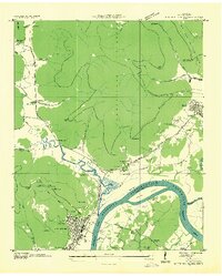
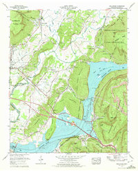
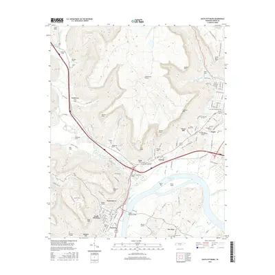
 1942 South Pittsburg1955 Print · USGSMarion County's river and mountain landscape comes alive in the 1940s as the Tennessee Valley Authority examines the region's development. Trace family roots at Raulston Cem, visit Jasper, or follow the St Louis and Chattanooga rail line through South Pittsburg.6 unique versions available
 - 1943 Map of South Pittsburg, 1946 Print
 1943 South Pittsburg1946 Print · USGSMarion County enters the mid-century as a vital river and rail corridor where the Cumberland Plateau meets the Tennessee River. Genealogists can trace family names at Raulston Cem, Chaudoin Cem, and rural schools like the Battle Creek Institute.2 unique versions available
 - 1943 Map of Sequatchie, 1946 Print
 1943 Sequatchie1946 Print · USGSThe Tennessee River valley in the early 1940s reveals a landscape being transformed by industrial power and major reservoir projects. Genealogists and historians can trace family locations through Old Union Cem, Killian Sch, and the Marion County Home.
 - 1953 Map of Chattanooga
 1953 Chattanooga1953 Print · USGSSoutheast Tennessee in the early fifties shows a landscape reshaped by river management and rail power. Trace the rail lines of the Southern Ry through riverside towns or locate the preserved grounds of the Chickamauga and Chattanooga National Military Park.
 - 1957 Map of Chattanooga, 1966 Print
 1957 Chattanooga1966 Print · USGSEast Tennessee in the mid-1960s shows a landscape of massive hydroelectric reservoirs and emerging industrial sites like the Atomic Energy Commission (Oak Ridge Area). Trace the rail networks of the Southern Ry through Chattanooga or locate family-named ridges across the Cumberland Plateau.3 unique versions available
 - 1959 Map of Chattanooga
 1959 Chattanooga1959 Print · USGSSoutheast Tennessee is shown here during a decade of industrial growth and hydroelectric development. Trace the regional rail networks of the Southern Ry and find landmark sites like Lookout Mountain, Fall Creek Falls State Park, and Chattanooga.
 - 1960 Map of Chattanooga
 1960 Chattanooga1960 Print · USGSSoutheast Tennessee and the southern Appalachians are shown here at the height of the river-management era. You can trace the valley rail lines and locate Lookout Mountain and the expansive waters of Chickamauga Reservoir.
 - 1964 Map of Chattanooga
 1964 Chattanooga1964 Print · USGSSoutheast Tennessee and the western Carolinas appear in the mid-sixties as a powerhouse of river-driven industry and mountain wilderness. Genealogists and historians can trace rail-town lineages along the Southern Ry or locate family landmarks near Watts Bar Lake and Tellico Plains.
 - 1970 Map of Sequatchie, 1972 Print
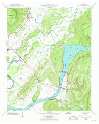
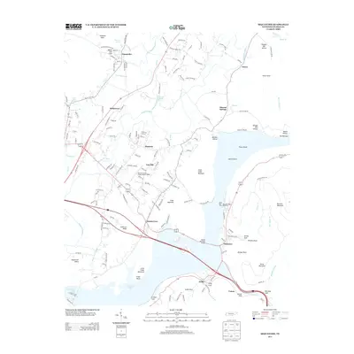
 1970 Sequatchie1972 Print · USGSThe Tennessee River valley south of Jasper is captured here in the early seventies, showing a landscape defined by major TVA reservoirs. Genealogists and researchers can locate family landmarks like Old Union Grove Cem or trace the site of the Hales Bar Dam.2 unique versions available
 - 1979 Map of Chattanooga, 1980 Print
 1979 Chattanooga1980 Print · USGSSoutheast Tennessee in the late seventies reveals a landscape shaped by massive TVA river projects and the industrial strength of the Cumberland Plateau. Genealogists and historians can trace the rail-to-river network through L & N RR junctions, the University of the South, and the Volunteer Army Ammunition Plant.
 - 1988 Map of Chattanooga, 1991 Print
 1988 Chattanooga1991 Print · USGSSoutheast Tennessee at the end of the 1980s reveals a complex landscape of deep river valleys and high coal-rich plateaus. Researchers can trace the legacy of the L & N RR through Tracy City or locate the sprawling Strip Mines near Whitwell.
 - 2010 Map of South Pittsburg, 2010 Print
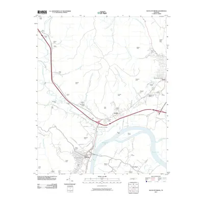 2010 South Pittsburg2010 Print · USGSCovers Jasper, including South Pittsburg, Kimball, and other nearby areas
 - 2010 Map of Sequatchie, 2010 Print
 2010 Sequatchie2010 Print · USGSCovers Jasper, including New Hope, Inman, and other nearby areas
 - 2013 Map of South Pittsburg, 2013 Print
 2013 South Pittsburg2013 Print · USGSCovers Jasper, including South Pittsburg, Kimball, and other nearby areas
 - 2013 Map of Sequatchie, 2013 Print
 2013 Sequatchie2013 Print · USGSCovers Jasper, including New Hope, Inman, and other nearby areas
 - 2016 Map of South Pittsburg, 2016 Print
 2016 South Pittsburg2016 Print · USGSCovers Jasper, including South Pittsburg, Kimball, and other nearby areas
 - 2016 Map of Sequatchie, 2016 Print
 2016 Sequatchie2016 Print · USGSCovers Jasper, including New Hope, Inman, and other nearby areas
 - 2019 Map of South Pittsburg, 2019 Print
 2019 South Pittsburg2019 Print · USGSCovers Jasper, including South Pittsburg, Kimball, and other nearby areas
 - 2019 Map of Sequatchie, 2019 Print
 2019 Sequatchie2019 Print · USGSCovers Jasper, including New Hope, Inman, and other nearby areas
 - 2022 Map of Sequatchie, 2022 Print
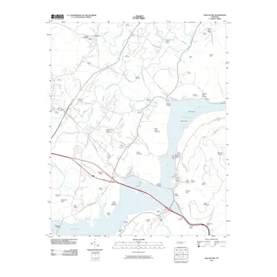
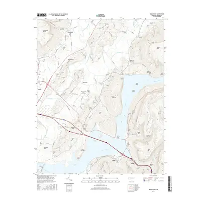
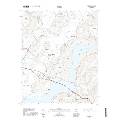
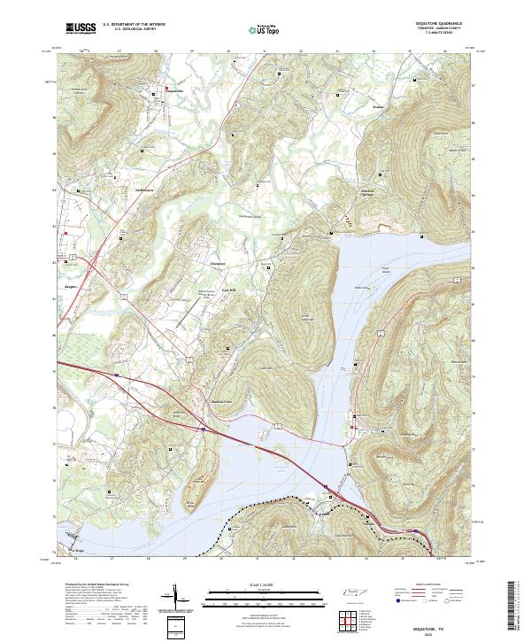 2022 Sequatchie2022 Print · USGSMarion County in the early twenty-first century reveals a landscape where the Sequatchie River meets the waters of Nickajack Lake. Genealogists and local historians can locate legacy sites like Ladds Cem, Nickletown, and the former industrial corridor of CSX Transportation.
 - 2022 Map of South Pittsburg, 2022 Print
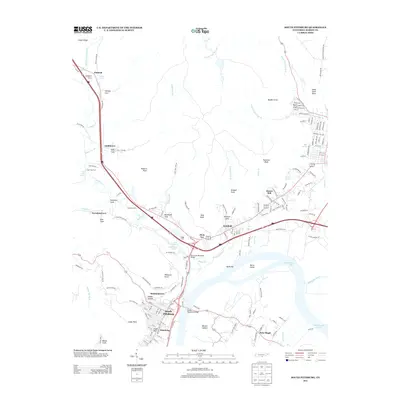
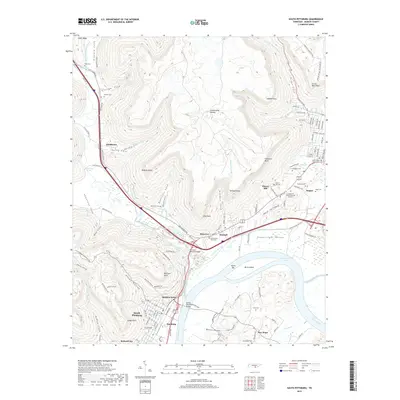
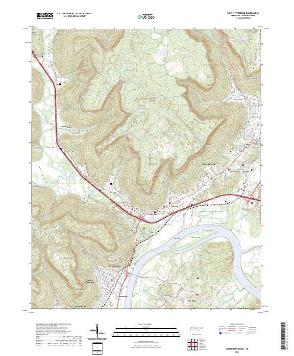 2022 South Pittsburg2022 Print · USGSMarion County at the start of the 2020s shows a landscape where river industry and mountain coves meet. Genealogists and researchers can trace family lines through communities like Raulstontown, New Hope, and the street grids of South Pittsburg.
End of results
Showing maps 1-25 of 25
Top cities near Jasper
- Chattanooga historical maps
- South Pittsburg historical maps
- Bridgeport historical maps
- Trenton historical maps
- Stevenson historical maps
- Tracy City historical maps
See more
Top neighborhoods of Jasper
Frequently asked questions
- What are the different types of historical maps available for Jasper?
- What is the oldest map of Jasper?
- Where can I purchase historical maps of Jasper for my home or office?
- Where can I download high-res historical maps of Jasper?
- Are there historical topographic maps available for Jasper?
- Is there historical aerial imagery available for Jasper?
- Where are historical maps of Jasper sourced from?