2020s Maps of Jasper, Tennessee
Explore 2 historic maps of Jasper from the 2020s. These maps offer a rare glimpse into what life looked like during the 2020s — showing old roads, neighborhoods, homes, and landmarks that have changed or disappeared over time.
Whether you're researching your family's past, planning a metal detecting trip, or studying how Jasper's landscape evolved across the 2020s, these high-resolution maps are a powerful tool for exploring the history of this region.
- Focus on a specific era: All maps on this page are from the 2020s, giving you a focused view of this time period.
- See what’s changed: Compare century-old streets, trails, and buildings to today's modern landscape using overlays and satellite layers.
- Research with precision: Use these maps for genealogy, historical research, land use analysis, or educational projects.
- View, download, or print: Maps are fully viewable online in high resolution, and can be downloaded or printed for your own records.
Start exploring Jasper's history through authentic maps from the 2020s. This is your window into the past.
Jasper, TN maps
(2)- 2022 Map of Sequatchie, 2022 Print
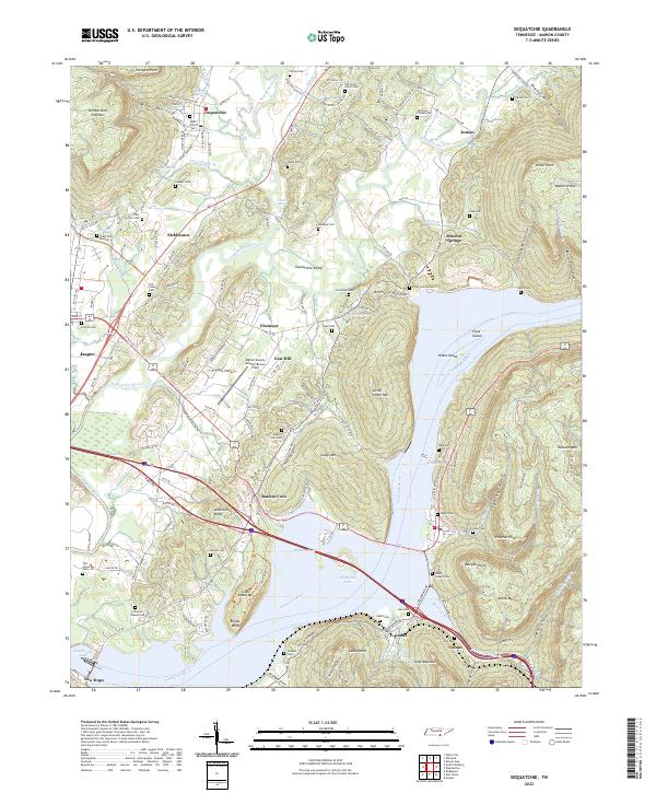 2022 Sequatchie2022 Print · USGSMarion County in the early twenty-first century reveals a landscape where the Sequatchie River meets the waters of Nickajack Lake. Genealogists and local historians can locate legacy sites like Ladds Cem, Nickletown, and the former industrial corridor of CSX Transportation.
 - 2022 Map of South Pittsburg, 2022 Print
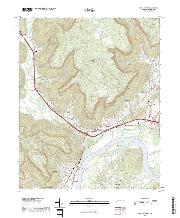 2022 South Pittsburg2022 Print · USGSMarion County at the start of the 2020s shows a landscape where river industry and mountain coves meet. Genealogists and researchers can trace family lines through communities like Raulstontown, New Hope, and the street grids of South Pittsburg.
End of results
Showing maps 1-2 of 2
Top cities near Jasper
- Chattanooga historical maps
- South Pittsburg historical maps
- Bridgeport historical maps
- Trenton historical maps
- Stevenson historical maps
- Tracy City historical maps
See more
Top neighborhoods of Jasper
Frequently asked questions
- What are the different types of historical maps available for Jasper?
- What is the oldest map of Jasper?
- Where can I purchase historical maps of Jasper for my home or office?
- Where can I download high-res historical maps of Jasper?
- Are there historical topographic maps available for Jasper?
- Is there historical aerial imagery available for Jasper?
- Where are historical maps of Jasper sourced from?