1930s Maps of Cornersville, Tennessee
Explore 3 historic maps of Cornersville from the 1930s. These maps offer a rare glimpse into what life looked like during the 1930s — showing old roads, neighborhoods, homes, and landmarks that have changed or disappeared over time.
Whether you're researching your family's past, planning a metal detecting trip, or studying how Cornersville's landscape evolved across the 1930s, these high-resolution maps are a powerful tool for exploring the history of this region.
- Focus on a specific era: All maps on this page are from the 1930s, giving you a focused view of this time period.
- See what’s changed: Compare century-old streets, trails, and buildings to today's modern landscape using overlays and satellite layers.
- Research with precision: Use these maps for genealogy, historical research, land use analysis, or educational projects.
- View, download, or print: Maps are fully viewable online in high resolution, and can be downloaded or printed for your own records.
Start exploring Cornersville's history through authentic maps from the 1930s. This is your window into the past.
Cornersville, TN maps
(3)- 1936 Map of Cornersville
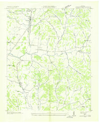 1936 Cornersville1936 Print · USGSMarshall County's rural landscape is captured here in the mid-1930s as modern power lines and highways began to intersect with long-established farming communities. Genealogists and local historians can trace the locations of the Gnat Grove Sch, Richland Ch, and small settlements like Graball and Diana.
 - 1936 Map of Lewisburg
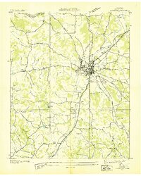 1936 Lewisburg1936 Print · USGSLewisburg was a thriving rail and agricultural hub in the mid-1930s at the intersection of two major rail lines. Researchers can trace family roots at Lone Oak Cem and Gils Chapel or locate the U S Dept of Agriculture Experimental Dairy Farm.
 - 1936 Map of Brick Church
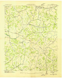 1936 Brick Church1936 Print · USGSGiles and Marshall Counties come into focus during the mid-1930s, showing a rural landscape organized around creek valleys and small community hubs. Researchers can locate family landmarks like the Odd Fellows Hall or trace school locations such as Woodlawn Sch and Fairview Sch.
End of results
Showing maps 1-3 of 3
Top cities near Cornersville
- Columbia historical maps
- Lewisburg historical maps
- Pulaski historical maps
- Petersburg historical maps
- Lynnville historical maps
Top neighborhoods of Cornersville
Frequently asked questions
- What are the different types of historical maps available for Cornersville?
- What is the oldest map of Cornersville?
- Where can I purchase historical maps of Cornersville for my home or office?
- Where can I download high-res historical maps of Cornersville?
- Are there historical topographic maps available for Cornersville?
- Is there historical aerial imagery available for Cornersville?
- Where are historical maps of Cornersville sourced from?