Old Maps of Lasea, Tennessee for Academic Research
Study the evolution of Lasea with 10 high-resolution historic maps. Whether you're teaching, researching, or modeling changes in land use, these maps provide essential visual documentation of urban, environmental, and geographic change.
- Analyze long-term change: Track patterns in development, transportation, and natural features.
- Ideal for environmental or urban studies: Support academic projects with primary historical map data.
- Use in the classroom or lab: Educators and researchers rely on these maps to bring historical context to life.
These maps are a powerful tool for teaching, research, and visualizing how Lasea has changed over the decades.
Lasea, TN maps
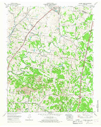
(10)- 1936 Map of Carters Creek
 1936 Carters Creek1936 Print · USGSThe northern reaches of Maury County are captured in the mid-1930s as the rural economy centered around the Rutherford Creek basin. Genealogists can locate family landmarks like Buford Cem, Smith Chapel, and the historic Greens Mill.
 - 1941 Map of Carters Creek
 1941 Carters Creek1941 Print · USGSCentral Tennessee at the start of the 1940s reveals a landscape of rural schoolhouses and family cemeteries along the Andrew Jackson Highway. Trace early mineral industry at the Phosphate Mine or locate ancestral sites like Old Brick Ch and Buford Cem.2 unique versions available
 - 1956 Map of Columbia, 1960 Print
 1956 Columbia1960 Print · USGSMiddle Tennessee in the mid-fifties presents a landscape of established river towns and critical rail hubs before the arrival of the modern interstate system. Researchers can trace the routes of the Louisville and Nashville railroad or locate historic landmarks like Stones River National Military Park and the Tennessee National Wildlife Refuge.6 unique versions available
 - 1965 Map of Carters Creek, 1967 Print
 1965 Carters Creek1967 Print · USGSMaury and Williamson Counties are shown here during the mid-1960s, a period defined by established agricultural research and active mining operations. Researchers can trace family history at Meadow Lawn Memorial Garden or locate the Tennessee Orphans Home and Lanton Church.2 unique versions available
 - 1985 Map of Murfreesboro, 1986 Print
 1985 Murfreesboro1986 Print · USGSMiddle Tennessee in the mid-1980s shows a landscape of growing towns and deep-rooted rural outposts. Local researchers can trace old family lines near Bell Buckle, locate landmarks like Donnel Chapel, or explore the grounds of Henry Horton State Park and Hoovers Gap.
 - 2010 Map of Carters Creek, 2010 Print
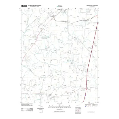 2010 Carters Creek2010 Print · USGSCovers Lasea, including Columbia, Spring Hill, and other nearby areas
 - 2013 Map of Carters Creek, 2013 Print
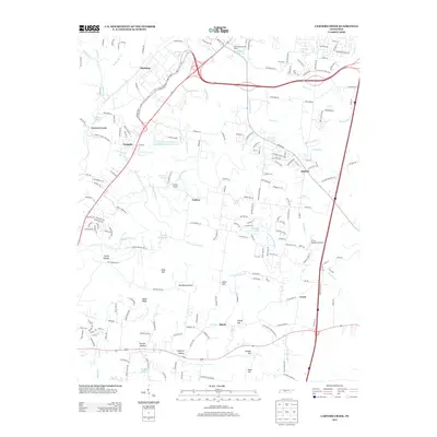 2013 Carters Creek2013 Print · USGSCovers Lasea, including Columbia, Spring Hill, and other nearby areas
 - 2016 Map of Carters Creek, 2016 Print
 2016 Carters Creek2016 Print · USGSCovers Lasea, including Columbia, Spring Hill, and other nearby areas
 - 2019 Map of Carters Creek, 2019 Print
 2019 Carters Creek2019 Print · USGSCovers Lasea, including Columbia, Spring Hill, and other nearby areas
 - 2022 Map of Carters Creek, 2022 Print
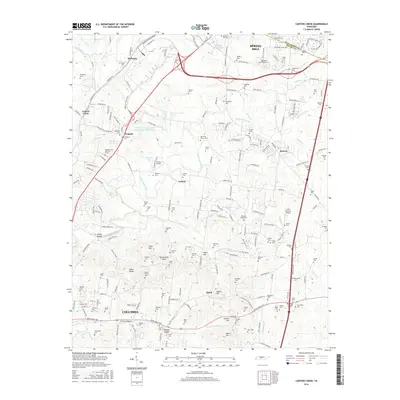
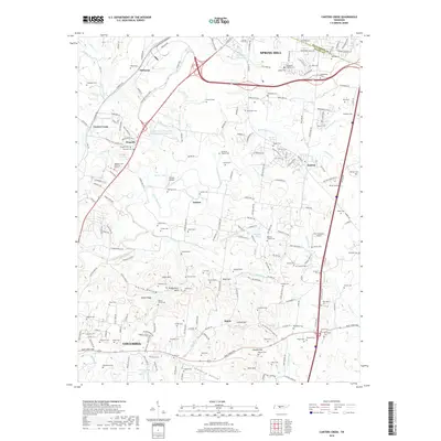
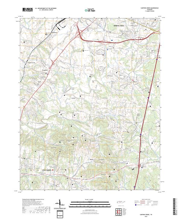 2022 Carters Creek2022 Print · USGSThe northern edge of Maury County comes into focus in this contemporary survey of the lands between Spring Hill and COLUMBIA. Genealogists can trace family names across Old Brick Church Cem, Aiken Ridge, and the University of Tennessee Experimental Farm Lake.
End of results
Showing maps 1-10 of 10
Top cities near Lasea
- Franklin historical maps
- Columbia historical maps
- Spring Hill historical maps
- Lewisburg historical maps
- Thompson's Station historical maps
- Chapel Hill historical maps
See more
Frequently asked questions
- What are the different types of historical maps available for Lasea?
- What is the oldest map of Lasea?
- Where can I purchase historical maps of Lasea for my home or office?
- Where can I download high-res historical maps of Lasea?
- Are there historical topographic maps available for Lasea?
- Is there historical aerial imagery available for Lasea?
- Where are historical maps of Lasea sourced from?