1950s Maps of Ramer, Tennessee
Explore 4 historic maps of Ramer from the 1950s. These maps offer a rare glimpse into what life looked like during the 1950s — showing old roads, neighborhoods, homes, and landmarks that have changed or disappeared over time.
Whether you're researching your family's past, planning a metal detecting trip, or studying how Ramer's landscape evolved across the 1950s, these high-resolution maps are a powerful tool for exploring the history of this region.
- Focus on a specific era: All maps on this page are from the 1950s, giving you a focused view of this time period.
- See what’s changed: Compare century-old streets, trails, and buildings to today's modern landscape using overlays and satellite layers.
- Research with precision: Use these maps for genealogy, historical research, land use analysis, or educational projects.
- View, download, or print: Maps are fully viewable online in high resolution, and can be downloaded or printed for your own records.
Start exploring Ramer's history through authentic maps from the 1950s. This is your window into the past.
Ramer, TN maps
(4)- 1951 Map of Chewalla, 1952 Print
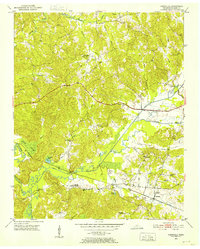 1951 Chewalla1952 Print · USGSThe rural Tennessee-Mississippi borderlands come into focus in the early fifties, showing a landscape of small schools, country churches, and river bottomlands. Genealogists can trace family roots at Otterville, Butlers Chapel, and landmarks like Kings Mountain.5 unique versions available
 - 1951 Map of Guys, 1952 Print
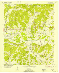 1951 Guys1952 Print · USGSMcNairy County at the start of the 1950s shows a rural landscape defined by the Gulf Mobile and Ohio railroad and small farming hubs. Researchers can trace historic schools and churches like Rosenwald Sch, Bemis Ch, and St Rest Ch (Cem).3 unique versions available
 - 1956 Map of Blytheville, 1964 Print
 1956 Blytheville1964 Print · USGSWest Tennessee and the Arkansas Delta come alive in this mid-century survey of the river-and-rail corridor connecting Memphis to Jackson. Genealogists and historians can trace the rail lines of the Louisville and Nashville RR and locate landmarks like Western State Hospital or Fort Pillow State Prison Farm.2 unique versions available
 - 1959 Map of Blytheville
 1959 Blytheville1959 Print · USGSWest Tennessee and Northeast Arkansas meet along the river in the late fifties, during a period of steady industrial and agricultural growth. Genealogists can trace the rail corridors of the Illinois Central through Jackson or explore landmarks like Shiloh National Military Park and Fort Pillow State Prison.
End of results
Showing maps 1-4 of 4
Top cities near Ramer
- Corinth historical maps
- Selmer historical maps
- Adamsville historical maps
- Farmington historical maps
- Bethel Springs historical maps
- Michie historical maps
See more
Frequently asked questions
- What are the different types of historical maps available for Ramer?
- What is the oldest map of Ramer?
- Where can I purchase historical maps of Ramer for my home or office?
- Where can I download high-res historical maps of Ramer?
- Are there historical topographic maps available for Ramer?
- Is there historical aerial imagery available for Ramer?
- Where are historical maps of Ramer sourced from?