Old Maps of Big Spring, Tennessee for Genealogy
Trace your family roots with 19 historic maps of Big Spring. These high-res maps reveal old neighborhoods, homesites, landmarks, and streets — helping you uncover where your ancestors lived and how the area evolved over time.
- Explore historic neighborhoods: Identify where your relatives may have lived in the 1800s or 1900s.
- Compare maps over time: Trace the changes in streets, buildings, and landmarks for multi-generational research.
- Perfect for genealogy & ancestry research: Used by family historians and researchers to map out lineage and migration.
These maps are an incredible resource for exploring your personal connection to Big Spring's past.
Big Spring, TN maps
(19)- 1886 Map of Cleveland
 1886 Cleveland1886 Print · USGSSoutheast Tennessee in the mid-1880s was a landscape defined by the iron rails and winding rivers that fueled the region's growth. You can trace early river crossings like Savannah Ford and Kincannons Ferry or locate old community centers like Chestua Mills.
 - 1892 Map of Cleveland
 1892 Cleveland1892 Print · USGSSoutheast Tennessee is captured in the late nineteenth century as a landscape of river ferries and emerging rail junctions. Genealogists and historians can locate early settlements like Charleston and Riceville or trace the original river crossings at Kincannons Ferry and Helderbrand Ford.
 - 1895 Map of Cleveland
 1895 Cleveland1895 Print · USGSSoutheast Tennessee thrived along the Hiwassee River and its rail corridors during the 1890s. Genealogists and historians can trace defunct river crossings like Bunker Hill Ferry and milling sites including Chestuee Mills and Longs Mills.
 - 1901 Map of Cleveland
 1901 Cleveland1901 Print · USGSSoutheast Tennessee was a thriving hub of river and rail commerce at the dawn of the twentieth century. Genealogists can trace family homesteads near vanished landmarks like Marble Switch, Bunker Hill Ferry, or the early settlements of Riceville and Benton.4 unique versions available
 - 1935 Map of Big Spring
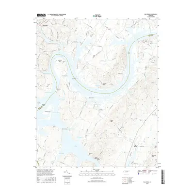
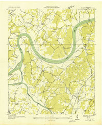 1935 Big Spring1935 Print · USGSThe Tennessee and Hiwassee rivers define the landscape in the mid-thirties, when ferries were the primary links between Meigs and Rhea counties. Genealogists can trace family roots through labels for Big Spring, Salem Ch, and the Garrison Cem.
 - 1942 Map of Big Spring
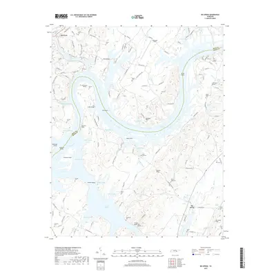
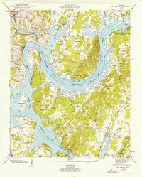 1942 Big Spring1942 Print · USGSThe Tennessee and Hiwassee Rivers meet in the early 1940s, revealing a landscape of reservoir development and deep-rooted farm communities. Genealogists can locate Big Spring and family sites like Shaver Cem, while historians can trace the Cotton Port Ferry.
 - 1943 Map of Big Spring, 1946 Print
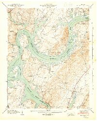 1943 Big Spring1946 Print · USGSThe Tennessee River valley in the early 1940s reveals a landscape reshaped by the newly formed Chickamauga Reservoir. Genealogists and local historians can trace family land near Big Spring, the Cotton Port Ferry, and numerous country churches like Burkett Chapel.2 unique versions available
 - 1953 Map of Chattanooga
 1953 Chattanooga1953 Print · USGSSoutheast Tennessee in the early fifties shows a landscape reshaped by river management and rail power. Trace the rail lines of the Southern Ry through riverside towns or locate the preserved grounds of the Chickamauga and Chattanooga National Military Park.
 - 1957 Map of Chattanooga, 1966 Print
 1957 Chattanooga1966 Print · USGSEast Tennessee in the mid-1960s shows a landscape of massive hydroelectric reservoirs and emerging industrial sites like the Atomic Energy Commission (Oak Ridge Area). Trace the rail networks of the Southern Ry through Chattanooga or locate family-named ridges across the Cumberland Plateau.3 unique versions available
 - 1959 Map of Chattanooga
 1959 Chattanooga1959 Print · USGSSoutheast Tennessee is shown here during a decade of industrial growth and hydroelectric development. Trace the regional rail networks of the Southern Ry and find landmark sites like Lookout Mountain, Fall Creek Falls State Park, and Chattanooga.
 - 1960 Map of Chattanooga
 1960 Chattanooga1960 Print · USGSSoutheast Tennessee and the southern Appalachians are shown here at the height of the river-management era. You can trace the valley rail lines and locate Lookout Mountain and the expansive waters of Chickamauga Reservoir.
 - 1964 Map of Chattanooga
 1964 Chattanooga1964 Print · USGSSoutheast Tennessee and the western Carolinas appear in the mid-sixties as a powerhouse of river-driven industry and mountain wilderness. Genealogists and historians can trace rail-town lineages along the Southern Ry or locate family landmarks near Watts Bar Lake and Tellico Plains.
 - 1967 Map of Big Spring, 1969 Print
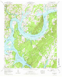 1967 Big Spring1969 Print · USGSThe Tennessee and Hiwassee rivers converge in this mid-century survey of Rhea and Meigs counties, highlighting a landscape of river meanders and conservation areas. Researchers can trace family history at Shaver Cem, locate the William Jennings Bryan University campus, or find the riverside Indian mound.3 unique versions available
 - 1981 Map of Cleveland
 1981 Cleveland1981 Print · USGSSoutheast Tennessee and Western North Carolina are documented here in the early eighties, as the Tennessee Valley Authority managed the region's vast river and forest resources. Researchers can trace the rail lines of the Southern and Louisville and Nashville or locate industrial sites in the Copper Basin and settlements like Ducktown.2 unique versions available
 - 2010 Map of Big Spring, 2010 Print
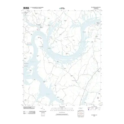 2010 Big Spring2010 Print · USGSCovers Big Spring, including Dayton, Edgewater, and other nearby areas
 - 2013 Map of Big Spring, 2013 Print
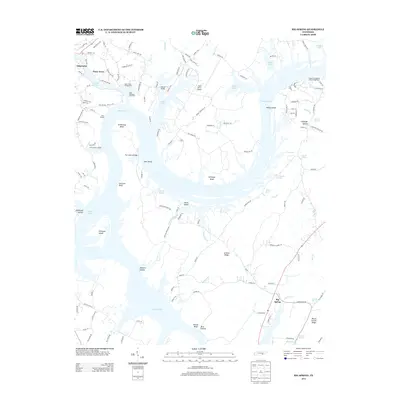 2013 Big Spring2013 Print · USGSCovers Big Spring, including Dayton, Edgewater, and other nearby areas
 - 2016 Map of Big Spring, 2016 Print
 2016 Big Spring2016 Print · USGSCovers Big Spring, including Dayton, Edgewater, and other nearby areas
 - 2019 Map of Big Spring, 2019 Print
 2019 Big Spring2019 Print · USGSCovers Big Spring, including Dayton, Edgewater, and other nearby areas
 - 2022 Map of Big Spring, 2022 Print
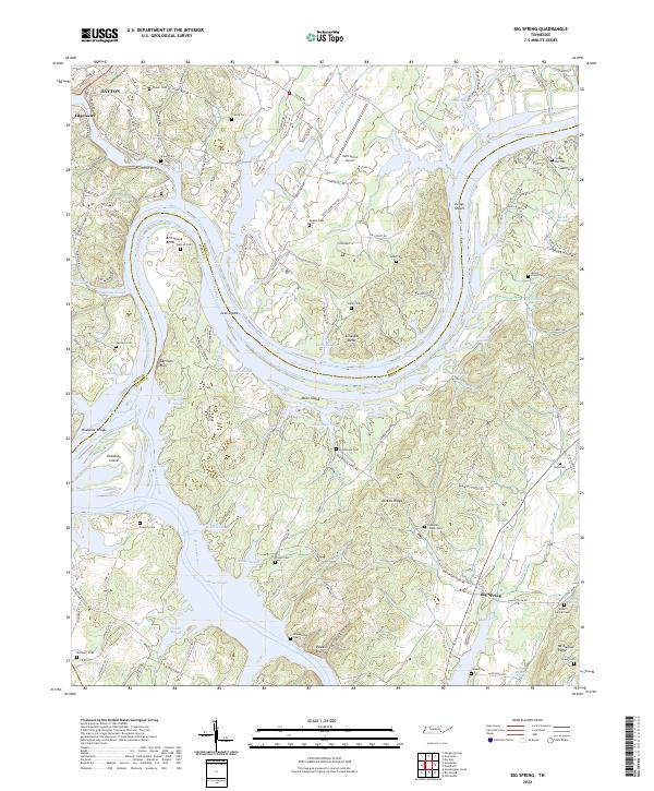 2022 Big Spring2022 Print · USGSThe Tennessee and Hiwassee Rivers converge here in the 2020s, shaping a landscape of river bends, islands, and rural ridges. Genealogists can trace deep local roots through several family cemeteries and country churches like Burketts Chapel Ch and Sullivan Cem.
End of results
Showing maps 1-19 of 19
Top cities near Big Spring
- Chattanooga historical maps
- Cleveland historical maps
- Soddy-Daisy historical maps
- Dayton historical maps
- Lakesite historical maps
- Decatur historical maps
See more
Frequently asked questions
- What are the different types of historical maps available for Big Spring?
- What is the oldest map of Big Spring?
- Where can I purchase historical maps of Big Spring for my home or office?
- Where can I download high-res historical maps of Big Spring?
- Are there historical topographic maps available for Big Spring?
- Is there historical aerial imagery available for Big Spring?
- Where are historical maps of Big Spring sourced from?