1900s (20th Century) Maps of Rafter, Tennessee
Explore 12 historic maps of Rafter from the 1900s (20th Century). These maps offer a rare glimpse into what life looked like during the 1900s — showing old roads, neighborhoods, homes, and landmarks that have changed or disappeared over time.
Whether you're researching your family's past, planning a metal detecting trip, or studying how Rafter's landscape evolved across the 1900s, these high-resolution maps are a powerful tool for exploring the history of this region.
- Focus on a specific era: All maps on this page are from the 1900s, giving you a focused view of this time period.
- See what’s changed: Compare century-old streets, trails, and buildings to today's modern landscape using overlays and satellite layers.
- Research with precision: Use these maps for genealogy, historical research, land use analysis, or educational projects.
- View, download, or print: Maps are fully viewable online in high resolution, and can be downloaded or printed for your own records.
Start exploring Rafter's history through authentic maps from the 1900s. This is your window into the past.
Rafter, TN maps
(12)- 1914 Map of Murphy
 1914 Murphy1914 Print · USGSThe Tennessee-North Carolina borderlands come to life in this early twentieth-century survey, showcasing a landscape of mountain ridges and river-driven commerce. Researchers can trace the Louisville and Nashville Railroad to old stops like Apalachia Sta or locate the historic Prince Ferry and White Cliff Springs.3 unique versions available
 - 1933 Map of Haw Knob
 1933 Haw Knob1933 Print · USGSThe Tennessee-North Carolina borderlands come alive in this early 1930s survey, showing the deep creek valleys and high peaks of the southern mountains. Researchers can find old community hubs like Tallassee Sch, Ballplay Ch, and the remote Hemlock Lookout.2 unique versions available
 - 1933 Map of Rafter
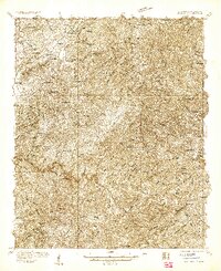
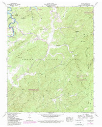
 1933 Rafter1933 Print · USGSMonroe County was a landscape of remote mountain schools and country churches in the early 1930s. Genealogists can trace family footprints near Glenndale Sch, Quaker Ch, and small crossroads like Acorn and Tariffville.
 - 1937 Map of Haw Knob
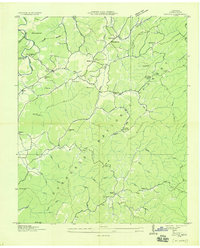
 1937 Haw Knob1937 Print · USGSMonroe County and the borderlands of the Smokies are captured in the mid-1930s as the national forest system expanded across these high ridges. Genealogists and local historians can locate early landmarks like Whigg Cabin, Ballplay Church, and the isolated Waucheesi School.
 - 1953 Map of Chattanooga
 1953 Chattanooga1953 Print · USGSSoutheast Tennessee in the early fifties shows a landscape reshaped by river management and rail power. Trace the rail lines of the Southern Ry through riverside towns or locate the preserved grounds of the Chickamauga and Chattanooga National Military Park.
 - 1957 Map of Rafter, 1959 Print
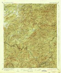
 1957 Rafter1959 Print · USGSMonroe County in the late fifties shows a rural mountain landscape deeply integrated into the state's forest and wildlife management areas. Genealogists and historians can locate remote churches and burial sites like Oak Grove Ch, Farris Chapel Cem, and the community of Tariffville.4 unique versions available
 - 1957 Map of Chattanooga, 1966 Print
 1957 Chattanooga1966 Print · USGSEast Tennessee in the mid-1960s shows a landscape of massive hydroelectric reservoirs and emerging industrial sites like the Atomic Energy Commission (Oak Ridge Area). Trace the rail networks of the Southern Ry through Chattanooga or locate family-named ridges across the Cumberland Plateau.3 unique versions available
 - 1959 Map of Chattanooga
 1959 Chattanooga1959 Print · USGSSoutheast Tennessee is shown here during a decade of industrial growth and hydroelectric development. Trace the regional rail networks of the Southern Ry and find landmark sites like Lookout Mountain, Fall Creek Falls State Park, and Chattanooga.
 - 1960 Map of Chattanooga
 1960 Chattanooga1960 Print · USGSSoutheast Tennessee and the southern Appalachians are shown here at the height of the river-management era. You can trace the valley rail lines and locate Lookout Mountain and the expansive waters of Chickamauga Reservoir.
 - 1964 Map of Chattanooga
 1964 Chattanooga1964 Print · USGSSoutheast Tennessee and the western Carolinas appear in the mid-sixties as a powerhouse of river-driven industry and mountain wilderness. Genealogists and historians can trace rail-town lineages along the Southern Ry or locate family landmarks near Watts Bar Lake and Tellico Plains.
 - 1981 Map of Cleveland
 1981 Cleveland1981 Print · USGSSoutheast Tennessee and Western North Carolina are documented here in the early eighties, as the Tennessee Valley Authority managed the region's vast river and forest resources. Researchers can trace the rail lines of the Southern and Louisville and Nashville or locate industrial sites in the Copper Basin and settlements like Ducktown.2 unique versions available
 - 1984 Map of Rafter, 1989 Print
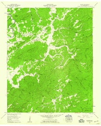
 1984 Rafter1989 Print · USGSMonroe County was undergoing significant changes in the mid-1980s as the Tellico reservoir project altered the local landscape. Researchers can trace family sites like Giles Cem and Farris Chapel, or locate rural centers such as Rafter and Acorn.
End of results
Showing maps 1-12 of 12
Top cities near Rafter
Frequently asked questions
- What are the different types of historical maps available for Rafter?
- What is the oldest map of Rafter?
- Where can I purchase historical maps of Rafter for my home or office?
- Where can I download high-res historical maps of Rafter?
- Are there historical topographic maps available for Rafter?
- Is there historical aerial imagery available for Rafter?
- Where are historical maps of Rafter sourced from?