2020s Maps of Clarksville, Tennessee
Explore 8 historic maps of Clarksville from the 2020s. These maps offer a rare glimpse into what life looked like during the 2020s — showing old roads, neighborhoods, homes, and landmarks that have changed or disappeared over time.
Whether you're researching your family's past, planning a metal detecting trip, or studying how Clarksville's landscape evolved across the 2020s, these high-resolution maps are a powerful tool for exploring the history of this region.
- Focus on a specific era: All maps on this page are from the 2020s, giving you a focused view of this time period.
- See what’s changed: Compare century-old streets, trails, and buildings to today's modern landscape using overlays and satellite layers.
- Research with precision: Use these maps for genealogy, historical research, land use analysis, or educational projects.
- View, download, or print: Maps are fully viewable online in high resolution, and can be downloaded or printed for your own records.
Start exploring Clarksville's history through authentic maps from the 2020s. This is your window into the past.
Clarksville, TN maps
(8)- 2022 Map of New Providence, 2022 Print
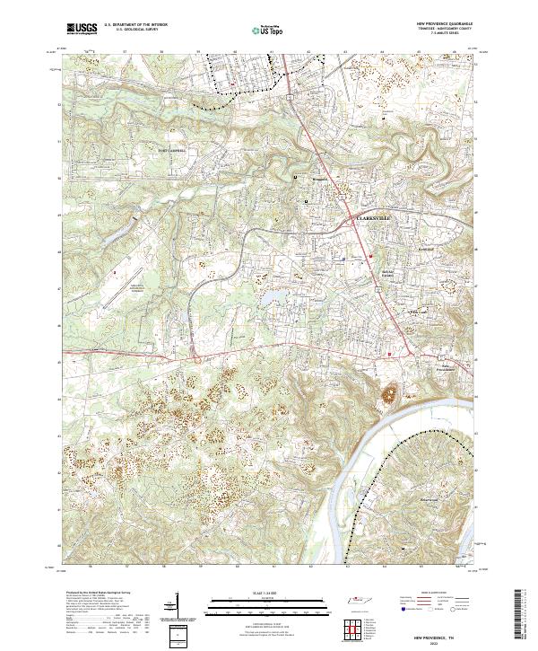 2022 New Providence2022 Print · USGSThe northern edge of Montgomery County is shown here in the early twenty-first century, where military life and college campuses meet the river. Genealogists can trace family sites at Fauntleroy Cem or Alex Yarbrough Cem near the Cumberland River.
 - 2022 Map of Sango, 2022 Print
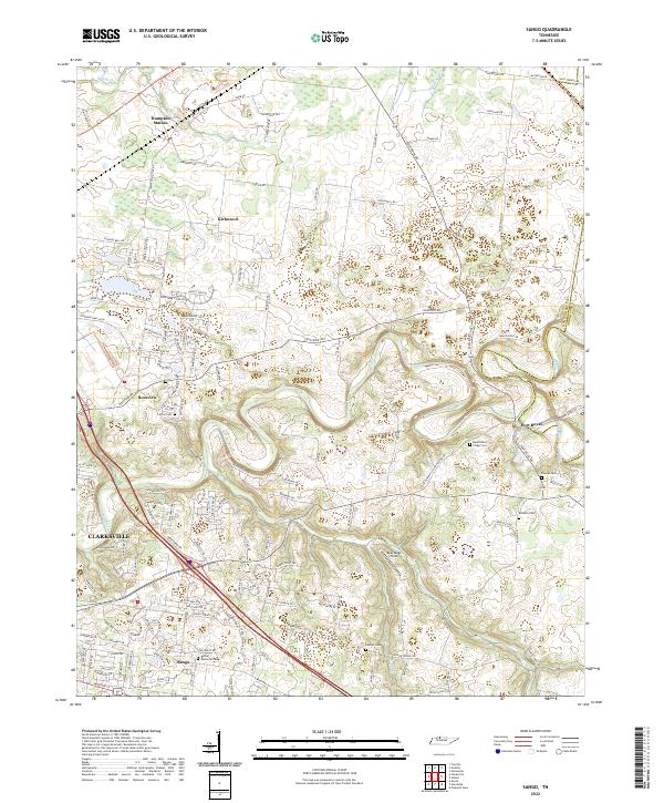 2022 Sango2022 Print · USGSEastern Montgomery County in the early twenty-first century reveals a landscape of historic river settlements and emerging suburban growth. Trace family heritage through numerous rural burial sites like Benevolent Lodge Cem or explore the river confluence at Port Royal.
 - 2022 Map of Excell, 2022 Print
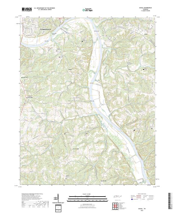 2022 Excell2022 Print · USGSThe Cumberland River valley south of Clarksville comes into sharp focus during the 2020s, showing a landscape defined by historic family landholdings and river navigation. Genealogists can trace deep local roots at Edward Neblett Cem and Brame Cem or explore the quiet crossroads of Liverworth and Salem.
 - 2022 Map of Henrietta, 2022 Print
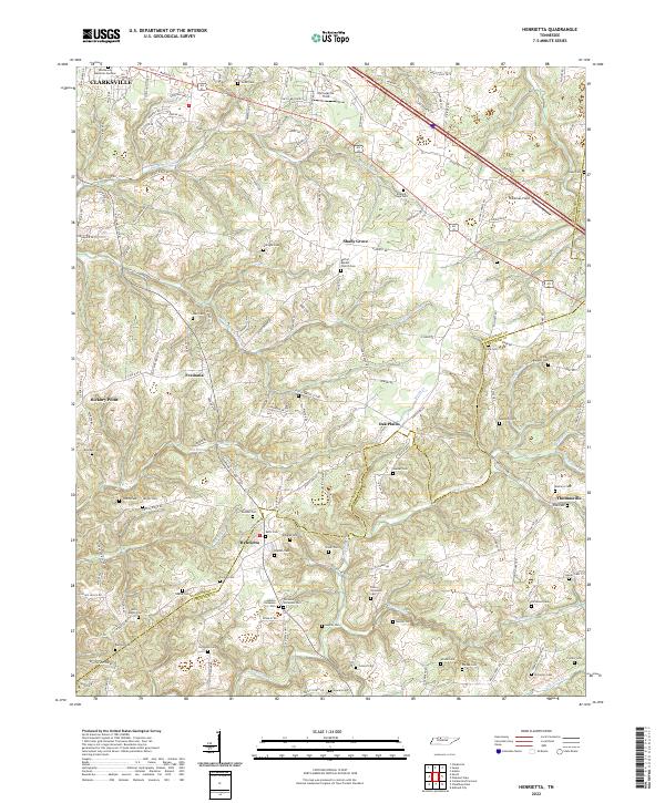 2022 Henrietta2022 Print · USGSThe rural borderlands of Montgomery and Cheatham counties are documented here in the early twenty-first century. Researchers can trace dozens of family burial sites and rural landmarks, from the Bethel Baptist Church to the Hollis Nanny Cem and Blue Spring.
 - 2022 Map of Palmyra, 2022 Print
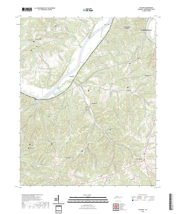 2022 Palmyra2022 Print · USGSSouthwest of Clarksville in the early twenty-first century, this riverine landscape follows the deep bends of the Cumberland. Genealogists can trace family landmarks and burial sites across Dotsonville, Palmyra, and Cunningham, including the Norris Cem and Wall Cem.
 - 2022 Map of Clarksville, 2022 Print
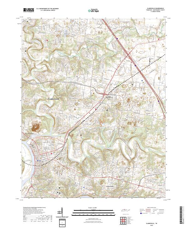 2022 Clarksville2022 Print · USGSThe city of Clarksville and its surrounding communities are shown here at the start of the 2020s as a thriving riverfront hub. Researchers can trace local heritage through sites like the Montgomery County Courthouse, Riverview Cem, and Saint Bethlehem.
 - 2022 Map of Oak Grove, 2022 Print
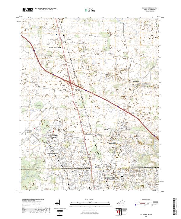 2022 Oak Grove2022 Print · USGSThe border between Kentucky and Tennessee meets at the edge of Fort Campbell in this contemporary look at the region. Researchers can trace military landmarks like Campbell Army Airfield alongside family sites like the Elliott Family Cem and Gee Cem.
 - 2022 Map of Trenton, 2022 Print
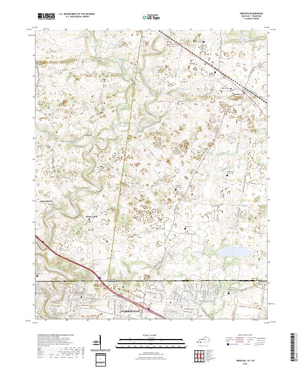 2022 Trenton2022 Print · USGSThe Kentucky and Tennessee borderlands come alive in this detailed look at rural life and crossroads settlements. Genealogists can trace family lines through numerous sites like Edgewood Cem, Barkers Mill, and Mount Zion Missionary Baptist Church.
End of results
Showing maps 1-8 of 8
Top cities near Clarksville
- Hopkinsville historical maps
- Oak Grove historical maps
- Guthrie historical maps
- Pembroke historical maps
- Trenton historical maps
Top neighborhoods of Clarksville
- Green Acres historical maps
- Bethel historical maps
- Pembrook Place historical maps
- Glenstone historical maps
- Greenland Farms historical maps
- Kingsbury historical maps
See more
Frequently asked questions
- What are the different types of historical maps available for Clarksville?
- What is the oldest map of Clarksville?
- Where can I purchase historical maps of Clarksville for my home or office?
- Where can I download high-res historical maps of Clarksville?
- Are there historical topographic maps available for Clarksville?
- Is there historical aerial imagery available for Clarksville?
- Where are historical maps of Clarksville sourced from?