Old Maps of Moore County, Tennessee for Hiking & Exploration
Hike through history with 66 historic maps of Moore County. Explore old trails, ghost towns, and forgotten backroads — perfect for outdoor adventurers and local explorers.
- Rediscover forgotten places: Map out old mining camps, roads, and footpaths that no longer exist on modern maps.
- Layer with modern tools: Combine with LiDAR or satellite views to plan hikes through historical terrain.
- Made for exploration: Popular among hikers, overlanders, and local history lovers.
Use these maps to find adventure and explore the hidden past of Moore County.
Moore County, TN maps
(66)- 1936 Map of Booneville
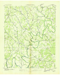
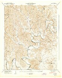
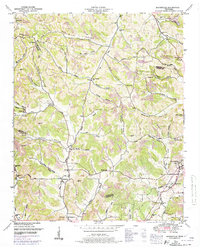
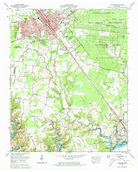
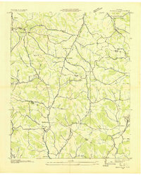 1936 Booneville1936 Print · USGSThe rural borderlands of Moore, Lincoln, and Bedford counties are captured here in the mid-1930s during a period of steady local development. Researchers can pinpoint early community hubs like Screamersville, Charity Sch, and the river crossing at Booneville.
 - 1936 Map of Cumberland Springs
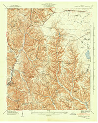
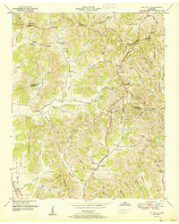
 1936 Cumberland Springs1936 Print · USGSMoore County and Lynchburg are captured in the mid-1930s as a land of narrow hollows and high ridges. Researchers can trace the early layout of Lynchburg and find community centers like Raysville Sch, Smith Chapel, and Cumberland Springs.
 - 1936 Map of Belleville
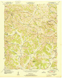
 1936 Belleville1936 Print · USGSLincoln County and the surrounding borderlands are captured here in the mid-1930s, showing a rural landscape organized around deep hollows and creek branches. Researchers can locate numerous local landmarks including Oak Hill Ch, Patton Cem, and the settlement of Belleville.
 - 1936 Map of Huntland
 1936 Huntland1936 Print · USGSFranklin County's rail-and-mill economy is on full display in the mid-thirties as the Nashville Chattanooga and St Louis Ry connects Huntland and Elora. Researchers can trace the heritage of rural communities through sites like Stonewall Mill, Simmons Chapel, and the Mc Clure Cem.
 - 1936 Map of Mulberry
 1936 Mulberry1936 Print · USGSMiddle Tennessee's river valleys come alive in the mid-1930s, showing the early reach of the TVA and the local rail network. Trace the paths to Lockes Mill, Lloyd Chapel, and family sites like Cowley Cem or Smith Cem.
 - 1936 Map of Camp Peay
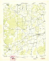
 1936 Camp Peay1936 Print · USGSIn the mid-1930s, the area around Tullahoma and Estill Springs was a hub of military and rail activity. Genealogists and historians can trace the National Guard Reservation at Camp Peay, family burial sites like Maplewood Cem, and local landmarks including the Girls Vocational Sch.
 - 1936 Map of Normandy
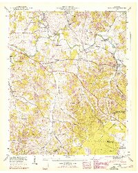
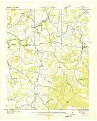 1936 Normandy1936 Print · USGSBedford and Moore counties come to life in the 1930s as the rail-and-river economy centers on the town of Normandy. Genealogists and historians can trace family locations at Bugscuffle, locate Jenkins Sch, or find industrial landmarks like Cortners Mill.
 - 1936 Map of Lois
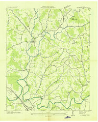
 1936 Lois1936 Print · USGSMoore County at the start of the Tennessee Valley Authority era shows a landscape of river-bend farms and scattered crossroads settlements. Genealogists can locate family-named landmarks such as Gray Cem, Browningtown, and the Liberty Hill Sch along the Elk River.
 - 1941 Map of Cumberland Springs, 1943 Print
 1941 Cumberland Springs1943 Print · USGSMoore County and the Highland Rim are captured in the early 1940s, just as the nearby military expansion began to transform the local landscape. Genealogists can trace family footprints through community sites like Lynchburg, Bakertown, and Hickory Hill Sch.5 unique versions available
 - 1941 Map of Camp Forrest, 1943 Print
 1941 Camp Forrest1943 Print · USGSThe Tennessee mobilization of the early 1940s is on full display as the Camp Forrest Military Reservation rises near Tullahoma. Genealogists and historians can trace family-named sites like Holt Cem and Pylant Springs before the landscape was fully altered by military expansion.2 unique versions available
 - 1943 Map of Mc Minnville, 1944 Print
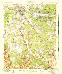
 1943 Mc Minnville1944 Print · USGSMid-Tennessee is captured here during the mobilization of the early 1940s, showing the vast Camp Forrest Military Reservation and thriving rail towns. Trace the N C & ST L line through Mcminnville or locate smaller rural hubs like Morrison and Hickerson Station.
 - 1944 Map of Shelbyville
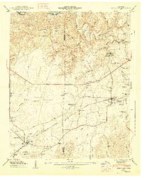
 1944 Shelbyville1944 Print · USGSMid-century Middle Tennessee is captured here during the wartime mobilization of the 1940s. Genealogists and researchers can trace family lands near Bugscuffle, Shelbyville Mills, and the expansive Camp Forrest Military Res.
 - 1947 Map of Mulberry, 1948 Print
 1947 Mulberry1948 Print · USGSLincoln County and Moore County communities thrive along the Elk River and its tributaries during the late 1940s. Genealogists and historians can trace family homesteads through over a dozen named burial sites like Renegar Cem, find landmarks like Lockes Mill, and locate the Moore Chapel Sch.3 unique versions available
 - 1947 Map of Lois, 1948 Print
 1947 Lois1948 Print · USGSMoore and Franklin counties are shown here just after the war, where the ELK RIVER winds through a landscape of family-named ridges and hollows. Researchers can trace old homesteads and community anchors like Lois, Brandon Chapel, and the Sylvania Sch.2 unique versions available
 - 1947 Map of Normandy, 1948 Print
 1947 Normandy1948 Print · USGSBedford and Moore Counties are captured here shortly after the war, when the Duck River still powered local industry. Genealogists can trace family names across Cortner Cem and Ledfords Mill or locate rural landmarks like Shoffner Ch.7 unique versions available
 - 1947 Map of Huntland, 1948 Print
 1947 Huntland1948 Print · USGSFranklin and Lincoln County life in the late 1940s centers on the rail corridor and river bends south of the Elk River. Local historians can trace family roots through sites like Falls Mill, Simmons Chapel, and numerous family burial grounds including Mc Clure Cem.4 unique versions available
 - 1949 Map of Belleville, 1974 Print
 1949 Belleville1974 Print · USGSLincoln County was a landscape of high ridges and deep hollows in the years following the war, centered around the community of Belleville. Researchers can trace old family burial grounds and country parishes like Hickory Hill Church and Wylie Cemetery.2 unique versions available
 - 1949 Map of Booneville, 1974 Print
 1949 Booneville1974 Print · USGSMoore County and the surrounding ridges come to life in this mid-century survey of the region around the Lynchburg distillery country. Genealogists can trace family footprints across dozens of named hollows and remote burial sites like Shoffner Cem and Cox Cem.2 unique versions available
 - 1951 Map of Belleville
 1951 Belleville1951 Print · USGSMid-century Middle Tennessee is captured here as a landscape of tight-knit valley communities and family ridges. Genealogists can trace the location of numerous burial grounds and rural meeting houses, such as Wylie Cem, Bledsoe Cem, and Oak Hill Ch.2 unique versions available
 - 1951 Map of Booneville
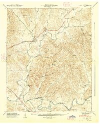
 1951 Booneville1951 Print · USGSMoore County and the hollows surrounding Lynchburg are captured in the early fifties before modern development reshaped these Highland Rim communities. Researchers can trace family homesteads near Booneville, the Motlow Cem, and the Charity Sch West.2 unique versions available
 - 1956 Map of Columbia, 1960 Print
 1956 Columbia1960 Print · USGSMiddle Tennessee in the mid-fifties presents a landscape of established river towns and critical rail hubs before the arrival of the modern interstate system. Researchers can trace the routes of the Louisville and Nashville railroad or locate historic landmarks like Stones River National Military Park and the Tennessee National Wildlife Refuge.6 unique versions available
 - 1962 Map of Tullahoma, 1965 Print
 1962 Tullahoma1965 Print · USGSTullahoma and Estill Springs are captured in the early sixties during a period of significant military and aerospace activity. Researchers can trace the sprawling Arnold Engineering Development Center or find family landmarks like Oakwood Cem and East Lincoln Sch.
 - 1972 Map of Tullahoma, 1973 Print
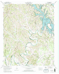
 1972 Tullahoma1973 Print · USGSTullahoma and Estill Springs are captured here during the early seventies as the region balanced its railroad heritage with the growing aerospace presence of the Arnold Engineering Development Center. Local historians can trace the rising waters of Tims Ford Lake and locate old family burial sites like Gault Cem and Lasater Cem.5 unique versions available
 - 1972 Map of Lois, 1973 Print
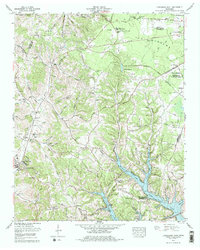
 1972 Lois1973 Print · USGSMoore County and the Elk River valley entered a new era in the early seventies with the filling of the Tims Ford reservoir. Researchers can trace submerged landmarks and still-standing rural centers like Lois, Lexie Crossroads, and the Union Grove Ch.2 unique versions available
 - 1978 Map of Lynchburg East
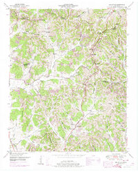
 1978 Lynchburg East1978 Print · USGSMoore County in the late seventies is captured here at the intersection of rural heritage and modern development. Researchers can trace numerous family cemeteries such as Sawyer Cem and Bobo Cem or explore the early footprint of Motlow State Community College.
Showing maps 1-25 of 66
Frequently asked questions
- What are the different types of historical maps available for Moore County?
- What is the oldest map of Moore County?
- Where can I purchase historical maps of Moore County for my home or office?
- Where can I download high-res historical maps of Moore County?
- Are there historical topographic maps available for Moore County?
- Is there historical aerial imagery available for Moore County?
- Where are historical maps of Moore County sourced from?