2020s Maps of Livingston, Tennessee
Explore 2 historic maps of Livingston from the 2020s. These maps offer a rare glimpse into what life looked like during the 2020s — showing old roads, neighborhoods, homes, and landmarks that have changed or disappeared over time.
Whether you're researching your family's past, planning a metal detecting trip, or studying how Livingston's landscape evolved across the 2020s, these high-resolution maps are a powerful tool for exploring the history of this region.
- Focus on a specific era: All maps on this page are from the 2020s, giving you a focused view of this time period.
- See what’s changed: Compare century-old streets, trails, and buildings to today's modern landscape using overlays and satellite layers.
- Research with precision: Use these maps for genealogy, historical research, land use analysis, or educational projects.
- View, download, or print: Maps are fully viewable online in high resolution, and can be downloaded or printed for your own records.
Start exploring Livingston's history through authentic maps from the 2020s. This is your window into the past.
Livingston, TN maps
(2)- 2022 Map of Okalona, 2022 Print
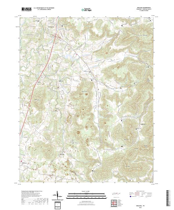 2022 Okalona2022 Print · USGSOverton County’s intricate ridges and coves are captured here in the contemporary era, showing the enduring rural layout of Livingston and Okalona. Researchers can locate numerous family burial grounds like Polk Bilbrey Cem and Ruths Chapel Cem tucked near Hellhole Mtn.
 - 2022 Map of Livingston, 2022 Print
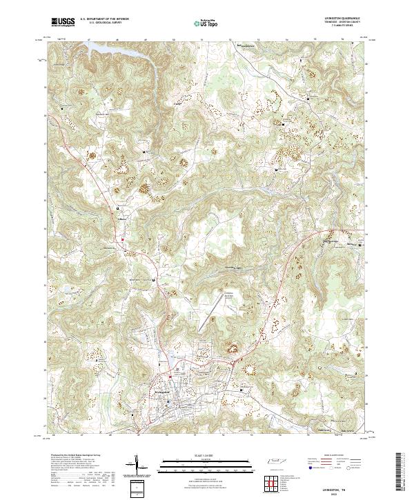 2022 Livingston2022 Print · USGSLivingston and the surrounding Overton County uplands are captured here in the twenty-first century, showing a landscape of persistent rural settlements and family landmarks. Researchers can trace ancestral roots through dozens of sites like Elm Grove Cem, Allons, and the historic Overton County Courthouse.
End of results
Showing maps 1-2 of 2
Top cities near Livingston
Frequently asked questions
- What are the different types of historical maps available for Livingston?
- What is the oldest map of Livingston?
- Where can I purchase historical maps of Livingston for my home or office?
- Where can I download high-res historical maps of Livingston?
- Are there historical topographic maps available for Livingston?
- Is there historical aerial imagery available for Livingston?
- Where are historical maps of Livingston sourced from?