Old Maps of Copperhill, Tennessee for Hiking & Exploration
Hike through history with 47 historic maps of Copperhill. Explore old trails, ghost towns, and forgotten backroads — perfect for outdoor adventurers and local explorers.
- Rediscover forgotten places: Map out old mining camps, roads, and footpaths that no longer exist on modern maps.
- Layer with modern tools: Combine with LiDAR or satellite views to plan hikes through historical terrain.
- Made for exploration: Popular among hikers, overlanders, and local history lovers.
Use these maps to find adventure and explore the hidden past of Copperhill.
Copperhill, TN maps
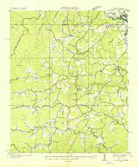
(47)- 1888 Map of Ellijay
 1888 Ellijay1888 Print · USGSNorth Georgia in the late 1880s was a land of high peaks and emerging rail lines as the mountains were first being methodically surveyed. You can trace the Marietta and North Georgia Railroad through Blue Ridge and locate vanished stops like Vanzants Store or the rural community of Cherry Log.
 - 1892 Map of Ellijay
 1892 Ellijay1892 Print · USGSNorth Georgia's mountain communities were primarily connected by river valleys and the winding Marietta and North Georgia Railroad in the late nineteenth century. Genealogists can trace early homesteads and centers of trade like Vanzant's Store, Mineral Bluff, and Cherry Log.
 - 1893 Map of Murphy
 1893 Murphy1893 Print · USGSThe Unaka Mountains and Hiwassee River valley are captured here in the late 19th century, showing a landscape of remote mountain gaps and early industry. Researchers can find old mining sites like Isabella Mine, river crossings such as Prince Fy., and rail stops at Hiwassee Sta..5 unique versions available
 - 1898 Map of Ellijay
 1898 Ellijay1898 Print · USGSNorth Georgia’s mountain country is captured here in the late nineteenth century, showing the early development of Gilmer and Fannin counties. Genealogists can trace family homesteads near old river crossings like Centers Ferry and settlements such as Mineral Bluff and Whitepath.2 unique versions available
 - 1911 Map of Ellijay
 1911 Ellijay1911 Print · USGSNorth Georgia and the Tennessee border are captured here at the turn of the century, showing a mountain landscape of river ferries and early rail. Genealogists can locate family landmarks like Higdons Store, the Pisgah church, or crossings at Bakers Ferry and Shallow Ford.4 unique versions available
 - 1914 Map of Murphy
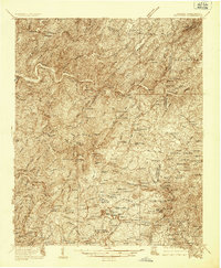
 1914 Murphy1914 Print · USGSThe Tennessee-North Carolina borderlands come to life in this early twentieth-century survey, showcasing a landscape of mountain ridges and river-driven commerce. Researchers can trace the Louisville and Nashville Railroad to old stops like Apalachia Sta or locate the historic Prince Ferry and White Cliff Springs.3 unique versions available
 - 1935 Map of Epworth
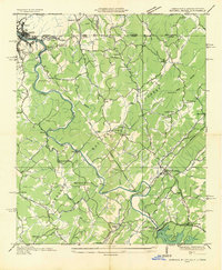
 1935 Epworth1935 Print · USGSNorth Georgia and the Tennessee borderlands are captured here in the mid-1930s, showing a landscape defined by copper mining and mountain farming. Researchers can locate vanished landmarks like Higdons Store, trace the Louisville and Nashville rail line, or find family roots at Madola Sch and Hipp Chapel.
 - 1935 Map of Mineral Bluff
 1935 Mineral Bluff1935 Print · USGSThe tri-state border region of Georgia, Tennessee, and North Carolina comes alive in the mid-1930s as industry and infrastructure reshape the mountain landscape. Genealogists can locate family landmarks like Paintertown Sch, Shady Grove Ch, and the homes near Mineral Bluff.
 - 1936 Map of Ducktown
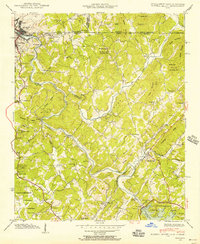
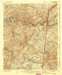
 1936 Ducktown1936 Print · USGSThe Tennessee and North Carolina borderlands come to life in the mid-1930s as the Copper Basin mining boom reaches its peak. Researchers can locate vanished infrastructure like the Tennessee Copper Co RR and legendary sites including the Burra Burra Mine and Kimsey Junior College.
 - 1936 Map of Postelle
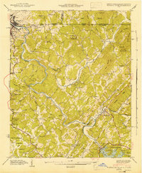
 1936 Postelle1936 Print · USGSPolk County was a hub of mining and hydroelectric power in the mid-1930s as the Tennessee Valley Authority reshaped the landscape. Researchers can trace ancestral roots at Kimsey Junior College or locate industrial sites like the Burra Burra Mine and Beckners Mill.
 - 1941 Map of Mineral Bluff, 1956 Print
 1941 Mineral Bluff1956 Print · USGSThe tri-state borderlands of Georgia, Tennessee, and North Carolina come alive in the early 1940s as the river-and-rail economy hums near Mineral Bluff. Genealogists and researchers can locate the Galloway Cem, trace the Louisville and Nashville Railroad, and find the CCC Camp 3467 TVA 29 site.4 unique versions available
 - 1941 Map of Epworth, 1957 Print
 1941 Epworth1957 Print · USGSThe Tennessee-Georgia state line and the industrial copper basin are captured here in the early 1940s. Genealogists and historians can trace family landmarks like Hipp Chapel, Patterson Mill, and the small settlement of Madola along the Fightingtown Creek.3 unique versions available
 - 1942 Map of Epworth
 1942 Epworth1942 Print · USGSThe Georgia-Tennessee border comes alive in the early 1940s, showing the rugged mountain corridor between McCaysville and Epworth. Researchers can trace old mountain homesteads, country schools like Payne Sch, and historic local landmarks such as Higdon Store and Patterson Mill.
 - 1943 Map of Mineral Bluff
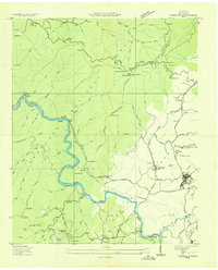
 1943 Mineral Bluff1943 Print · USGSFannin County and the tri-state border region are shown here in the early 1940s, just after the completion of the Blue Ridge Dam. Researchers can trace family history through sites like Galloway Cem or follow the Louisville and Nashville tracks through Mineral Bluff.
 - 1943 Map of Ducktown
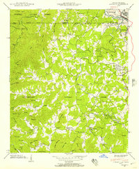
 1943 Ducktown1943 Print · USGSSoutheast Tennessee mining country is captured here during the 1940s as the regional copper industry reached its peak. Genealogists and historians can trace industrial footprints at the Burra Burra Mine or locate families near Freelingtown and the Ironsburg Sch.2 unique versions available
 - 1953 Map of Chattanooga
 1953 Chattanooga1953 Print · USGSSoutheast Tennessee in the early fifties shows a landscape reshaped by river management and rail power. Trace the rail lines of the Southern Ry through riverside towns or locate the preserved grounds of the Chickamauga and Chattanooga National Military Park.
 - 1955 Map of Rome
 1955 Rome1955 Print · USGSThe tri-state borderlands of Georgia, Alabama, and Tennessee appear in the mid-fifties as a landscape of ridge-and-valley industry and river navigation. Genealogists can trace family footprints near Chattanooga, the iron works of Gadsden, and textile towns like Trion or Summerville.
 - 1957 Map of Ducktown, 1959 Print
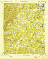
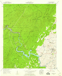 1957 Ducktown1959 Print · USGSThe copper industry and mountain wilderness met in the late fifties near the Tennessee-Georgia border. Genealogists and industrial historians can trace the Burra Burra Mine, the Louisville and Nashville rail line, and the waters of Ocoee No 3 Lake.4 unique versions available
 - 1957 Map of Chattanooga, 1966 Print
 1957 Chattanooga1966 Print · USGSEast Tennessee in the mid-1960s shows a landscape of massive hydroelectric reservoirs and emerging industrial sites like the Atomic Energy Commission (Oak Ridge Area). Trace the rail networks of the Southern Ry through Chattanooga or locate family-named ridges across the Cumberland Plateau.3 unique versions available
 - 1958 Map of Rome, 1966 Print
 1958 Rome1966 Print · USGSNorthwest Georgia and neighboring Tennessee and Alabama are captured here in the late fifties, showcasing a landscape of high ridges and river valleys. Researchers can trace historic rail lines like the Seaboard Air Line RR and explore the bounds of Cloudland Canyon State Park or Fort Oglethorpe.3 unique versions available
 - 1959 Map of Chattanooga
 1959 Chattanooga1959 Print · USGSSoutheast Tennessee is shown here during a decade of industrial growth and hydroelectric development. Trace the regional rail networks of the Southern Ry and find landmark sites like Lookout Mountain, Fall Creek Falls State Park, and Chattanooga.
 - 1960 Map of Chattanooga
 1960 Chattanooga1960 Print · USGSSoutheast Tennessee and the southern Appalachians are shown here at the height of the river-management era. You can trace the valley rail lines and locate Lookout Mountain and the expansive waters of Chickamauga Reservoir.
 - 1961 Map of Rome
 1961 Rome1961 Print · USGSNorthwest Georgia and neighboring Tennessee and Alabama are shown here at a moment of significant mid-century growth. Researchers can trace the rail networks of the Central of Georgia or locate landmarks within Chickamauga and Chattanooga Nat Military Park.
 - 1963 Map of Rome
 1963 Rome1963 Print · USGSThe tri-state corner of Georgia, Alabama, and Tennessee is captured here during a period of massive reservoir expansion and post-war growth. Genealogists and historians can trace the rail corridors of the Southern Ry or locate landmarks like Fort Oglethorpe and Cloudland Canyon State Park.
 - 1964 Map of Chattanooga
 1964 Chattanooga1964 Print · USGSSoutheast Tennessee and the western Carolinas appear in the mid-sixties as a powerhouse of river-driven industry and mountain wilderness. Genealogists and historians can trace rail-town lineages along the Southern Ry or locate family landmarks near Watts Bar Lake and Tellico Plains.
Showing maps 1-25 of 47
Top cities near Copperhill
- McCaysville historical maps
- Blue Ridge historical maps
- Ducktown historical maps
- Morganton historical maps
Top neighborhoods of Copperhill
Frequently asked questions
- What are the different types of historical maps available for Copperhill?
- What is the oldest map of Copperhill?
- Where can I purchase historical maps of Copperhill for my home or office?
- Where can I download high-res historical maps of Copperhill?
- Are there historical topographic maps available for Copperhill?
- Is there historical aerial imagery available for Copperhill?
- Where are historical maps of Copperhill sourced from?