Old Maps of Cookeville, Tennessee
Explore 11 old maps of Cookeville, spanning from 1897 to today. These high-resolution historic maps reveal how streets, neighborhoods, landmarks, and natural features evolved over time — perfect for genealogy, metal detecting, research, and local history exploration.
What you can do with these maps:
- See how Cookeville changed over time: Compare historical maps to modern-day views to trace roads, homesites, rail lines & more.
- View detailed metadata: Each map includes creators, publishers, year, scale, and archive source.
- Overlay maps with satellite & LiDAR: Visualize the past alongside modern tools to explore terrain & human change.
- Trusted historical sources: Maps sourced from the USGS, Library of Congress, and other archives.
- Access maps your way: View online, download high-res files, or order prints for personal or research use.
Start exploring old maps of Cookeville to uncover forgotten places, hidden landmarks, and the deep history beneath your feet.
Cookeville, TN maps
(11)- 1897 Map of Standingstone
 1897 Standingstone1897 Print · USGSCovers Cookeville, including Crossville, Livingston, and other nearby areas
 - 1898 Map of Standingstone
 1898 Standingstone1898 Print · USGSCovers Cookeville, including Crossville, Livingston, and other nearby areas8 unique versions available
 - 1943 Map of Cookeville
 1943 Cookeville1943 Print · USGSCovers Cookeville, including Sparta, Algood, and other nearby areas
 - 1944 Map of Cookeville
 1944 Cookeville1944 Print · USGSCovers Cookeville, including Sparta, Algood, and other nearby areas
 - 1953 Map of Cookeville East, 1955 Print
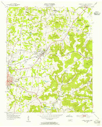 1953 Cookeville East1955 Print · USGSCovers Cookeville, including Algood, Bangham, and other nearby areas4 unique versions available
 - 1953 Map of Cookeville West, 1955 Print
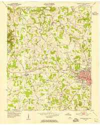 1953 Cookeville West1955 Print · USGSCovers Cookeville, including Baxter, Rose Garden Estates, and other nearby areas5 unique versions available
 - 1956 Map of Burgess Falls, 1957 Print
 1956 Burgess Falls1957 Print · USGSCovers Cookeville, including Bakers Crossroads, Amber Meadows, and other nearby areas4 unique versions available
 - 1956 Map of Dry Valley, 1957 Print
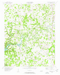
 1956 Dry Valley1957 Print · USGSCovers Cookeville, including Hillwood, Board Valley, and other nearby areas3 unique versions available
 - 1956 Map of Corbin, 1966 Print
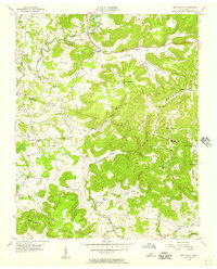
 1956 Corbin1966 Print · USGSCovers Cookeville, including Knoxville, Oak Ridge, and other nearby areas3 unique versions available
 - 1958 Map of Corbin
 1958 Corbin1958 Print · USGSCovers Cookeville, including Knoxville, Oak Ridge, and other nearby areas
 - 1982 Map of Cookeville, 1983 Print
 1982 Cookeville1983 Print · USGSCovers Cookeville, including Crossville, Lafayette, and other nearby areas
End of results
Showing maps 1-11 of 11
Top cities near Cookeville
- Sparta historical maps
- Livingston historical maps
- Algood historical maps
- Baxter historical maps
- Gainesboro historical maps
Top neighborhoods of Cookeville
- Green Acres historical maps
- Holladay historical maps
- Capshaw Woods historical maps
- College Heights historical maps
- Wildwood historical maps
- Pleasant View historical maps
See more
Frequently asked questions
- What are the different types of historical maps available for Cookeville?
- What is the oldest map of Cookeville?
- Where can I purchase historical maps of Cookeville for my home or office?
- Where can I download high-res historical maps of Cookeville?
- Are there historical topographic maps available for Cookeville?
- Is there historical aerial imagery available for Cookeville?
- Where are historical maps of Cookeville sourced from?