Old Maps of Putnam County, Tennessee
Explore 122 old maps of Putnam County, spanning from 1892 to today. These high-resolution historic maps reveal how streets, neighborhoods, landmarks, and natural features evolved over time — perfect for genealogy, metal detecting, research, and local history exploration.
What you can do with these maps:
- See how Putnam County changed over time: Compare historical maps to modern-day views to trace roads, homesites, rail lines & more.
- View detailed metadata: Each map includes creators, publishers, year, scale, and archive source.
- Overlay maps with satellite & LiDAR: Visualize the past alongside modern tools to explore terrain & human change.
- Trusted historical sources: Maps sourced from the USGS, Library of Congress, and other archives.
- Access maps your way: View online, download high-res files, or order prints for personal or research use.
Start exploring old maps of Putnam County to uncover forgotten places, hidden landmarks, and the deep history beneath your feet.
Putnam County, TN maps
(122)- 1892 Map of Pikeville
 1892 Pikeville1892 Print · USGSThe Cumberland Plateau in the 1890s shows a rugged landscape of early river ferries and mountain gaps. Genealogists and historians can trace the paths between Sparta and Crossville, locating landmarks like Hodge Ferry and the Rock House tavern.
 - 1895 Map of Pikeville
 1895 Pikeville1895 Print · USGSThe Cumberland Plateau was a landscape of mountain settlements and critical gaps in the 1890s. Genealogists can trace family roots through upland communities like Pomona and Lantana, or locate old landmarks like Hale Chapel and Hodge Ferry along the river.7 unique versions available
 - 1897 Map of Standingstone
 1897 Standingstone1897 Print · USGSThe Upper Cumberland Plateau at the end of the 19th century shows a landscape of deep coves and rising rail towns. Trace the early tracks of the Nashville and Knoxville railroad or find family roots near Livingston, Standingstone, and the Cedar Springs church.
 - 1898 Map of Standingstone
 1898 Standingstone1898 Print · USGSThe Cumberland Plateau of Middle Tennessee comes alive in the late nineteenth century, showing the isolated settlements and early industry of the western mountains. Trace the route of the Nashville and Knoxville RR through Monterey or locate family-named coves like Johnson Cove and Deck Cove.8 unique versions available
 - 1925 Map of Gainesboro, 1954 Print
 1925 Gainesboro1954 Print · USGSJackson County, Tennessee, is captured here in the mid-1920s when the river and hollows defined every community boundary. Genealogists can trace family landmarks and vanished river crossings like Gainesboro Ferry, Cummins Mill, and the Free State Sch.
 - 1928 Map of Gordonsville
 1928 Gordonsville1928 Print · USGSMiddle Tennessee in the late twenties was a landscape defined by the winding bends of the Caney Fork and the rise of rural river settlements. Genealogists can locate family-named landmarks like Walker Creek Sch and Hurst Chapel, or trace old river crossings at Greenmoos Ferry and Loves Ferry.2 unique versions available
 - 1929 Map of Gainesboro
 1929 Gainesboro1929 Print · USGSJackson County in the late twenties was defined by its river-and-rail economy and upland settlements. Researchers can trace historic river crossings like Gainesboro Ferry and find family-named landmarks such as Cummins Mill and Butlers Landing.2 unique versions available
 - 1935 Map of Campbell Junction
 1935 Campbell Junction1935 Print · USGSCumberland County’s high plateau country is documented here in the mid-1930s as modern power and transit networks begin to cross the landscape. Researchers can trace the early path of Tennessee State Highway No 70 and the railroad at Campbell Junction.
 - 1935 Map of Clarkrange
 1935 Clarkrange1935 Print · USGSThe Cumberland plateau comes into focus during the mid-thirties as the newly constructed Alvin G York Highway began transforming the region. Genealogists and historians can trace old homestead paths and early settlements like Clarkrange and Rinnie.
 - 1942 Map of Statesville
 1942 Statesville1942 Print · USGSMid-century Tennessee comes alive in this survey of the river valleys and rail lines east of Nashville. Researchers can trace the path of the Tennessee Central Railway and locate historic points like Denny Seminary and Tuckers Crossroads.
 - 1943 Map of Cookeville
 1943 Cookeville1943 Print · USGSMiddle Tennessee during the early 1940s reveals a landscape defined by the Tennessee Central Railroad and the ascent to the Cumberland Plateau. Trace local heritage through rural settlements like Silver Point and Bloomington Springs or the river crossing at Hodge Ferry.
 - 1944 Map of Cookeville
 1944 Cookeville1944 Print · USGSUpper Tennessee during the war years shows a landscape shaped by deep river gorges and the rising Cumberland Plateau. Researchers can trace old mountain settlements like Bon Air or locate river landmarks such as Hodge Ferry and Burgess Falls Dam.
 - 1946 Map of Campbell Junction, 1974 Print
 1946 Campbell Junction1974 Print · USGSThe high Cumberland Plateau comes into focus in the mid-1940s as the Tennessee Central railroad links small upland communities. Genealogists and local researchers can trace family sites at Welch Cem, Rains Cem, and Pugh Cem or locate the early grounds of Camp Nakanawa.3 unique versions available
 - 1946 Map of Clarkrange, 1976 Print
 1946 Clarkrange1976 Print · USGSThe rural heart of the Tennessee Cumberland Plateau comes into focus in the mid-1940s, centered on the crossroads of Clarkrange. Genealogists and local historians can trace family locations near Union Grove Sch, Muddy Pond, and the Alvin C York Highway.
 - 1946 Map of Obey City, 1976 Print
 1946 Obey City1976 Print · USGSThe Cumberland Plateau of the late 1940s is captured here at a time when coal mining was transforming the rural landscape around Obey City. Researchers can trace old family lineages through Looper Cem and Thompson Cem or follow the Tennessee Central Railroad.2 unique versions available
 - 1950 Map of Clarkrange
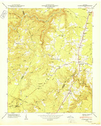 1950 Clarkrange1950 Print · USGSMid-century Fentress County is defined here by the high-plateau route of the Alvin C York Highway and the rugged breaks of the Cumberland Plateau. You can trace family homesteads near Muddy Pond, local schools like Martha Washington School, and the crossroads at Clarkrange.2 unique versions available
 - 1950 Map of Obey City
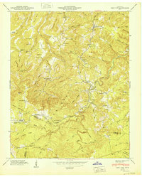 1950 Obey City1950 Print · USGSOverton County’s rugged plateau terrain is captured here in the post-war era as the Tennessee Central railroad served the mountain communities. Genealogists can trace family roots at Obey City, Hanging Limb, and numerous rural landmarks like Buckner Chapel or the Shaver Cem.
 - 1950 Map of Campbell Junction
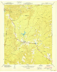 1950 Campbell Junction1950 Print · USGSThe Cumberland Plateau in the mid-century is captured here as the Tennessee Central railroad snakes through the divide between Putnam and Cumberland counties. Family researchers can trace local roots through Welch Cem, Rains Cem, and settlements like Campbell Junction and The Cowpens.2 unique versions available
 - 1951 Map of Windle, 1989 Print
 1951 Windle1989 Print · USGSOverton County’s rural character is preserved in this mid-century survey of the rugged plateau and river valleys. Researchers can trace historic family-named cemeteries and schools like Oneal Sch, Mathew Cem, and the settlement at Rickman.
 - 1953 Map of Chattanooga
 1953 Chattanooga1953 Print · USGSSoutheast Tennessee in the early fifties shows a landscape reshaped by river management and rail power. Trace the rail lines of the Southern Ry through riverside towns or locate the preserved grounds of the Chickamauga and Chattanooga National Military Park.
 - 1953 Map of Cookeville East, 1955 Print
 1953 Cookeville East1955 Print · USGSPutnam and Overton counties are captured here in the early fifties, centered on the growing rail and road hub of Cookeville. Researchers can trace the path of the Tennessee Central Railroad and find long-established rural landmarks like Post Oak Ch, Heprys Chapel, and Swallows Sch.5 unique versions available
 - 1953 Map of Cookeville West, 1955 Print
 1953 Cookeville West1955 Print · USGSPutnam County's mid-century landscape is centered here on the growth of Cookeville and its surrounding hill country. Genealogists and historians can trace family homesteads through numerous landmarks like the Junior Military Academy, Mc Broom Chapel, and Pilot Knob.6 unique versions available
 - 1954 Map of De Rossett, 1955 Print
 1954 De Rossett1955 Print · USGSWhite County life in the mid-1950s centered on the plateau ridge and its surrounding coves. Genealogists and historians can trace family locations in Stringtown and Mobra, or find industrial sites like the Strip Mine near Ravenscroft.5 unique versions available
 - 1955 Map of Monterey Lake, 1956 Print
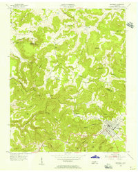 1955 Monterey Lake1956 Print · USGSThe Putnam County plateau comes into focus in the mid-fifties, centered on the railroad town of Monterey. Researchers can trace the winding Tennessee Central tracks through a landscape of family-named landmarks like Stamps Cem, Lee Sch, and Bee Rock.
 - 1955 Map of Windle, 1956 Print
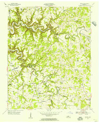 1955 Windle1956 Print · USGSMid-century life in rural Overton County centered on small creek-side settlements and high-ridge community churches. You can trace family roots through numerous local landmarks like Rickman, Lynns Chapel Sch, and the Camp Ground Cem.
Showing maps 1-25 of 122
Top cities of Putnam County
Frequently asked questions
- What are the different types of historical maps available for Putnam County?
- What is the oldest map of Putnam County?
- Where can I purchase historical maps of Putnam County for my home or office?
- Where can I download high-res historical maps of Putnam County?
- Are there historical topographic maps available for Putnam County?
- Is there historical aerial imagery available for Putnam County?
- Where are historical maps of Putnam County sourced from?