1990s Maps of Robertson County, Tennessee
Explore 2 historic maps of Robertson County from the 1990s. These maps offer a rare glimpse into what life looked like during the 1990s — showing old roads, neighborhoods, homes, and landmarks that have changed or disappeared over time.
Whether you're researching your family's past, planning a metal detecting trip, or studying how Robertson County's landscape evolved across the 1990s, these high-resolution maps are a powerful tool for exploring the history of this region.
- Focus on a specific era: All maps on this page are from the 1990s, giving you a focused view of this time period.
- See what’s changed: Compare century-old streets, trails, and buildings to today's modern landscape using overlays and satellite layers.
- Research with precision: Use these maps for genealogy, historical research, land use analysis, or educational projects.
- View, download, or print: Maps are fully viewable online in high resolution, and can be downloaded or printed for your own records.
Start exploring Robertson County's history through authentic maps from the 1990s. This is your window into the past.
Robertson County, TN maps
(2)- 1994 Map of Whites Creek, 1997 Print
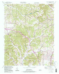 1994 Whites Creek1997 Print · USGSNorth of Nashville in the mid-1990s, the hollows and ridges of the Highland Rim remained a patchwork of small communities and family landmarks. Genealogists and local historians can trace the foundations of Joelton and Whites Creek or locate historic sites like Walkers Ch and Alex Green Sch.
 - 1994 Map of Forest Grove, 1997 Print
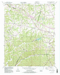 1994 Forest Grove1997 Print · USGSThe hills of Cheatham and Davidson Counties are captured here in the mid-nineties, showing a landscape of rural ridges and developing communities. Researchers can trace the heritage of local settlements through landmarks like Paines Chapel, Morny Sch, and the winding Old Clarksville Pike.
End of results
Showing maps 1-2 of 2
Top cities of Robertson County
- Springfield historical maps
- Greenbrier historical maps
- Coopertown historical maps
- Ridgetop historical maps
- Cross Plains historical maps
- Orlinda historical maps
See more
Frequently asked questions
- What are the different types of historical maps available for Robertson County?
- What is the oldest map of Robertson County?
- Where can I purchase historical maps of Robertson County for my home or office?
- Where can I download high-res historical maps of Robertson County?
- Are there historical topographic maps available for Robertson County?
- Is there historical aerial imagery available for Robertson County?
- Where are historical maps of Robertson County sourced from?