Old Maps of Robertson County, Tennessee for Metal Detecting
Plan your next treasure hunt with 127 historic maps of Robertson County. Find old homesites, ghost towns, trails, and gathering spots that may be lost to time — perfect for identifying promising metal detecting locations.
- Locate forgotten sites: Uncover places like long-lost settlements, abandoned rail lines, or gathering spots.
- Plan better hunts: Use map overlays combined with LiDAR or satellite views to narrow in on historically rich areas.
- Made for detectorists: Thousands of hobbyists use these maps to discover relics, coins, and hidden history.
Use these historic maps to boost your research and find new opportunities beneath the surface of Robertson County.
Robertson County, TN maps
(127)- 1903 Map of Nashville
 1903 Nashville1903 Print · USGSTennessee's capital region is captured at the dawn of the 1900s, when iron pikes and river locks dominated local commerce. Trace ancestral routes along Stewarts Ferry Pike, find rural landmarks like Curry Mill, or locate historical sites like The Hermitage.4 unique versions available
 - 1931 Map of Ridgetop, 1957 Print
 1931 Ridgetop1957 Print · USGSUpper Middle Tennessee in the early thirties reveals a landscape of ridge-top towns and deep hollows. Genealogists can trace family footprints through dozens of rural landmarks like St Michaels Ch, Gordons Store, and the old Ridgetop Sta.2 unique versions available
 - 1935 Map of Ridgetop
 1935 Ridgetop1935 Print · USGSNorthern Tennessee's ridge country is captured here between the mid-twenties and early thirties, showing a landscape tied to the Louisville and Nashville railroad. Genealogists can trace family roots through numerous local landmarks like Bethlehem Sch, Gordons Store, and St Michaels Ch.2 unique versions available
 - 1942 Map of Gallatin
 1942 Gallatin1942 Print · USGSThe Tennessee-Kentucky borderlands were a crossroads of river and rail during the early war years. Genealogists and historians can trace family roots through dozens of named settlements like Bethpage, Prices Mill, and Mitchellville, or locate historic river crossings such as Kirkpatricks Ferry.
 - 1950 Map of Allensville, 1952 Print
 1950 Allensville1952 Print · USGSSpanning the Kentucky and Tennessee border in the early 1950s, this area centers on the vital Louisville and Nashville rail line. Researchers can trace the rural communities of Allensville and Keysburg or locate the Belmont Cem near the winding Red River.2 unique versions available
 - 1950 Map of Guthrie, 1952 Print
 1950 Guthrie1952 Print · USGSGuthrie and the Kentucky-Tennessee borderlands are shown here at the mid-century, where the rail lines of the Louisville and Nashville meet. Researchers can trace rural life through landmarks like Warfield School, Lester Chapel, and the small settlement at Pinchem.3 unique versions available
 - 1951 Map of Adairville, 1952 Print
 1951 Adairville1952 Print · USGSAdairville and the Kentucky-Tennessee borderlands are captured here in the early fifties, showing a landscape defined by the Red River and its South Fork. Local historians can trace family roots at Greenwood Cem or locate community hubs like Mortimer Sta and Townsend Sch.3 unique versions available
 - 1951 Map of Dot, 1952 Print
 1951 Dot1952 Print · USGSThe Kentucky and Tennessee borderlands come alive in this early 1950s survey of the Red River valley. Researchers can trace the winding course of Whippoorwill Creek and locate community anchors like Lickskillet, Millertown Ch, and Cedar Grove Sch.3 unique versions available
 - 1951 Map of Franklin, 1952 Print
 1951 Franklin1952 Print · USGSThe Kentucky-Tennessee borderlands in the early fifties come to life on this detailed map of the Franklin area. Genealogists and historians can trace the Louisville and Nashville rail line and locate rural landmarks like Peden Mill and Union Chapel.2 unique versions available
 - 1951 Map of Prices Mill, 1952 Print
 1951 Prices Mill1952 Print · USGSThe Kentucky-Tennessee state line divides this 1950s farming landscape where the river and local mills defined rural commerce. Genealogists can locate family landmarks and community centers such as Prices Mill, White Hill Ch, and the Red River Sch.2 unique versions available
 - 1952 Map of Springfield North, 1953 Print
 1952 Springfield North1953 Print · USGSMid-century Robertson County was a landscape of rail-linked towns and rural school districts defined by the winding Sulphur Fork. Genealogists can trace family footprints at Bartlett Cem, Elmwood Cem, and rural centers like Barren Plain or Cedar Hill.2 unique versions available
 - 1952 Map of Youngville, 1953 Print
 1952 Youngville1953 Print · USGSRobertson County in the early fifties was a landscape of small crossroads settlements and winding river valleys. Genealogists and researchers can trace rural life through landmarks like Brick Sch, the Janie Bell Cem, and the State Fish Hatchery.2 unique versions available
 - 1953 Map of Orlinda, 1955 Print
 1953 Orlinda1955 Print · USGSUpper Middle Tennessee near the Kentucky border comes to life in this mid-century survey of rural Robertson and Sumner counties. Genealogists can trace family names through sites like Kilgore Station, Jamestown School, and dozens of family plots like Traughber Cem.3 unique versions available
 - 1954 Map of White House, 1955 Print
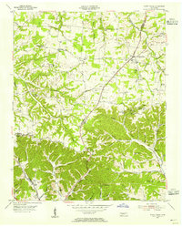 1954 White House1955 Print · USGSThe Tennessee borderlands of Robertson and Sumner counties are captured here in the mid-1950s. Family researchers can trace dozens of homesteads and burial grounds like the Strickland Cem, alongside landmarks such as Indian Cave and White House.4 unique versions available
 - 1955 Map of Whites Creek, 1956 Print
 1955 Whites Creek1956 Print · USGSDavidson County north of Nashville was a landscape of steep ridges and deep hollows in the mid-1950s. Family historians can trace ancestral lands through named features like Bennett Hollow or find rural landmarks like Union Hill Ch and Joelton.4 unique versions available
 - 1955 Map of Forest Grove, 1956 Print
 1955 Forest Grove1956 Print · USGSNorthwest of Nashville in the mid-fifties, this area shows a rural landscape of ridges and hollows defined by the meeting of three counties. Genealogists can trace family landmarks like Gupton Cem, New Hope Ch, and the small settlement of Morny.5 unique versions available
 - 1956 Map of Portland, 1957 Print
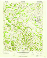 1956 Portland1957 Print · USGSSumner County during the mid-fifties shows a landscape of small farming hamlets and steam-era rail infrastructure. Researchers can trace family roots at Byram Chapel, locate the site of Oakmont Sch, and follow the Louisville and Nashville line through Portland.4 unique versions available
 - 1956 Map of Nashville, 1971 Print
 1956 Nashville1971 Print · USGSThe Tennessee-Kentucky borderlands come into focus in the mid-1960s as major reservoir projects transformed the Cumberland and Tennessee river valleys. Researchers can trace the rail networks of the Louisville and Nashville and visit sites like Fort Campbell and Fort Donelson National Military Park.2 unique versions available
 - 1957 Map of Adams, 1958 Print
 1957 Adams1958 Print · USGSUpper Middle Tennessee was a land of winding river valleys and rail-side hamlets during the mid-fifties. You can trace the historic Louisville and Nashville line through Adams or locate rural landmarks like Jo-Byrns High Sch and Harmony Ch.4 unique versions available
 - 1957 Map of Pleasant View, 1958 Print
 1957 Pleasant View1958 Print · USGSMid-century Middle Tennessee comes to life here, showing the rural landscapes of Cheatham and Robertson counties. Genealogists can locate family landmarks like Fox Cem or trace the development of crossroads hamlets such as Stroudville, Gause, and Pleasant View.3 unique versions available
 - 1957 Map of Henrietta, 1958 Print
 1957 Henrietta1958 Print · USGSThe rural Montgomery and Cheatham county line comes into focus during the late fifties, showing a landscape of family farms and small crossroads. Genealogists can trace family names at the Hollis-Nanny Cem or locate the County Home for the Indigent.3 unique versions available
 - 1957 Map of Sango, 1958 Print
 1957 Sango1958 Print · USGSThe Red River valley on the Montgomery and Robertson county line is captured here in the mid-fifties, showing a landscape of small farms and rural parishes. Researchers can locate family landmarks like Hampton Station, Durham Cave, and the historic crossroads at Port Royal.5 unique versions available
 - 1959 Map of Nashville
 1959 Nashville1959 Print · USGSMiddle Tennessee and Southern Kentucky come into focus during the late fifties, showing the region's transition into a modern transportation and military hub. Researchers can trace the sprawling Fort Campbell Military Reservation or locate historic rail stops along the Tennessee Central Ry and Illinois Central RR.
 - 1961 Map of Greenbrier, 1963 Print
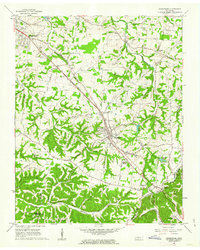 1961 Greenbrier1963 Print · USGSRobertson County's rail-and-road corridor comes alive in the early sixties as communities grew along the Louisville and Nashville line. Genealogists can trace family landmarks like the Bloodworth Cem, Lights Chapel Cem, and Hygeia Springs.3 unique versions available
 - 1961 Map of Springfield South, 1963 Print
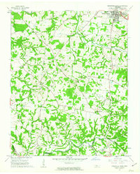 1961 Springfield South1963 Print · USGSRobertson County's rural landscapes and agricultural crossroads are captured here in the early sixties. Researchers can locate family landmarks like Martins Chapel Cem, the County Farm, and community hubs like Glover Crossroad.4 unique versions available
Showing maps 1-25 of 127
Top cities of Robertson County
- Springfield historical maps
- Greenbrier historical maps
- Coopertown historical maps
- Ridgetop historical maps
- Cross Plains historical maps
- Orlinda historical maps
See more
Frequently asked questions
- What are the different types of historical maps available for Robertson County?
- What is the oldest map of Robertson County?
- Where can I purchase historical maps of Robertson County for my home or office?
- Where can I download high-res historical maps of Robertson County?
- Are there historical topographic maps available for Robertson County?
- Is there historical aerial imagery available for Robertson County?
- Where are historical maps of Robertson County sourced from?