2020s Maps of Murfreesboro, Tennessee
Explore 6 historic maps of Murfreesboro from the 2020s. These maps offer a rare glimpse into what life looked like during the 2020s — showing old roads, neighborhoods, homes, and landmarks that have changed or disappeared over time.
Whether you're researching your family's past, planning a metal detecting trip, or studying how Murfreesboro's landscape evolved across the 2020s, these high-resolution maps are a powerful tool for exploring the history of this region.
- Focus on a specific era: All maps on this page are from the 2020s, giving you a focused view of this time period.
- See what’s changed: Compare century-old streets, trails, and buildings to today's modern landscape using overlays and satellite layers.
- Research with precision: Use these maps for genealogy, historical research, land use analysis, or educational projects.
- View, download, or print: Maps are fully viewable online in high resolution, and can be downloaded or printed for your own records.
Start exploring Murfreesboro's history through authentic maps from the 2020s. This is your window into the past.
Murfreesboro, TN maps
(6)- 2022 Map of Rockvale, 2022 Print
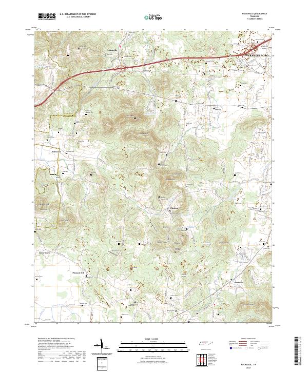 2022 Rockvale2022 Print · USGSRutherford County at the start of the 2020s shows a landscape where growing suburbs meet historic family farmsteads and springs. Researchers can trace dozens of ancestral burial sites like McClaren - Marable Cem and unique landmarks such as Snail Shell Cave Spring.
 - 2022 Map of Dillton, 2022 Print
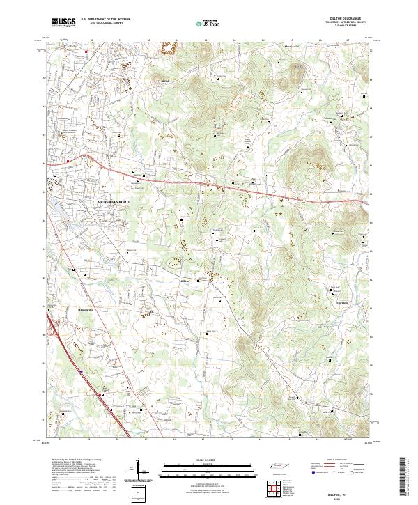 2022 Dillton2022 Print · USGSRutherford County at the start of the 2020s shows the expansion of Murfreesboro alongside deep-rooted rural settlements. Researchers can trace family history through dozens of named sites like Lillard Cem or locate the Flat Rock Cedar Glade And Barrens State Natural Area.
 - 2022 Map of Lascassas, 2022 Print
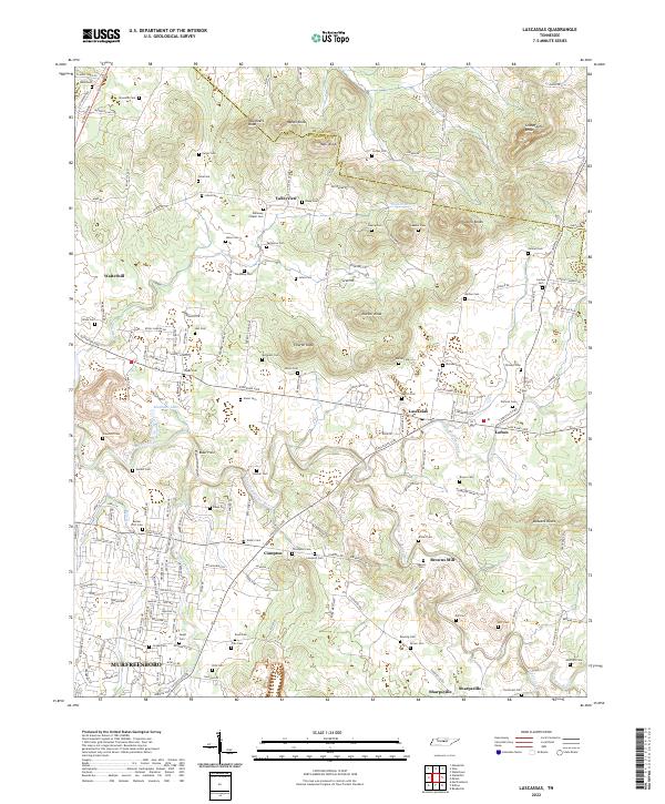 2022 Lascassas2022 Print · USGSRutherford County at the dawn of the 2020s shows a landscape of historic river valleys and prominent knobs. Researchers can trace numerous family burial sites like Drennan Cem and Donnell Cem near the historic settlements of Lascassas and Sharpsville.
 - 2022 Map of Smyrna, 2022 Print
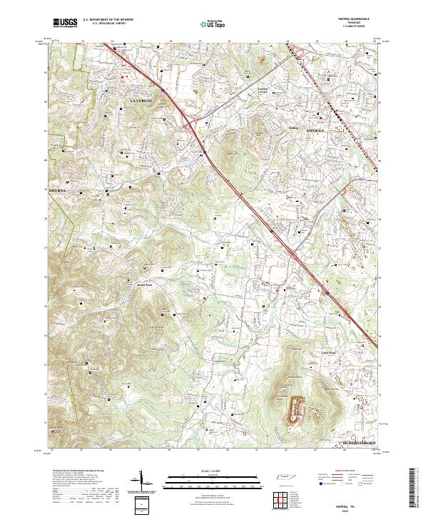 2022 Smyrna2022 Print · USGSRutherford County in the early twenty-first century shows a fascinating blend of rapid development and preserved family history. Genealogists can trace ancestral sites like the Sam Davis Cem, Hill-Roulhac Cem, and the community of Rocky Fork.
 - 2022 Map of Murfreesboro, 2022 Print
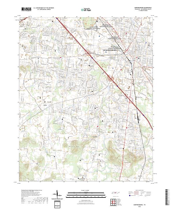 2022 Murfreesboro2022 Print · USGSMurfreesboro and its surrounding knobs are shown here as the city expanded around its Civil War heritage in the early twenty-first century. Genealogists and historians can locate numerous burial grounds such as Benevolent Cem and Liddon Cem or trace the winding path of Puckett Cr.
 - 2022 Map of Walterhill, 2022 Print
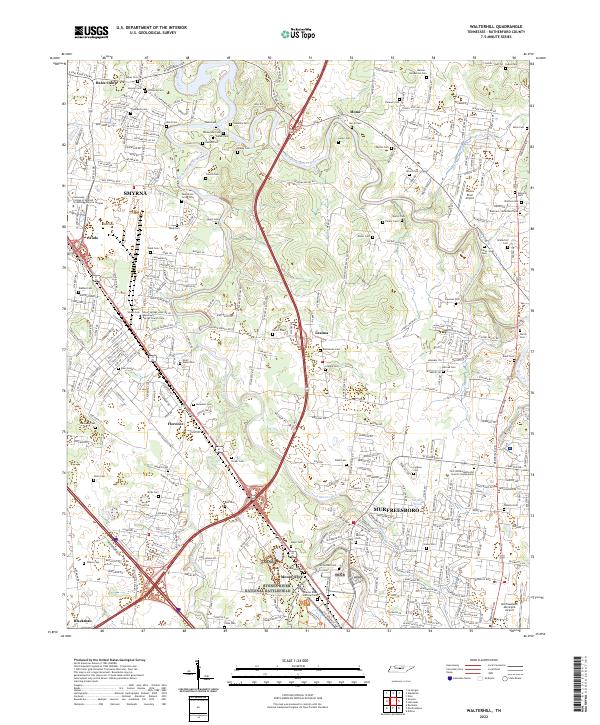 2022 Walterhill2022 Print · USGSRutherford County at the start of the 2020s shows a landscape where suburban growth meets preserved Civil War history. Researchers can locate dozens of family burial sites like Holloway Cem and Ward Cem alongside the Stones River National Battlefield.
End of results
Showing maps 1-6 of 6
Top cities near Murfreesboro
- Nashville historical maps
- Smyrna historical maps
- La Vergne historical maps
- Nolensville historical maps
- Eagleville historical maps
Top neighborhoods of Murfreesboro
- Esquire Estates historical maps
- Lascassas Villa historical maps
- Barfield Meadows historical maps
- Battleground Estates historical maps
- Green Meadows historical maps
- Broodwood historical maps
See more
Frequently asked questions
- What are the different types of historical maps available for Murfreesboro?
- What is the oldest map of Murfreesboro?
- Where can I purchase historical maps of Murfreesboro for my home or office?
- Where can I download high-res historical maps of Murfreesboro?
- Are there historical topographic maps available for Murfreesboro?
- Is there historical aerial imagery available for Murfreesboro?
- Where are historical maps of Murfreesboro sourced from?