Old Maps of Sequatchie County, Tennessee
Explore 102 old maps of Sequatchie County, spanning from 1888 to today. These high-resolution historic maps reveal how streets, neighborhoods, landmarks, and natural features evolved over time — perfect for genealogy, metal detecting, research, and local history exploration.
What you can do with these maps:
- See how Sequatchie County changed over time: Compare historical maps to modern-day views to trace roads, homesites, rail lines & more.
- View detailed metadata: Each map includes creators, publishers, year, scale, and archive source.
- Overlay maps with satellite & LiDAR: Visualize the past alongside modern tools to explore terrain & human change.
- Trusted historical sources: Maps sourced from the USGS, Library of Congress, and other archives.
- Access maps your way: View online, download high-res files, or order prints for personal or research use.
Start exploring old maps of Sequatchie County to uncover forgotten places, hidden landmarks, and the deep history beneath your feet.
Sequatchie County, TN maps
(102)- 1888 Map of Chattanooga
 1888 Chattanooga1888 Print · USGSSoutheast Tennessee in the late nineteenth century was a landscape of river ferries and mountain mining. Trace family roots and vanished landmarks near Chattanooga, from the Aetna Mines to historic river crossings like Harrison Ferry.
 - 1892 Map of Pikeville
 1892 Pikeville1892 Print · USGSThe Cumberland Plateau in the 1890s shows a rugged landscape of early river ferries and mountain gaps. Genealogists and historians can trace the paths between Sparta and Crossville, locating landmarks like Hodge Ferry and the Rock House tavern.
 - 1893 Map of Mc Minnville
 1893 Mc Minnville1893 Print · USGSThe river-and-rail economy of Warren and DeKalb counties is captured here in the 1890s. Researchers can trace old ferry crossings like Pin Hook Ferry and local industry at Daly Mill or Magness Mills.
 - 1893 Map of Chattanooga
 1893 Chattanooga1893 Print · USGSSoutheast Tennessee is shown here in the 1890s, when river ferries and coal mines defined the landscape around the booming hub of Chattanooga. Genealogists and researchers can trace family lands near Eldridge Landing, the Mc Nabb Mines, or old settlements like Ooltewah.9 unique versions available
 - 1895 Map of Mc Minnville
 1895 Mc Minnville1895 Print · USGSWarren and DeKalb Counties in the 1890s are defined by the winding Collins River and the early rail lines connecting the Highland Rim. Genealogists can trace family footprints near Magness Mills, White Seminary, or old river crossings like Bailiff Old Ferry.5 unique versions available
 - 1895 Map of Sewanee
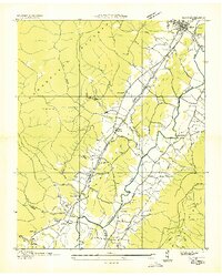
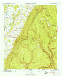
 1895 Sewanee1895 Print · USGSThe Cumberland Plateau and Sequatchie Valley come alive in the late nineteenth century, showing a landscape shaped by coal, iron, and the rails. Genealogists and historians can trace family-named coves and industrial sites like the Cowan Tunnel, Beersheba Springs, and the Stone Quarry.6 unique versions available
 - 1895 Map of Pikeville
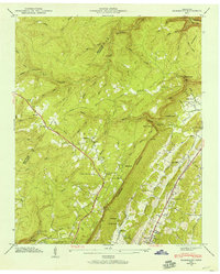
 1895 Pikeville1895 Print · USGSThe Cumberland Plateau was a landscape of mountain settlements and critical gaps in the 1890s. Genealogists can trace family roots through upland communities like Pomona and Lantana, or locate old landmarks like Hale Chapel and Hodge Ferry along the river.7 unique versions available
 - 1935 Map of Soddy
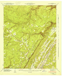
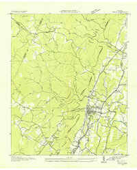 1935 Soddy1935 Print · USGSThe Cumberland Escarpment meets the industrial valley floor north of Chattanooga in the mid-1930s. Researchers can trace family roots at Hotwater Cem or locate the old Rathburn Station along the Southern Railway.
 - 1935 Map of Mount Airy
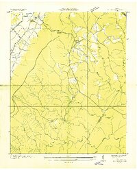
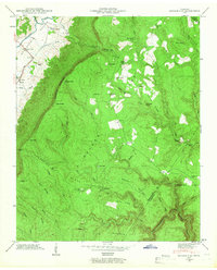
 1935 Mount Airy1935 Print · USGSBledsoe County is documented here in the mid-1930s, showing the agricultural valley between the plateau and the ridge. You can trace early family sites like Ewtonville Siding, Walkers Ford, and Sunny Side Sch along the river and rail lines.
 - 1935 Map of Smart Mountain
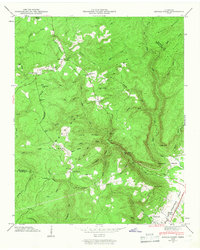
 1935 Smart Mountain1935 Print · USGSThe Cumberland Plateau highlands are captured here in the mid-1930s at the junction of Van Buren, Bledsoe, and Sequatchie counties. Local historians can trace the foundations of the community at the Hitchcock Sch and Hitchcock Cem near Smart Mtn.
 - 1936 Map of Palmer
 1936 Palmer1936 Print · USGSMid-1930s Grundy County comes alive through this look at the plateau's rail-and-coal industry. Trace the complex narrow gage routes serving the Clifty Mines or locate family roots near Tatesville and Griffith Sch.
 - 1936 Map of Daus
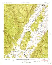
 1936 Daus1936 Print · USGSThe Sequatchie Valley was a bustling corridor of rail and river industry in the mid-1930s, caught between the Cumberland Plateau and Walden Ridge. Genealogists and historians can locate old schools and cemeteries like John Henry Chapel Sch, Stone Cem, and the community of Cartwright.
 - 1936 Map of Henson Gap
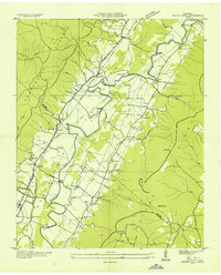
 1936 Henson Gap1936 Print · USGSThe Tennessee highlands near Henson Gap are captured in the mid-1930s as the TVA modernization began to reach these rural ridges. Genealogists and local historians can trace family land near Lewis Chapel Sch, Davis Chapel Ch, and the banks of Soddy Creek.
 - 1936 Map of Ketner Gap
 1936 Ketner Gap1936 Print · USGSMarion and Sequatchie counties appear in the mid-1930s as a landscape of isolated coal mines and ridge-top gaps. Genealogists and historians can trace family locations through Grayson Cem, Sulphur Springs Sch, and the industrial sites at Barnes Mine.
 - 1936 Map of Fairmount
 1936 Fairmount1936 Print · USGSThe plateau communities of Walden Ridge are captured here in the mid-1930s as modern infrastructure reached these mountain settlements. Genealogists can trace family footprints through numerous landmarks like Sawyer Cem, Fairmount Sch, and Union Springs Ch.
 - 1936 Map of Savage Point
 1936 Savage Point1936 Print · USGSThe high Cumberland Plateau meets the Sequatchie Valley during the mid-1930s, showing the early reach of regional power lines. Researchers can find family burial sites like Mc Laughlin Cem, the local Fredona Sch, and Travis Mill on the creek.
 - 1943 Map of Ketner Gap, 1960 Print
 1943 Ketner Gap1960 Print · USGSMarion and Sequatchie Counties are shown here during the early 1940s as the river valley and plateau transitioned into the modern era. Family historians can locate several local landmarks, from Kelley Chapel and Powells Crossroads to the Suck Creek Sch and Pickett Cem.5 unique versions available
 - 1945 Map of Fairmount, 1957 Print
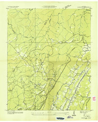
 1945 Fairmount1957 Print · USGSThe Cumberland Plateau meets the valley floor north of Chattanooga in the mid-1940s. Local researchers can trace family landmarks along Sawyer Road and locate rural hubs like Lone Oak, Summertown, and the Nathan L Bachman Sch.
 - 1946 Map of Savage Point
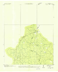
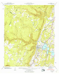
 1946 Savage Point1946 Print · USGSThe town of Dunlap and the surrounding heights of the Cumberland Plateau are captured here in the mid-1940s. Genealogists and historians can trace local landmarks like Sequatchie County High Sch, King Cem, and Cagle.4 unique versions available
 - 1946 Map of Henson Gap
 1946 Henson Gap1946 Print · USGSThe Cumberland plateau and Sequatchie valley meet in the mid-1940s at a time of rural reliance on traditional ridge communities. Genealogists and local historians can trace family landmarks like Lewis Chapel, Lewis Cem, and the Alvin C. York Highway.4 unique versions available
 - 1946 Map of Fairmount, 1947 Print
 1946 Fairmount1947 Print · USGSHamilton County uplands and the plateau settlements north of Chattanooga are captured here just after the war. Genealogists can locate family landmarks like Vandergriff Cem and Levi Cem or trace rural routes like the William Howard Taft Highway.
 - 1946 Map of Ketner Gap, 1947 Print
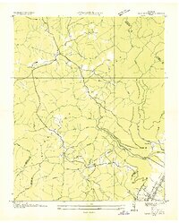
 1946 Ketner Gap1947 Print · USGSThe Tennessee mountains meet the valley floor in the 1940s as rural life centers around family-named gaps and hollows. Researchers can locate ancestral homesteads near Pickett Cem, Hicks Chapel Sch, and the crossroads at Powells Crossroads.
 - 1946 Map of Daus, 1956 Print
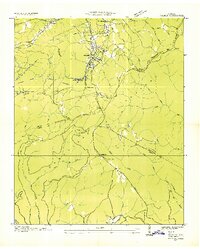
 1946 Daus1956 Print · USGSThe Sequatchie Valley is captured just after the war as the mountain and valley economies intertwined. Genealogists and historians can trace family roots through numerous sites like Hatfield Cem, New Hope Ch, and the rail stops at Daus and Dunlap.6 unique versions available
 - 1946 Map of Soddy, 1960 Print
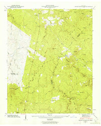
 1946 Soddy1960 Print · USGSHamilton County settlement meets the newly formed Chickamauga Lake shoreline in the years following the second World War. Genealogists can trace family roots through the Soddy-Daisy High School and numerous burial grounds like Lovelady Cem and Millsaps Cem.2 unique versions available
 - 1946 Map of Smartt Mountain, 1962 Print
 1946 Smartt Mountain1962 Print · USGSHigh atop the Cumberland Plateau in the mid-1940s, this area spans the intersection of three Tennessee counties during a period of remote mountain settlement. Genealogists can locate family landmarks like Jordan Rock House, Bellview Church, and the Hitchcox Cem.4 unique versions available
Showing maps 1-25 of 102
Top cities of Sequatchie County
Frequently asked questions
- What are the different types of historical maps available for Sequatchie County?
- What is the oldest map of Sequatchie County?
- Where can I purchase historical maps of Sequatchie County for my home or office?
- Where can I download high-res historical maps of Sequatchie County?
- Are there historical topographic maps available for Sequatchie County?
- Is there historical aerial imagery available for Sequatchie County?
- Where are historical maps of Sequatchie County sourced from?