2020s Maps of Dover, Tennessee
Explore 2 historic maps of Dover from the 2020s. These maps offer a rare glimpse into what life looked like during the 2020s — showing old roads, neighborhoods, homes, and landmarks that have changed or disappeared over time.
Whether you're researching your family's past, planning a metal detecting trip, or studying how Dover's landscape evolved across the 2020s, these high-resolution maps are a powerful tool for exploring the history of this region.
- Focus on a specific era: All maps on this page are from the 2020s, giving you a focused view of this time period.
- See what’s changed: Compare century-old streets, trails, and buildings to today's modern landscape using overlays and satellite layers.
- Research with precision: Use these maps for genealogy, historical research, land use analysis, or educational projects.
- View, download, or print: Maps are fully viewable online in high resolution, and can be downloaded or printed for your own records.
Start exploring Dover's history through authentic maps from the 2020s. This is your window into the past.
Dover, TN maps
(2)- 2022 Map of Standing Rock, 2022 Print
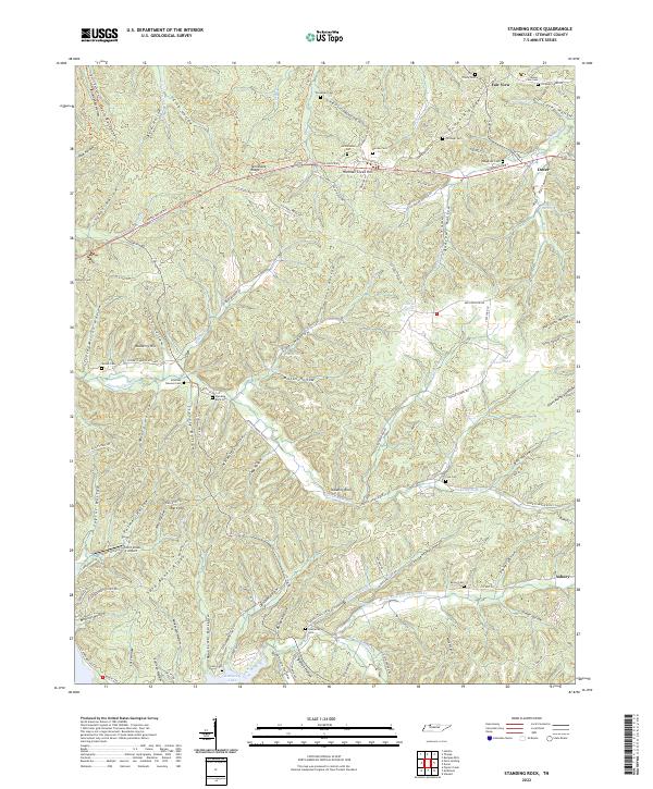 2022 Standing Rock2022 Print · USGSStewart County's river-carved landscape is shown here in the 2020s, featuring the ridges and hollows that define this corner of Tennessee. Researchers can locate many family burial sites like Cole Cem and Leatherwood Cem or trace the drainage of Standing Rock Cr to the shore of Kentucky Lake.
 - 2022 Map of Dover, 2022 Print
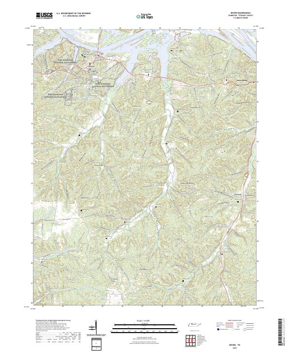 2022 Dover2022 Print · USGSThe Tennessee river country near Dover comes into focus on this 2022 sheet, showcasing the intersection of Civil War history and modern conservation. Researchers can trace family history through numerous burial grounds like Brigham Cem and Byrd Cem or explore the wooded ridges of Fort Donelson National Battlefield.
End of results
Showing maps 1-2 of 2
Top cities near Dover
Frequently asked questions
- What are the different types of historical maps available for Dover?
- What is the oldest map of Dover?
- Where can I purchase historical maps of Dover for my home or office?
- Where can I download high-res historical maps of Dover?
- Are there historical topographic maps available for Dover?
- Is there historical aerial imagery available for Dover?
- Where are historical maps of Dover sourced from?