Old Maps of Dover, Tennessee for Academic Research
Study the evolution of Dover with 17 high-resolution historic maps. Whether you're teaching, researching, or modeling changes in land use, these maps provide essential visual documentation of urban, environmental, and geographic change.
- Analyze long-term change: Track patterns in development, transportation, and natural features.
- Ideal for environmental or urban studies: Support academic projects with primary historical map data.
- Use in the classroom or lab: Educators and researchers rely on these maps to bring historical context to life.
These maps are a powerful tool for teaching, research, and visualizing how Dover has changed over the decades.
Dover, TN maps
(17)- 1936 Map of Standing Rock
 1936 Standing Rock1936 Print · USGSStewart County's interior ridges and hollows are captured here in the late 1930s, showing a landscape defined by small-scale farming and isolated valleys. Genealogists can trace family footprints through sites like Sykes Cem, McGee Sch, and the Standing community.
 - 1936 Map of Dover
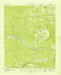
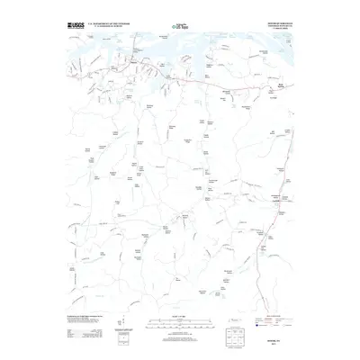
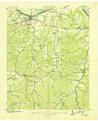 1936 Dover1936 Print · USGSStewart County's river-driven economy and Civil War heritage are on full display in the mid-1930s, centered on the strategic bends of the Cumberland. Genealogists can trace family landmarks like Moore Cem or visit old community hubs like Carlisle and Asbury Ch.
 - 1950 Map of Standing Rock, 1953 Print
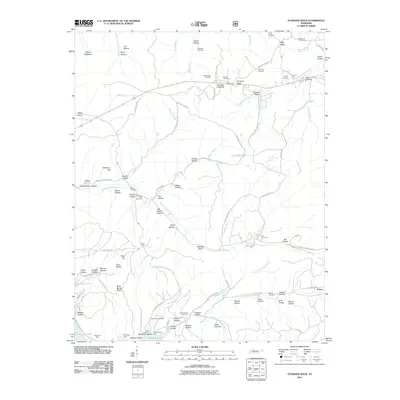
 1950 Standing Rock1953 Print · USGSStewart County, Tennessee, is captured here in the early fifties as its communities adapted to the formation of the Tennessee River reservoirs. Researchers can trace rural life through landmarks like Standing Rock Church, Midway Sch, and the Martin Cem.4 unique versions available
 - 1950 Map of Dover, 1954 Print
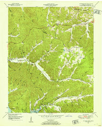
 1950 Dover1954 Print · USGSStewart County in the early fifties is mapped here at the height of its river-and-ridge character. Genealogists and historians can locate family-named landmarks and rural centers like the Lower Long Creek School, Settle Cem, and Fort Donelson National Military Park.4 unique versions available
 - 1956 Map of Nashville, 1971 Print
 1956 Nashville1971 Print · USGSThe Tennessee-Kentucky borderlands come into focus in the mid-1960s as major reservoir projects transformed the Cumberland and Tennessee river valleys. Researchers can trace the rail networks of the Louisville and Nashville and visit sites like Fort Campbell and Fort Donelson National Military Park.2 unique versions available
 - 1959 Map of Nashville
 1959 Nashville1959 Print · USGSMiddle Tennessee and Southern Kentucky come into focus during the late fifties, showing the region's transition into a modern transportation and military hub. Researchers can trace the sprawling Fort Campbell Military Reservation or locate historic rail stops along the Tennessee Central Ry and Illinois Central RR.
 - 1985 Map of Dickson
 1985 Dickson1985 Print · USGSMid-Tennessee in the mid-1980s was defined by the intersection of the Cumberland and Tennessee rivers and a massive network of wildlife refuges. Researchers can trace the Seaboard System rail lines connecting Waverly, Dickson, and White Bluff, or locate old landmarks near Fort Donelson National Military Park.
 - 2010 Map of Dover, 2010 Print
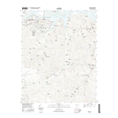
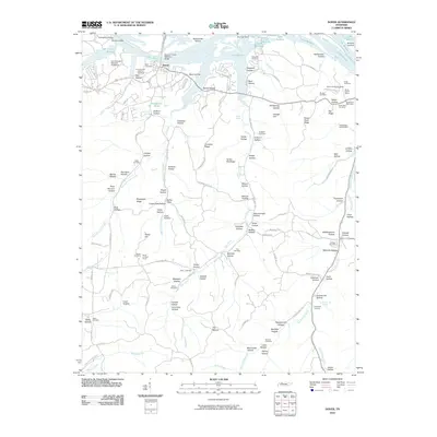 2010 Dover2010 Print · USGSCovers Dover, including Bear Spring, Carlisle, and other nearby areas
 - 2011 Map of Standing Rock, 2011 Print
 2011 Standing Rock2011 Print · USGSCovers Dover, including Asbury, Fair View, and other nearby areas
 - 2013 Map of Standing Rock, 2013 Print
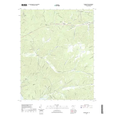
 2013 Standing Rock2013 Print · USGSCovers Dover, including Asbury, Fair View, and other nearby areas
 - 2013 Map of Dover, 2013 Print
 2013 Dover2013 Print · USGSCovers Dover, including Bear Spring, Carlisle, and other nearby areas
 - 2016 Map of Dover, 2016 Print
 2016 Dover2016 Print · USGSCovers Dover, including Bear Spring, Carlisle, and other nearby areas
 - 2016 Map of Standing Rock, 2016 Print
 2016 Standing Rock2016 Print · USGSCovers Dover, including Asbury, Fair View, and other nearby areas
 - 2019 Map of Standing Rock, 2019 Print
 2019 Standing Rock2019 Print · USGSCovers Dover, including Asbury, Fair View, and other nearby areas
 - 2019 Map of Dover, 2019 Print
 2019 Dover2019 Print · USGSCovers Dover, including Bear Spring, Carlisle, and other nearby areas
 - 2022 Map of Standing Rock, 2022 Print
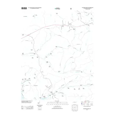
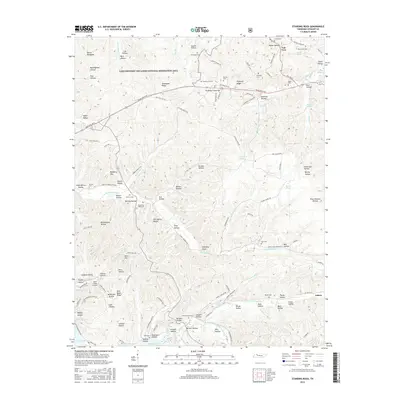
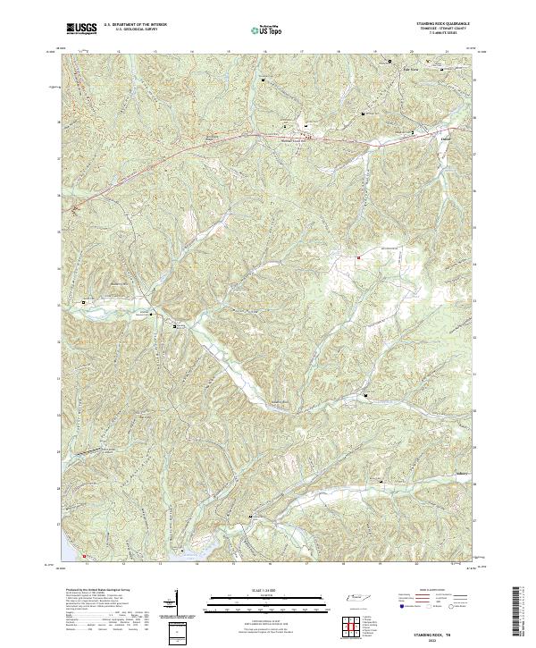 2022 Standing Rock2022 Print · USGSStewart County's river-carved landscape is shown here in the 2020s, featuring the ridges and hollows that define this corner of Tennessee. Researchers can locate many family burial sites like Cole Cem and Leatherwood Cem or trace the drainage of Standing Rock Cr to the shore of Kentucky Lake.
 - 2022 Map of Dover, 2022 Print
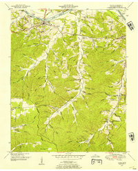
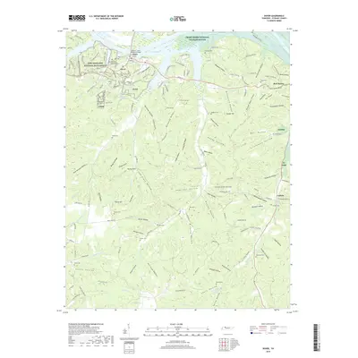
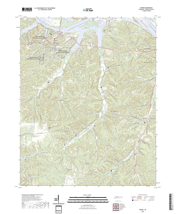 2022 Dover2022 Print · USGSThe Tennessee river country near Dover comes into focus on this 2022 sheet, showcasing the intersection of Civil War history and modern conservation. Researchers can trace family history through numerous burial grounds like Brigham Cem and Byrd Cem or explore the wooded ridges of Fort Donelson National Battlefield.
End of results
Showing maps 1-17 of 17
Top cities near Dover
Frequently asked questions
- What are the different types of historical maps available for Dover?
- What is the oldest map of Dover?
- Where can I purchase historical maps of Dover for my home or office?
- Where can I download high-res historical maps of Dover?
- Are there historical topographic maps available for Dover?
- Is there historical aerial imagery available for Dover?
- Where are historical maps of Dover sourced from?