Old Maps of Chase Meadows, Sullivan County for Metal Detecting
Plan your next treasure hunt with 17 historic maps of Chase Meadows. Find old homesites, ghost towns, trails, and gathering spots that may be lost to time — perfect for identifying promising metal detecting locations.
- Locate forgotten sites: Uncover places like long-lost settlements, abandoned rail lines, or gathering spots.
- Plan better hunts: Use map overlays combined with LiDAR or satellite views to narrow in on historically rich areas.
- Made for detectorists: Thousands of hobbyists use these maps to discover relics, coins, and hidden history.
Use these historic maps to boost your research and find new opportunities beneath the surface of Chase Meadows.
Chase Meadows, Sullivan County maps
(17)- 1897 Map of Bristol
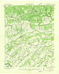
 1897 Bristol1897 Print · USGSThe Tennessee-Virginia borderlands in the late nineteenth century were a landscape of steep ridges and river-dependent commerce. Genealogists can trace family homesteads near Bickley Mill, locate river crossings like Childress Ferry, or find early rail stops along the Norfolk and Western RR.
 - 1902 Map of Bristol
 1902 Bristol1902 Print · USGSThe interstate border region around Bristol appears here at the start of the twentieth century, defined by its deep mountain ridges and river valleys. Researchers can trace the early industrial footprint of the area through numerous landmarks like Bickley Mill, Kings Mill, and the Norfolk and Western RR.6 unique versions available
 - 1935 Map of Indian Springs
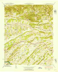
 1935 Indian Springs1935 Print · USGSSullivan County and the Virginia borderlands are captured here in the mid-1930s as modern power and aviation networks began to reach these rural communities. Genealogists can locate family landmarks like Pyles Cem, Huddle Mill, and numerous neighborhood schools including Shadylawn Sch.
 - 1935 Map of Mages
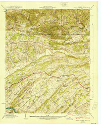
 1935 Mages1935 Print · USGSThe Tennessee-Virginia borderlands appear here in the mid-1930s, showing a landscape of ridge-and-valley settlements and rural crossroads. Researchers can locate numerous family-centered sites including Pyles Cem, St Joseph Ch, and Mill Point.
 - 1939 Map of Indian Springs, 1954 Print
 1939 Indian Springs1954 Print · USGSSullivan County, Tennessee, and Scott County, Virginia, are captured here at the end of the 1930s as a network of creek-side farms and mountain gaps. Genealogists can locate family landmarks like Pyles Cem, Bridwell Town, and schools like Gunnings Academy or Shadylawn Sch.
 - 1940 Map of Indian Springs
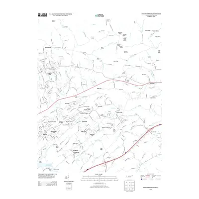
 1940 Indian Springs1940 Print · USGSThe Tennessee and Virginia borderlands come alive in this pre-war survey of Sullivan County. Genealogists and local historians can trace the family networks of Bridwell Town, locate Gunnings Academy, and find long-standing mills like Huddle Mill.
 - 1955 Map of Johnson City
 1955 Johnson City1955 Print · USGSEast Tennessee and the bordering highlands of Virginia and Kentucky appear here during the post-war industrial boom. You can trace the complex network of mountain ridges and new TVA lakes, from Johnson City to the coalfields near Middlesboro and Lynch.
 - 1957 Map of Johnson City, 1966 Print
 1957 Johnson City1966 Print · USGSUpper East Tennessee and Southwest Virginia are shown here during the mid-sixties transition of the Appalachians. Researchers can trace the industrial rail hubs of Kingsport, the sprawling waters of Cherokee Lake, and the historic Cumberland Gap.
 - 1959 Map of Indian Springs, 1961 Print
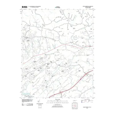
 1959 Indian Springs1961 Print · USGSSullivan County at the close of the 1950s shows a landscape of ridge-top farms and growing valley suburbs along the Virginia Tennessee border. Genealogists can locate family landmarks like Pettyjohn Mill, Huddle Mill, and numerous cemeteries including Hickman Cem and Baker Cem.5 unique versions available
 - 1960 Map of Johnson City
 1960 Johnson City1960 Print · USGSUpper East Tennessee and the surrounding tri-state area are shown in the mid-fifties during the height of the TVA reservoir era. Trace the industrial rail lines of the Southern and Louisville and Nashville between Kingsport and Johnson City.
 - 1963 Map of Johnson City
 1963 Johnson City1963 Print · USGSThe Tri-Cities and the surrounding Appalachian ridges are shown in detail during the early sixties, highlighting the era's vital rail and river networks. Genealogists and historians can trace the routes of the Clinchfield RR and locate settlements from Rogersville to Elizabethton.
 - 1981 Map of Bristol
 1981 Bristol1981 Print · USGSAppalachia and the Tri-Cities region are shown at a peak of industrial and rail development in the early eighties. Researchers can trace the Clinchfield Railroad through the mountains or find local landmarks like King College and the Holston Army Ammunition Plant.2 unique versions available
 - 2010 Map of Indian Springs, 2010 Print
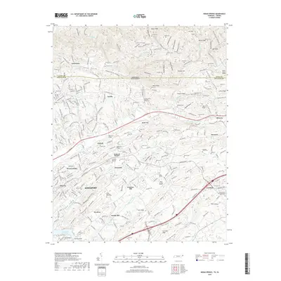
 2010 Indian Springs2010 Print · USGSCovers Chase Meadows, including Kingsport, Bloomingdale, and other nearby areas
 - 2013 Map of Indian Springs, 2013 Print
 2013 Indian Springs2013 Print · USGSCovers Chase Meadows, including Kingsport, Bloomingdale, and other nearby areas
 - 2016 Map of Indian Springs, 2016 Print
 2016 Indian Springs2016 Print · USGSCovers Chase Meadows, including Kingsport, Bloomingdale, and other nearby areas
 - 2019 Map of Indian Springs, 2019 Print
 2019 Indian Springs2019 Print · USGSCovers Chase Meadows, including Kingsport, Bloomingdale, and other nearby areas
 - 2022 Map of Indian Springs, 2022 Print
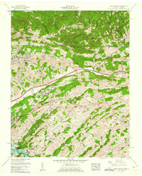
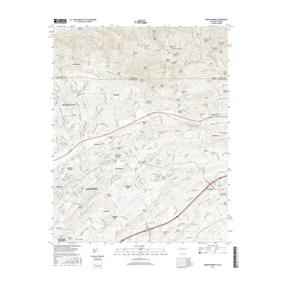
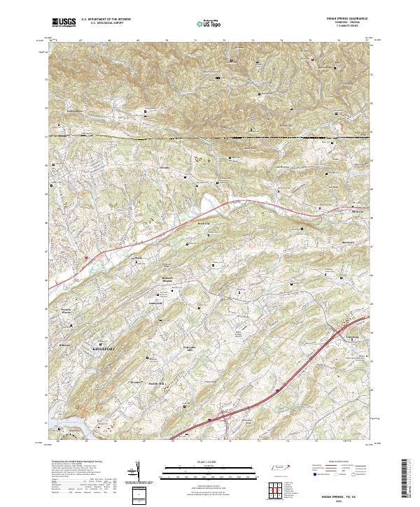 2022 Indian Springs2022 Print · USGSSullivan County, Tennessee, at the start of the 2020s shows a landscape where urban KINGSPORT meets long-standing rural ridges. Researchers can trace family history through numerous community landmarks like Pettyjohn Mill, Arcadia United Methodist Church, and Gunnings Cem.
End of results
Showing maps 1-17 of 17
Frequently asked questions
- What are the different types of historical maps available for Chase Meadows?
- What is the oldest map of Chase Meadows?
- Where can I purchase historical maps of Chase Meadows for my home or office?
- Where can I download high-res historical maps of Chase Meadows?
- Are there historical topographic maps available for Chase Meadows?
- Is there historical aerial imagery available for Chase Meadows?
- Where are historical maps of Chase Meadows sourced from?